MyTopo
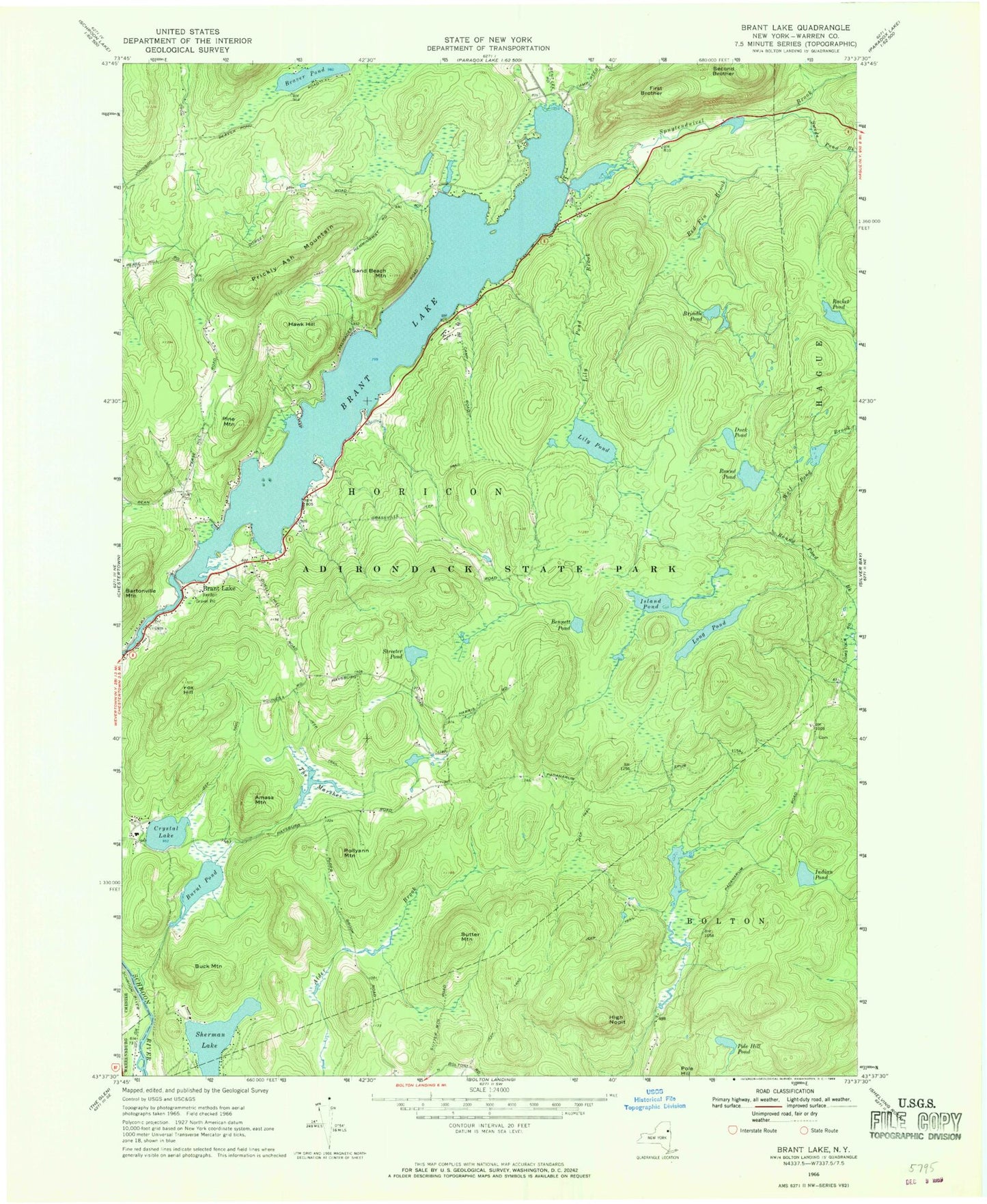
Classic USGS Brant Lake New York 7.5'x7.5' Topo Map
Couldn't load pickup availability
Historical USGS topographic quad map of Brant Lake in the state of New York. Typical map scale is 1:24,000, but may vary for certain years, if available. Print size: 24" x 27"
This quadrangle is in the following counties: Warren.
The map contains contour lines, roads, rivers, towns, and lakes. Printed on high-quality waterproof paper with UV fade-resistant inks, and shipped rolled.
Contains the following named places: Amasa Mountain, Bennett Pond, Brant Lake, Brant Lake, Brindle Pond, Buck Mountain, Burnt Pond, Crystal Lake, Duck Pond, First Brother, Fox Hill, Hawk Hill, High Nopit, Indian Pond, Island Pond, Lily Pond, Lily Pond Brook, Long Pond, Pine Mountain, Pole Hill Pond, Pollyann Mountain, Prickly Ash Mountain, Racket Pond, Red Fin Brook, Round Pond, Sand Beach Mountain, Second Brother, Sherman Lake, Spuytenduivel Brook, Streeter Pond, Sutter Mountain, Swede Pond Brook, The Marsher, Beaver Pond, Wolf Pond Brook, Town of Horicon, Brant Lake Cemetery, Brant Lake Wesleyan Church, Horicon Baptist Church