MyTopo
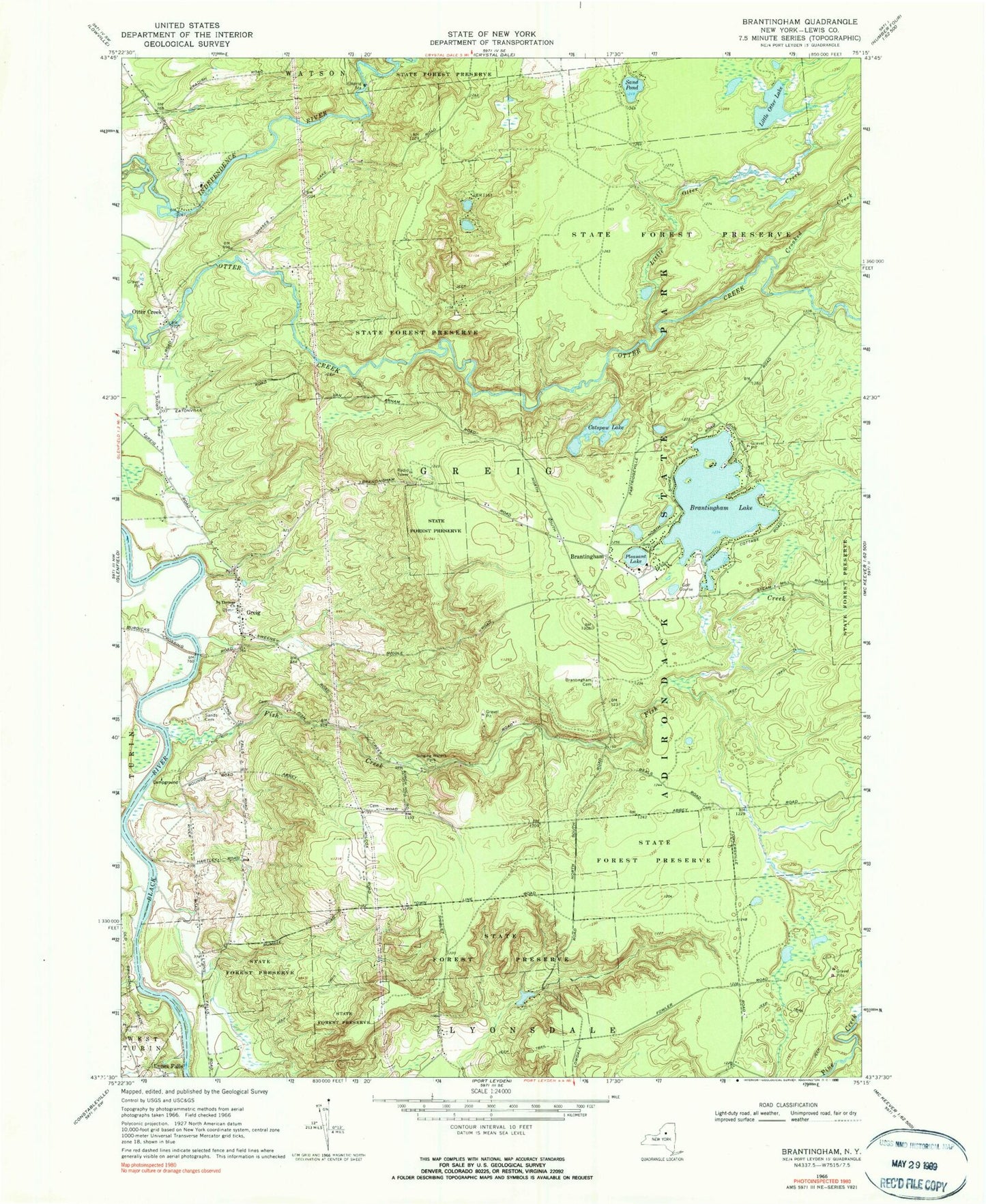
Classic USGS Brantingham New York 7.5'x7.5' Topo Map
Couldn't load pickup availability
Historical USGS topographic quad map of Brantingham in the state of New York. Typical map scale is 1:24,000, but may vary for certain years, if available. Print size: 24" x 27"
This quadrangle is in the following counties: Lewis.
The map contains contour lines, roads, rivers, towns, and lakes. Printed on high-quality waterproof paper with UV fade-resistant inks, and shipped rolled.
Contains the following named places: Brantingham, Brantingham Cemetery, Brantingham Lake, Catspaw Lake, Crooked Creek, Fish Creek, Greig, Little Otter Creek, Little Otter Lake, Little Pine Creek, Lyons Falls, Mill Creek, Otter Creek, Pleasant Lake, Saint Thomas Church, Sand Pond, Sands Cemetery, Singing Waters Park, Copper Creek, Douglass Creek, Calvary Bible Church, 3G Volunteer Fire Company Brantingham Station 2, Eatonville Falls, Shingle Mill Falls, Singing Waters Falls, Brantingham Community Post Office