
MyTopo
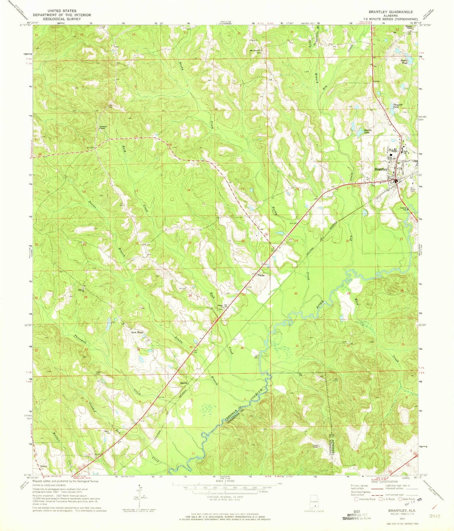
Classic USGS Brantley Alabama 7.5'x7.5' Topo Map
Couldn't load pickup availability
Historical USGS topographic quad map of Brantley in the state of Alabama. Map scale may vary for some years, but is generally around 1:24,000. Print size is approximately 24" x 27"
This quadrangle is in the following counties: Covington, Crenshaw.
The map contains contour lines, roads, rivers, towns, and lakes. Printed on high-quality waterproof paper with UV fade-resistant inks, and shipped rolled.
Contains the following named places: Bailey Dam, Bealls Pond, Brantley, Brantley Assembly of God Church, Brantley Baptist Church, Brantley Cemetery, Brantley Division, Brantley Fire and Rescue, Brantley High School, Brantley Police Department, Brantley Post Office, Brantley Stadium, Brantley United Methodist Church, Brunson Chapel, Bryce Smith Dam, Buck Creek, Bushy Creek, Cameron Chapel, Camerons Chapel Cemetery, Clark Cemetery, Clark Lake, Clark Lake Dam, Crooked Run Creek, Davis Cemetery, Double Branch, Dry Creek, Enon Primitive Baptist Church, Faith Church, Hollis, Hugins Store, L D Thaggard Dam, Liberty Church, Live Oak Church, Macedonia Church, Morning Star Church, Mount Olive Church, Muck Creek, New Hope, New Hope Church, Rock Hill Church, Sally Branch, Sasser Church, Sasser School, Shinglepile Branch, Smiths Lake, Sports, Thagard Pond, Theba, Threemile Creek, Town of Brantley, Town of Dozier, Trovener, Vaughns Store, Veasey Chapel, ZIP Code: 36009


