MyTopo
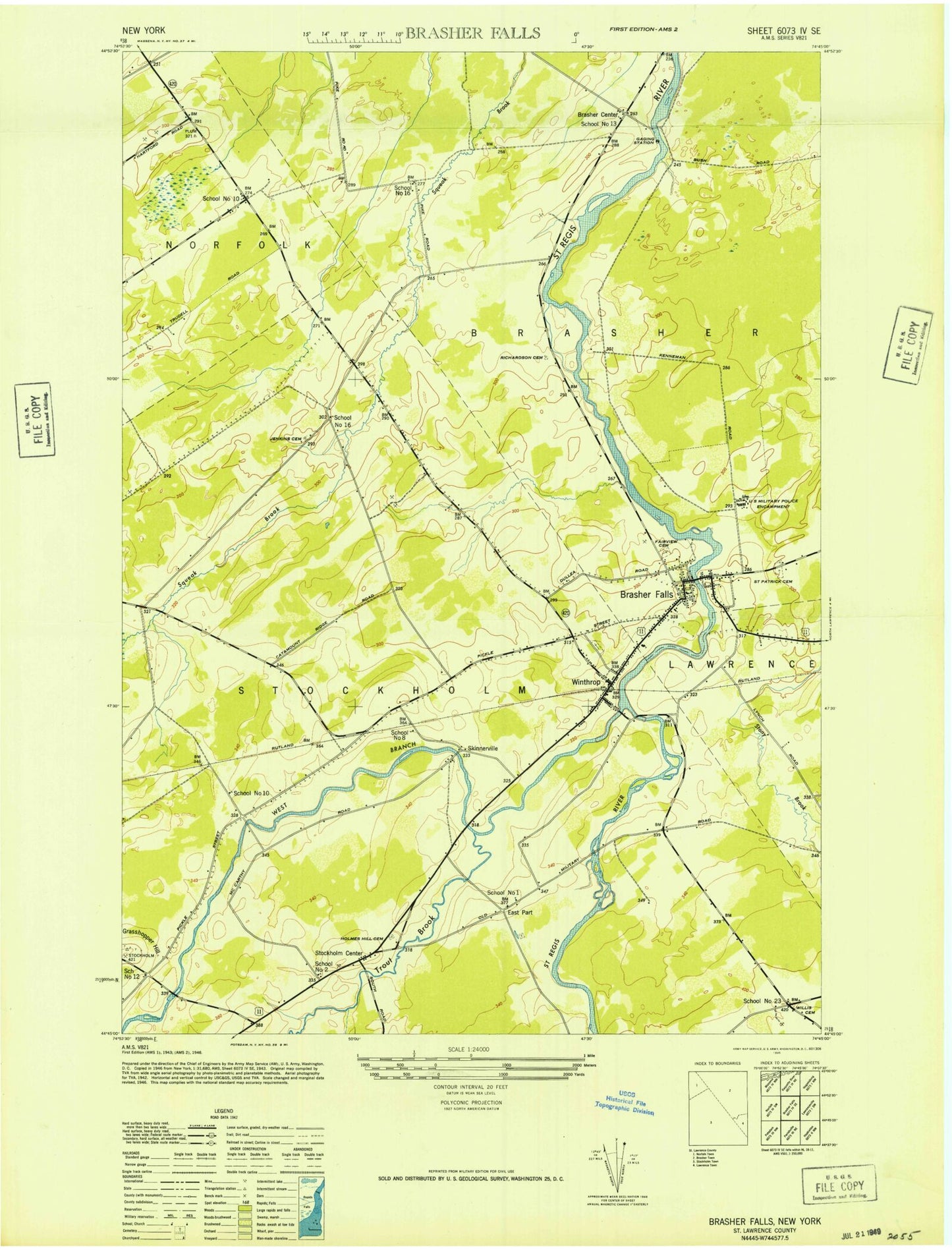
Classic USGS Brasher Falls New York 7.5'x7.5' Topo Map
Couldn't load pickup availability
Historical USGS topographic quad map of Brasher Falls in the state of New York. Map scale is 1:24000. Print size is approximately 24" x 27"
This quadrangle is in the following counties: St. Lawrence.
The map contains contour lines, roads, rivers, towns, and lakes. Printed on high-quality waterproof paper with UV fade-resistant inks, and shipped rolled.
Contains the following named places: Bell Brook, Brasher - Winthrop Volunteer Fire Department, Brasher Center, Brasher Falls, Brasher Falls, Brasher Falls Census Designated Place, Brasher Falls Post Office, Brasher Falls Sewer District 1 Sewage Treatment Plant, Brasher Falls-Winthrop Census Designated Place (historical), East Part, East Part Cemetery, Fairview Cemetery, Grasshopper Hill, Holmes Hill Cemetery, Jenkins Cemetery, Kyle Cemetery, Meadowbrook Golf Course, Norfolk Volunteer Fire Department Station 3, Richardson Cemetery, Riverside Campground, Saint Lawrence Central School, Saint Lawrence Middle School, Saint Patrick Cemetery, Saint Patricks Church, School Number 1 (historical), School Number 10 (historical), School Number 10 (historical), School Number 13 (historical), School Number 16 (historical), School Number 16 (historical), School Number 2 (historical), School Number 23 (historical), School Number 8 (historical), Skinnerville, Stockholm Center, Tri Town Volunteer Rescue Squad, Trout Brook, Victory Baptist Church, West Branch Saint Regis River, Willis Cemetery, Winthrop, Winthrop Census Designated Place, Winthrop Post Office