MyTopo
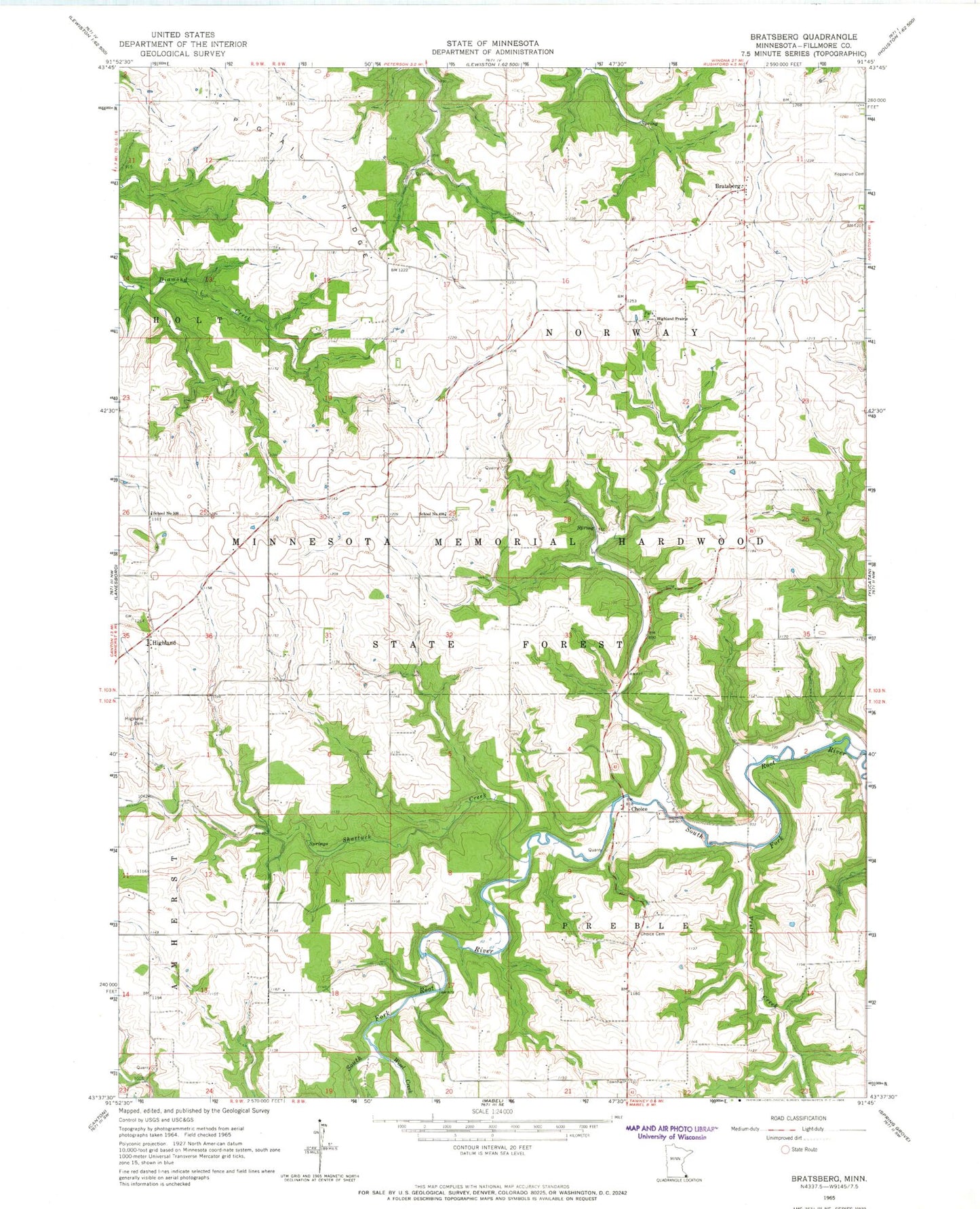
Classic USGS Bratsberg Minnesota 7.5'x7.5' Topo Map
Couldn't load pickup availability
Historical USGS topographic quad map of Bratsberg in the state of Minnesota. Map scale may vary for some years, but is generally around 1:24,000. Print size is approximately 24" x 27"
This quadrangle is in the following counties: Fillmore.
The map contains contour lines, roads, rivers, towns, and lakes. Printed on high-quality waterproof paper with UV fade-resistant inks, and shipped rolled.
Contains the following named places: Bratsberg, Bratsberg Post Office, Choice, Choice Cemetery, Choice Post Office, Highland, Highland Cemetery, Highland Post Office, Highland Prairie Cemetery, Highland Prairie Church, Kopperud Cemetery, KQYB-FM (Spring Grove), North Highland Cemetery, Pigtail Ridge, School Number 498, School Number 508, Shattuck Creek, Township of Norway, Township of Preble, Vesta Creek, Wisel Cemetery, Wisel Creek