
MyTopo
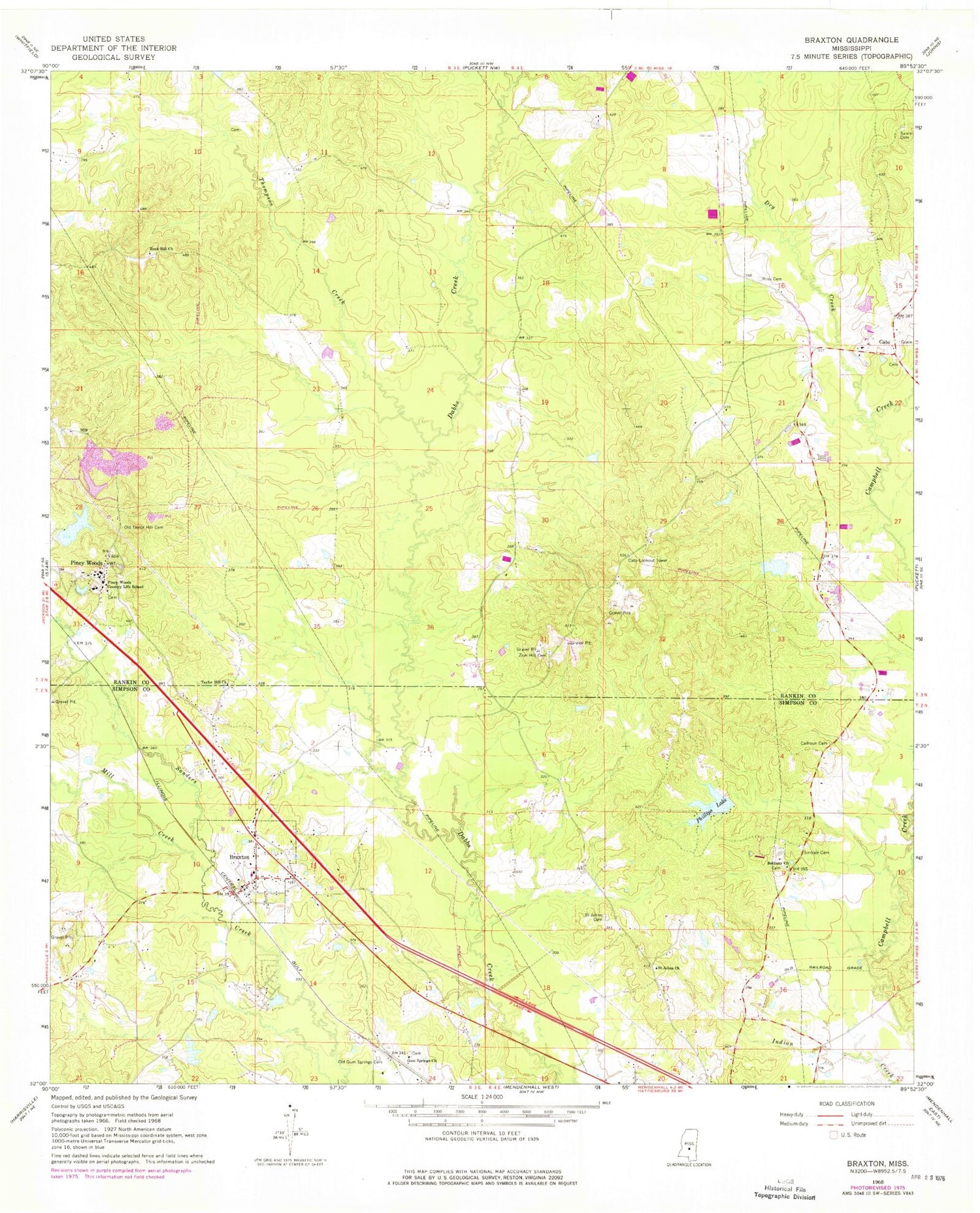
Classic USGS Braxton Mississippi 7.5'x7.5' Topo Map
Couldn't load pickup availability
Historical USGS topographic quad map of Braxton in the state of Mississippi. Map scale may vary for some years, but is generally around 1:24,000. Print size is approximately 24" x 27"
This quadrangle is in the following counties: Rankin, Simpson.
The map contains contour lines, roads, rivers, towns, and lakes. Printed on high-quality waterproof paper with UV fade-resistant inks, and shipped rolled.
Contains the following named places: Belpine, Bethany Cemetery, Bethany Church, Bethet School, Braxton, Braxton Baptist Church, Braxton Cemetery, Braxton Fire Rescue, Braxton Post Office, Calhoun Cemetery, Cato, Cato Cemetery, Cato Fire Department, Cato Lookout Tower, Cato School, Cato Springs Baptist Church, David Thomas Cemetery, Davis Lake Dam, Dry Creek, Easterling School, George, Gum Springs, Gum Springs Cemetery, Gum Springs Church, John Phillips Lake Dam, Mill Creek, Mrs W G McGee Lake Dam, Old Gum Springs Cemetery, Old Taylor Hill Cemetery, Phillips Lake, Pine Lake, Piney Woods, Piney Woods Cemetery, Piney Woods Country Life School, Piney Woods Lake Dam, Piney Woods Post Office, Rock Hill Church, Rockhill Cemetery, Ross Cemetery, Saint Johns Cemetery, Saint Johns Church, Salem Cemetery, Sinclair Cemetery, Taylor Hill Church, Thompson Creek, Village of Braxton, Zion Hill Cemetery, ZIP Code: 39044


