MyTopo
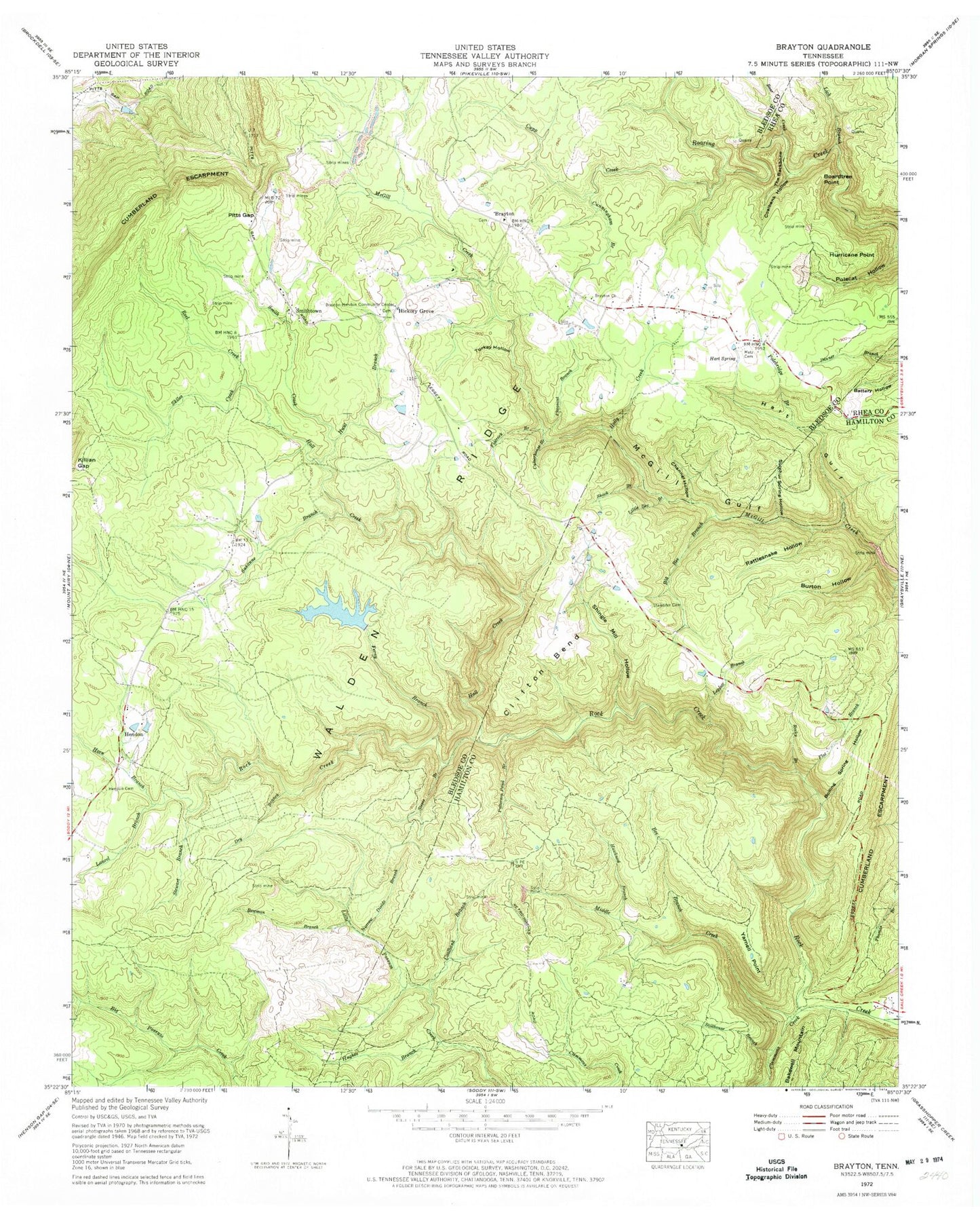
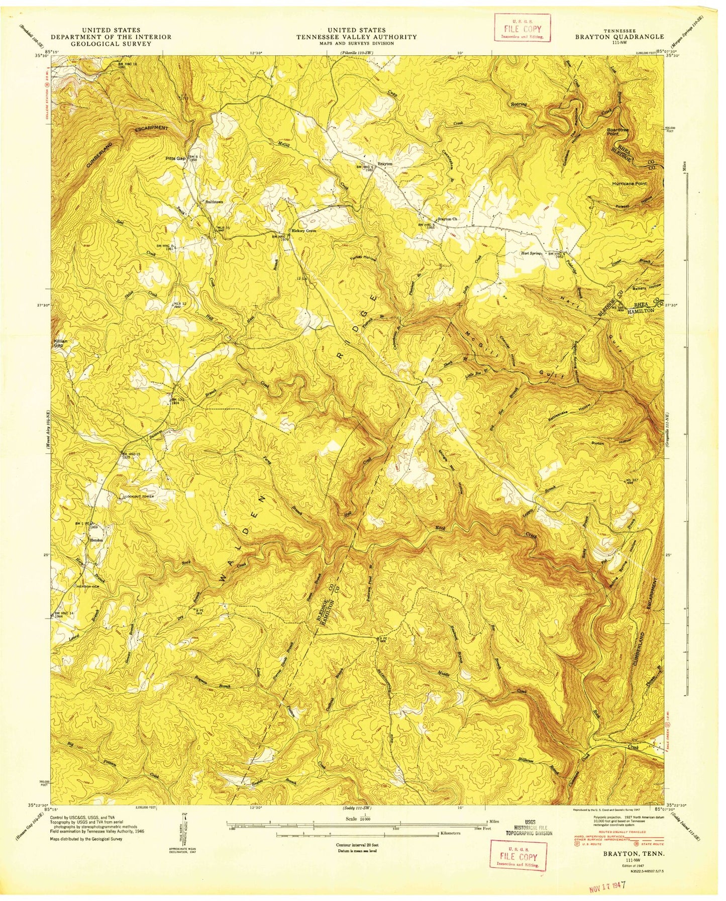
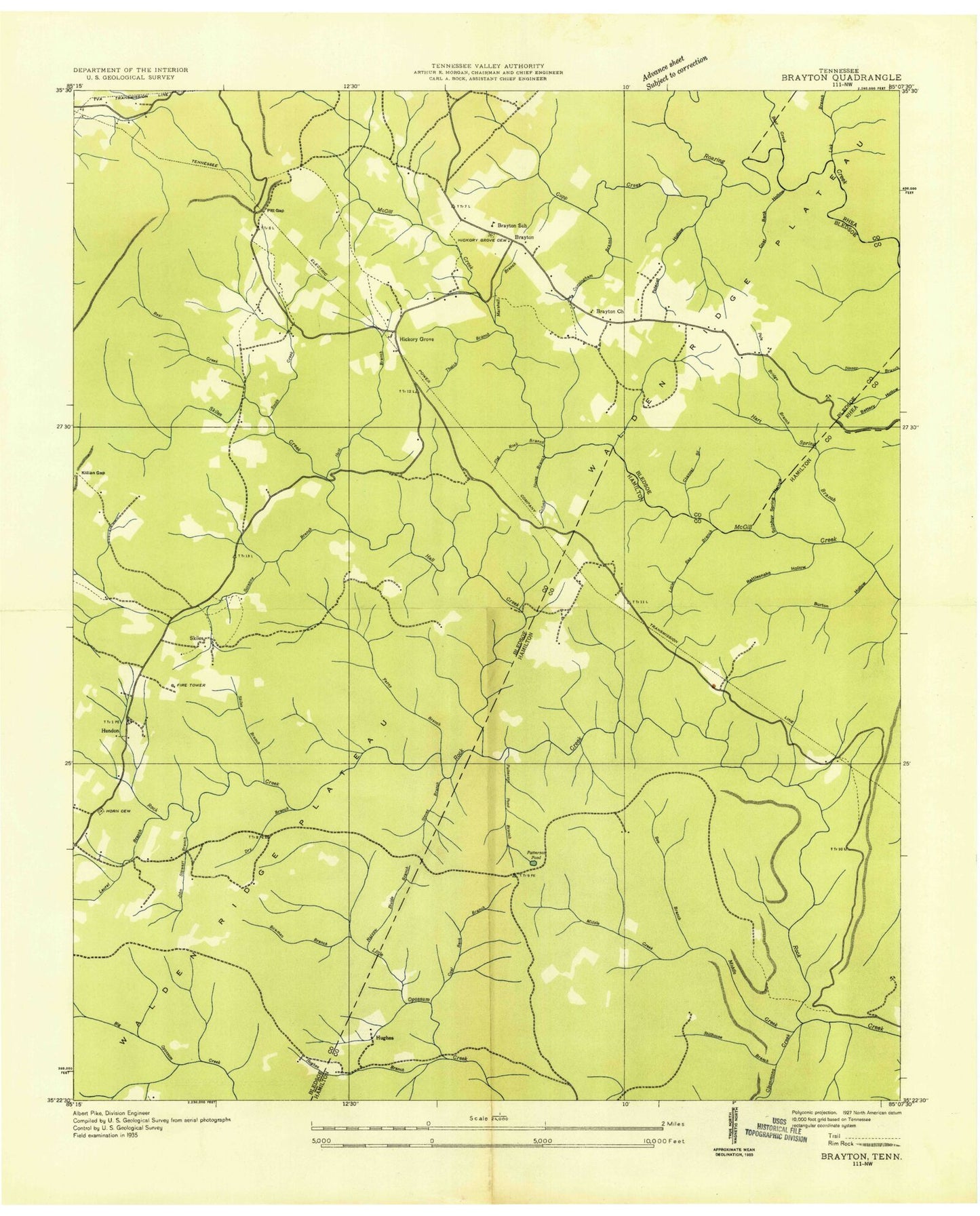
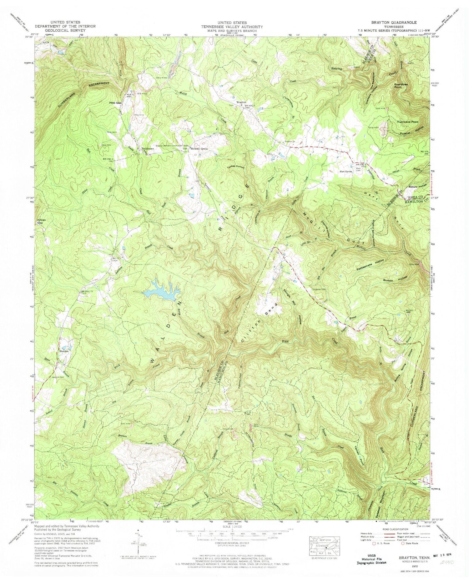
Classic USGS Brayton Tennessee 7.5'x7.5' Topo Map
Couldn't load pickup availability
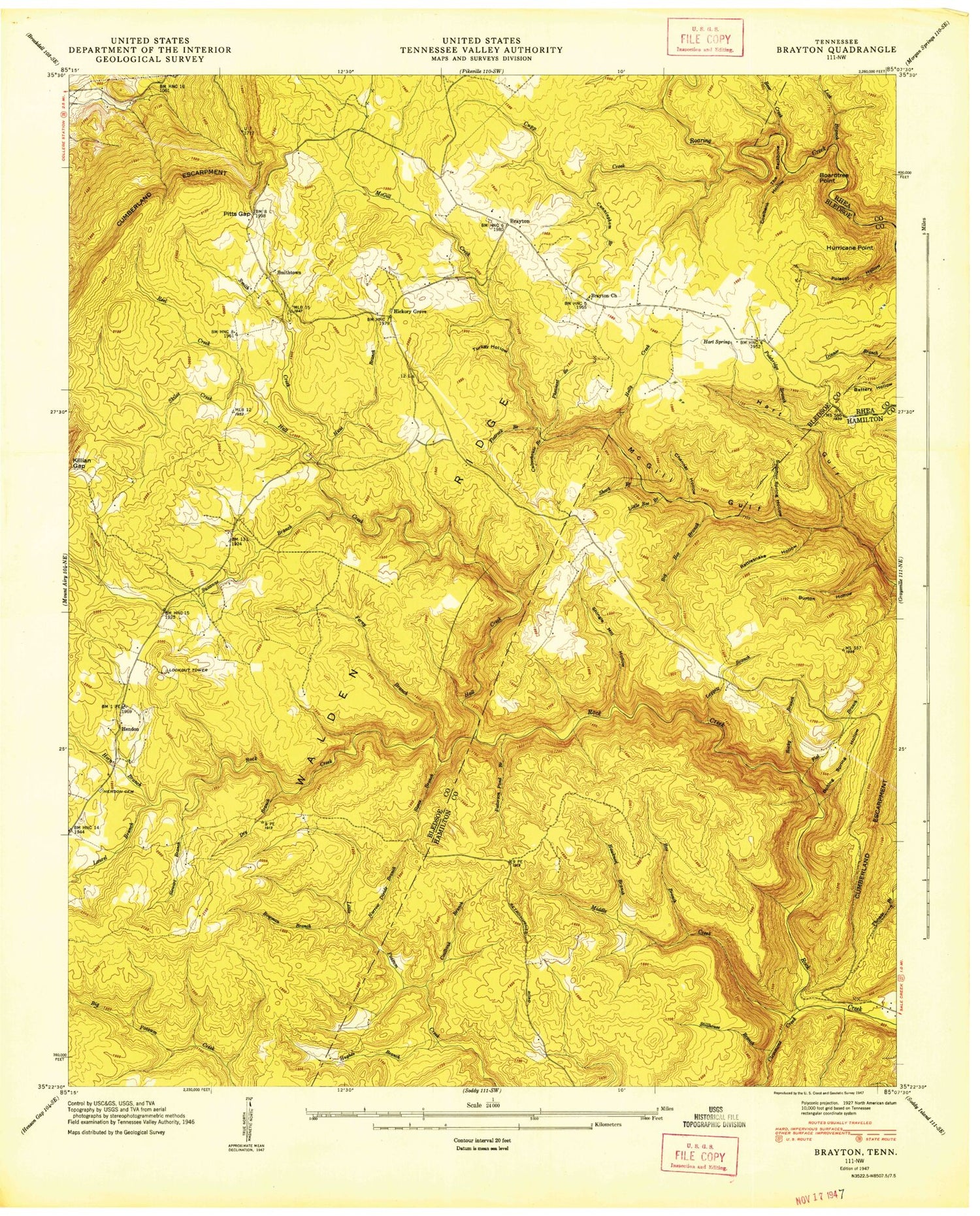
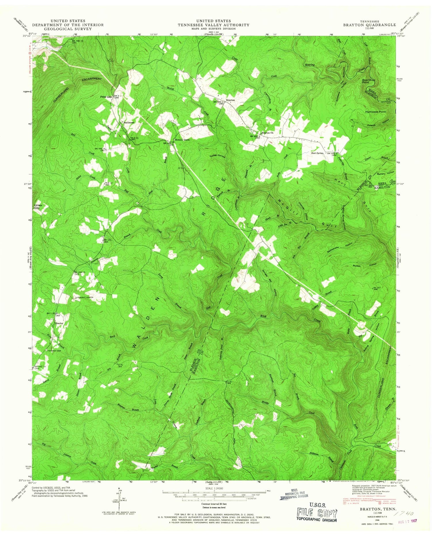
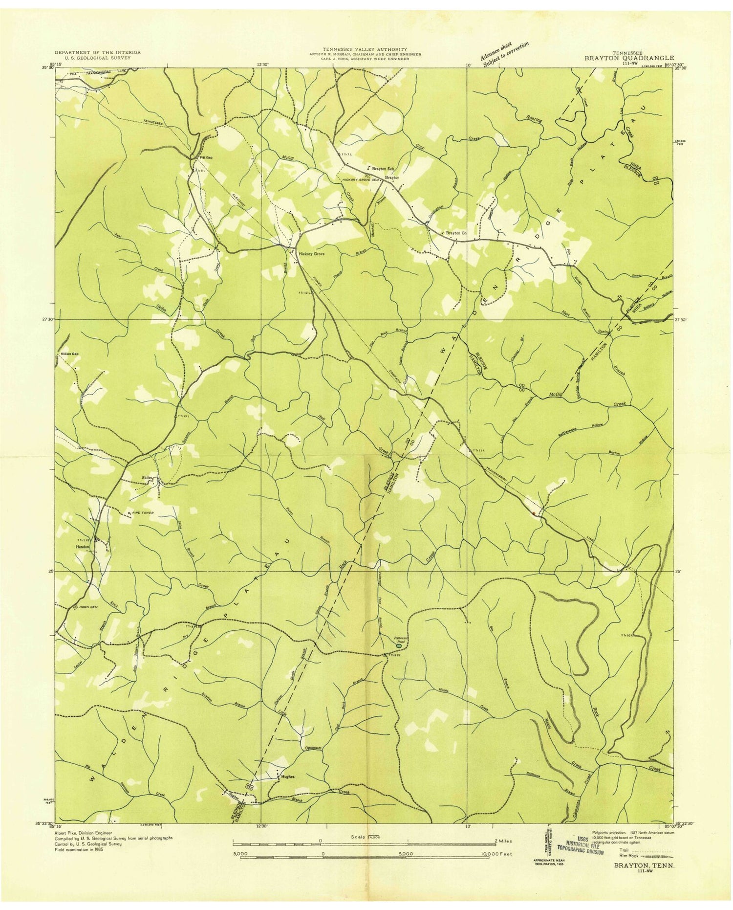
Historical USGS topographic quad map of Brayton in the state of Tennessee. Typical map scale is 1:24,000, but may vary for certain years, if available. Print size: 24" x 27"
This quadrangle is in the following counties: Bledsoe, Hamilton, Rhea.
The map contains contour lines, roads, rivers, towns, and lakes. Printed on high-quality waterproof paper with UV fade-resistant inks, and shipped rolled.
Contains the following named places: Clemmons Creek, Shingle Mill Hollow, Skiles Creek, Smith Creek, Standifer Community Cemetery, Steves Branch, Stillhouse Branch, Sulphur Spring Hollow, Suzanne Branch, The Backbone, Turkey Hollow, Yarnell Point, Bear Creek, Bee Branch, Big Bee Branch, Boardtree Point, Boiling Spring Hollow, Bowman Branch, Brayton Church, Brayton-Hendon Community Center, Burton Hollow, Channel Hollow, Clifton Bend, Cunningham Branch, Dry Branch, Ferny Branch, Flat Branch, Flatrock Branch, Hall Creek, Hart Gulf, Hart Spring, Hawknest Branch, Hendon Cemetery, Holly Creek, Horn Branch, Hughes Branch, Hunt Branch, Hurricane Point, Killian Gap, Laurel Branch, Leggett Branch, Lick Branch, Little Bee Branch, Metz Cemetery, Middle Creek, Narrow Divide Branch, Patterson Pond Branch, Pheasant Branch, Pitts Gap, Polebridge Branch, Rattlesnake Hollow, Reel Creek, Rocky Branch, Shack Branch, Vannoort Lake, Vannoort Lake Dam, Stewart Branch, Coalbank Branch, Coalbank Hollow, Culverhouse Branch, Cupp Creek, Channel Branch, Polecat Hollow, Skiles (historical), Skiles Branch, Thatch Branch, Hughes (historical), Patterson Pond, Smithtown, Brayton, Hendon, Hickory Grove, Brayton School (historical), Hendon School (historical), Hickory Grove Cemetery, Commissioner District 3, Brayton Volunteer Fire Department, Clemmons Creek, Shingle Mill Hollow, Skiles Creek, Smith Creek, Standifer Community Cemetery, Steves Branch, Stillhouse Branch, Sulphur Spring Hollow, Suzanne Branch, The Backbone, Turkey Hollow, Yarnell Point, Bear Creek, Bee Branch, Big Bee Branch, Boardtree Point, Boiling Spring Hollow, Bowman Branch, Brayton Church, Brayton-Hendon Community Center, Burton Hollow, Channel Hollow, Clifton Bend, Cunningham Branch, Dry Branch, Ferny Branch, Flat Branch, Flatrock Branch, Hall Creek, Hart Gulf, Hart Spring, Hawknest Branch, Hendon Cemetery, Holly Creek, Horn Branch, Hughes Branch, Hunt Branch, Hurricane Point, Killian Gap, Laurel Branch, Leggett Branch, Lick Branch, Little Bee Branch, Metz Cemetery, Middle Creek, Narrow Divide Branch, Patterson Pond Branch, Pheasant Branch, Pitts Gap, Polebridge Branch, Rattlesnake Hollow, Reel Creek, Rocky Branch, Shack Branch, Vannoort Lake, Vannoort Lake Dam, Stewart Branch, Coalbank Branch, Coalbank Hollow, Culverhouse Branch, Cupp Creek, Channel Branch, Polecat Hollow, Skiles (historical), Skiles Branch, Thatch Branch, Hughes (historical), Patterson Pond, Smithtown, Brayton, Hendon, Hickory Grove, Brayton School (historical), Hendon School (historical), Hickory Grove Cemetery, Commissioner District 3, Brayton Volunteer Fire Department, Clemmons Creek, Shingle Mill Hollow, Skiles Creek, Smith Creek, Standifer Community Cemetery, Steves Branch, Stillhouse Branch, Sulphur Spring Hollow, Suzanne Branch, The Backbone, Turkey Hollow, Yarnell Point, Bear Creek, Bee Branch, Big Bee Branch, Boardtree Point, Boiling Spring Hollow, Bowman Branch, Brayton Church, Brayton-Hendon Community Center, Burton Hollow, Channel Hollow, Clifton Bend, Cunningham Branch, Dry Branch, Ferny Branch, Flat Branch, Flatrock Branch, Hall Creek, Hart Gulf, Hart Spring, Hawknest Branch, Hendon Cemetery, Holly Creek, Horn Branch, Hughes Branch, Hunt Branch, Hurricane Point, Killian Gap, Laurel Branch, Leggett Branch, Lick Branch, Little Bee Branch, Metz Cemetery, Middle Creek, Narrow Divide Branch, Patterson Pond Branch, Pheasant Branch, Pitts Gap, Polebridge Branch, Rattlesnake Hollow, Reel Creek, Rocky Branch, Shack Branch, Vannoort Lake, Vannoort Lake Dam, Stewart Branch, Coalbank Branch, Coalbank Hollow, Culverhouse Branch, Cupp Creek, Channel Branch, Polecat Hollow, Skiles (historical), Skiles Branch, Thatch Branch, Hughes (historical), Patterson Pond, Smithtown, Brayton, Hendon, Hickory Grove, Brayton School (historical), Hendon School (historical), Hickory Grove Cemetery, Commissioner District 3, Brayton Volunteer Fire Department