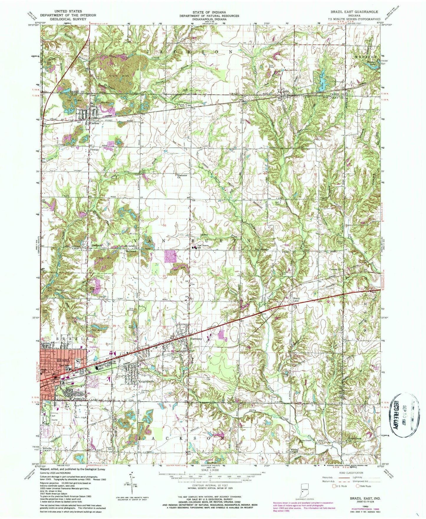
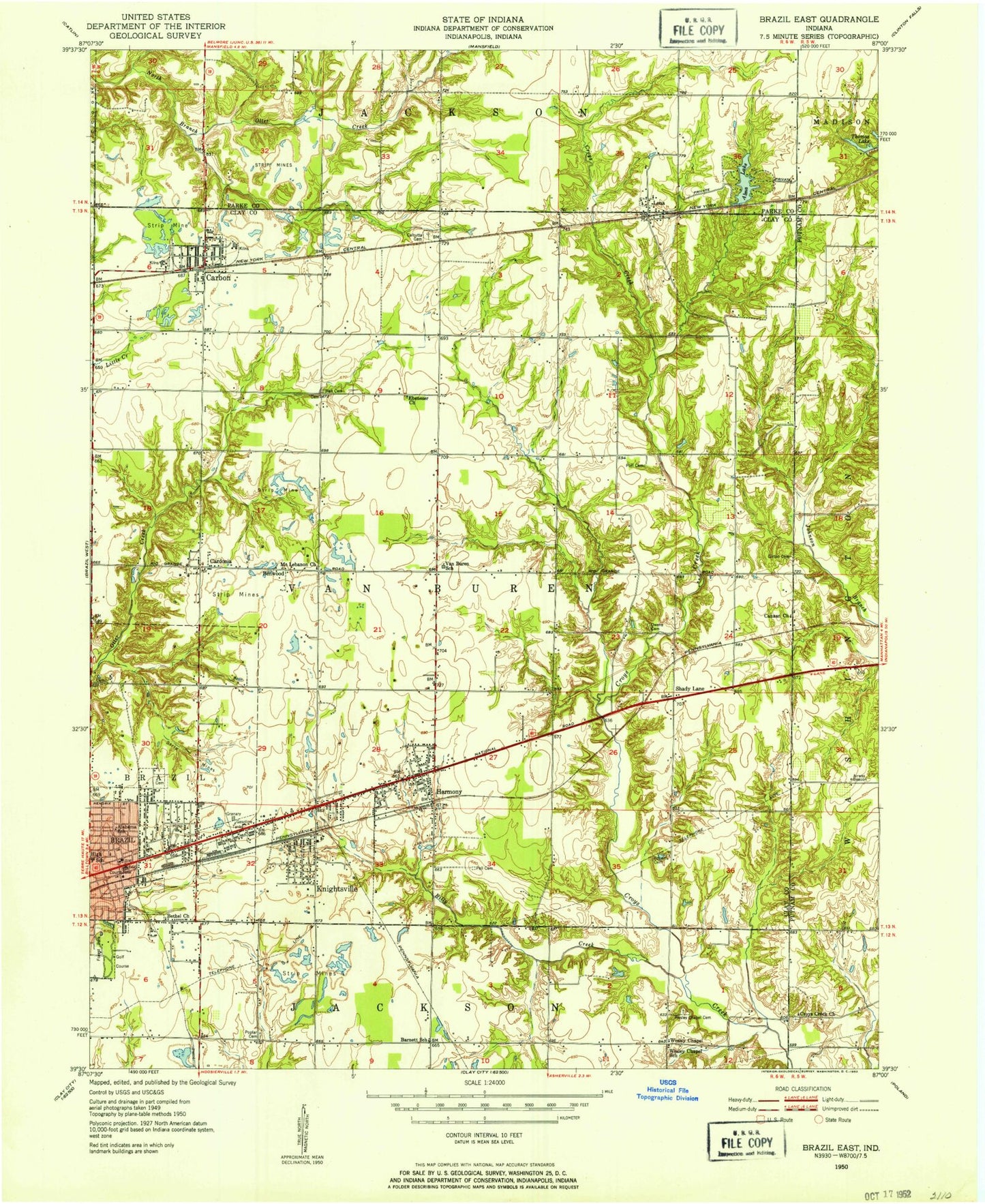
MyTopo
Classic USGS Brazil East Indiana 7.5'x7.5' Topo Map
Couldn't load pickup availability
Historical USGS topographic quad map of Brazil East in the state of Indiana. Map scale may vary for some years, but is generally around 1:24,000. Print size is approximately 24" x 27"
This quadrangle is in the following counties: Clay, Parke, Putnam.
The map contains contour lines, roads, rivers, towns, and lakes. Printed on high-quality waterproof paper with UV fade-resistant inks, and shipped rolled.
Contains the following named places: Alma Creek, Alma Lake, Benwood, Benwood Run, Bethel Church, Bethel Run, Billy Creek, Bowles Lake, Bowles Lake Dam, Brazil Fire Department, Brazil High School, Bullet Branch, Calcutta, Calcutta Cemetery, Calcutta Run, Carbon, Carbon Post Office, Cardonia, Cardonia Run, City of Brazil, Clay County Search and Rescue, Croys Creek Church, Dam Brook, Donaldsonville, East Brook, East Side Elementary School, Ebenezer Church, Ebenezer Creek, Girton Cemetery, Girton Run, Green Hollow, Gun Creek, Harm Run, Harmony, Harmony Cemetery, Harmony Drain, Harmony Post Office, Jack Brook, Kid Run, Knightsville, Knightsville Post Office, Lena, Lena Drain, Mechanicsburg, Mount Lebanon Church, National Run, Owens Cemetery, Pell Brook, Pell Cemetery, Poff Brook, Poff Cemetery, Pontiac, Poplar Cemetery, Reinoehl Field, Risslers Lake, Risslers Lake Dam, Roberts Brook, Roberts Cemetery, Saint Vincent Clay Hospital, School Brook, Scrouge Branch, Thomas Lake, Town of Carbon, Town of Harmony, Town of Knightsville, Township of Brazil, Township of Van Buren, Van Buren Creek, Van Buren Elementary School, Van Buren High School, Van Buren Volunteer Fire Department, Wesley Chapel, Wesley Chapel Cemetery, Wesley Drain, ZIP Codes: 47834, 47853, 47857