MyTopo
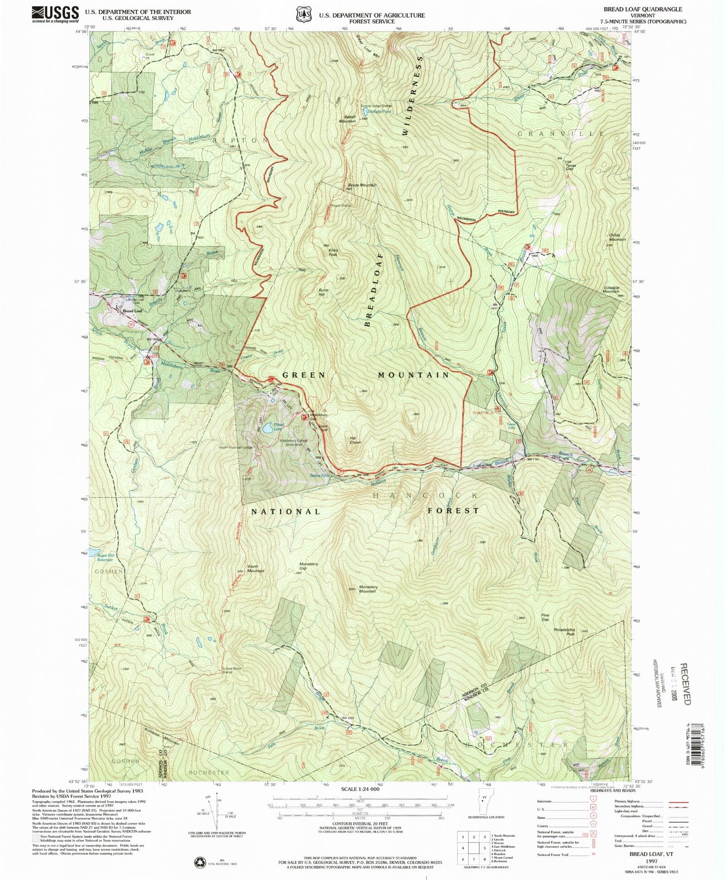
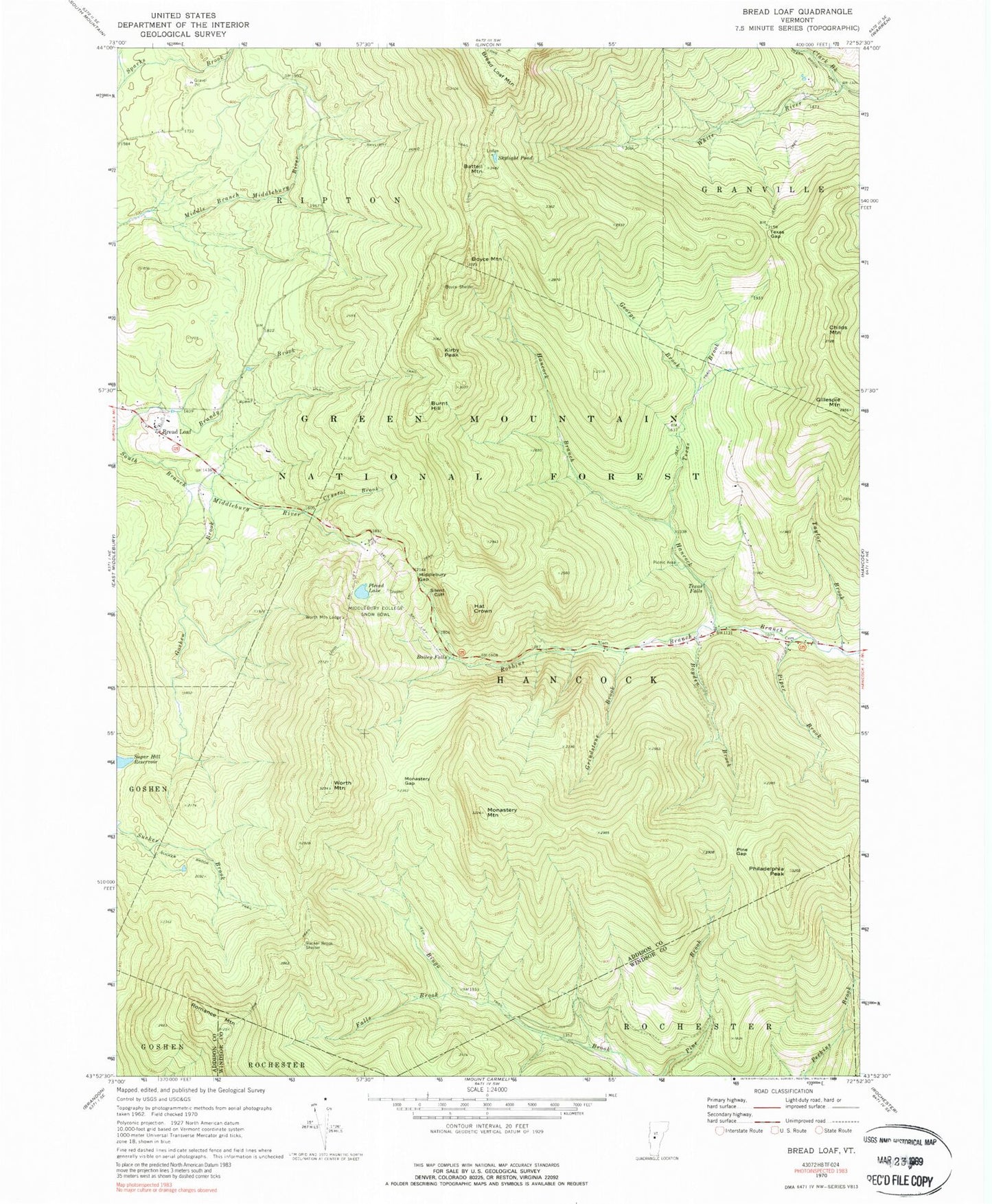
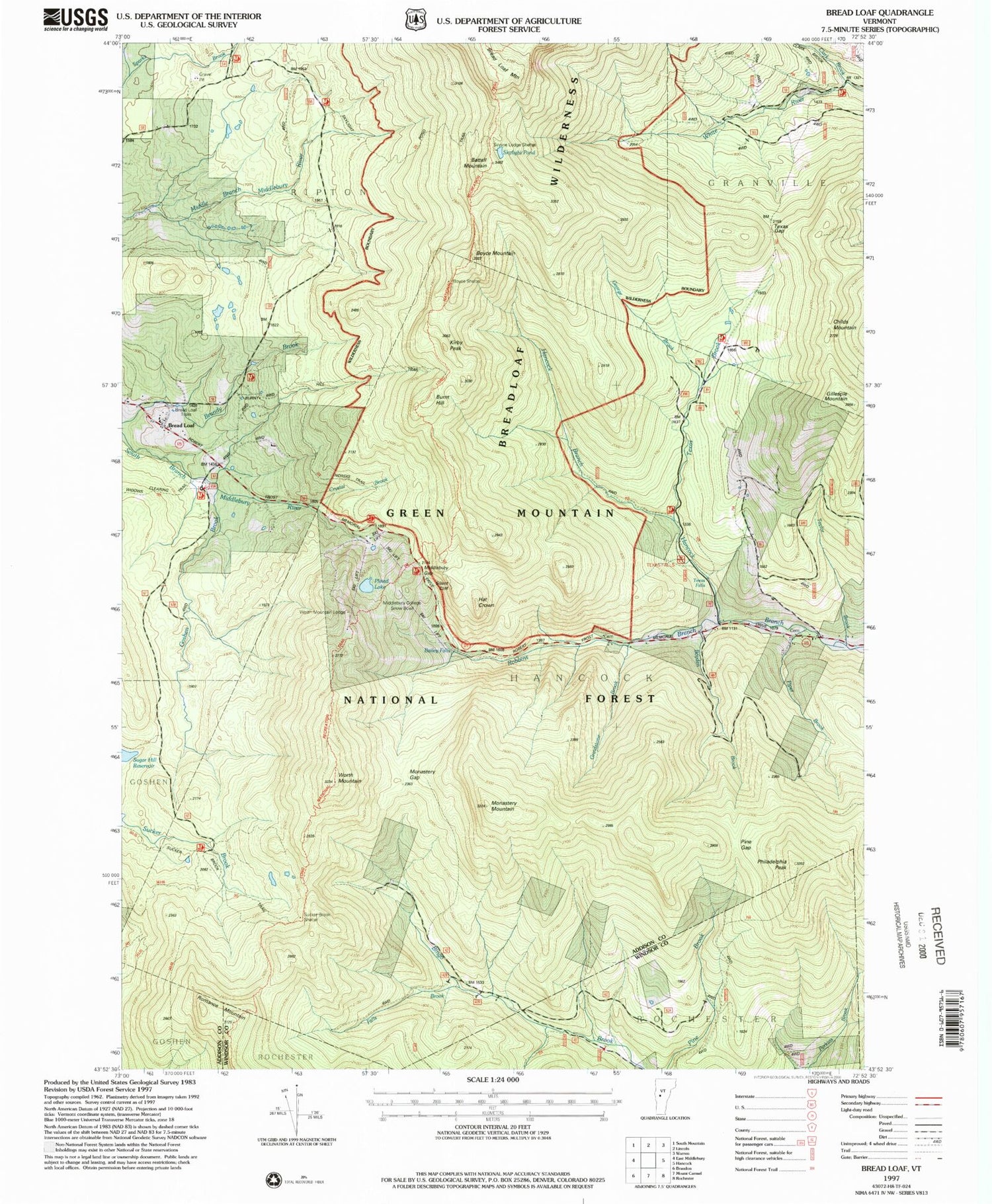
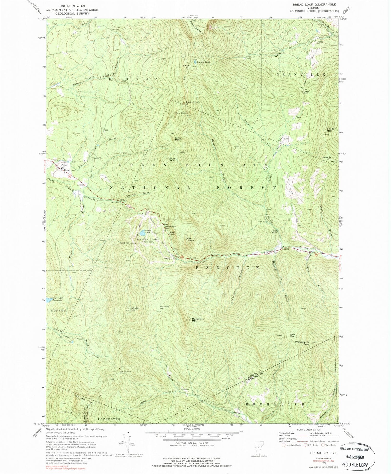
Classic USGS Bread Loaf Vermont 7.5'x7.5' Topo Map
Couldn't load pickup availability
Historical USGS topographic quad map of Bread Loaf in the state of Vermont. Typical map scale is 1:24,000, but may vary for certain years, if available. Print size: 24" x 27"
This quadrangle is in the following counties: Addison, Windsor.
The map contains contour lines, roads, rivers, towns, and lakes. Printed on high-quality waterproof paper with UV fade-resistant inks, and shipped rolled.
Contains the following named places: Bailey Falls, Battell Mountain, Boyce Mountain, Boyce Shelter, Boyden Brook, Bread Loaf, Burnt Hill, Burnt Hill Trail, Childs Mountain, Clark Brook, Crystal Brook, Falls Brook, George Brook, Gillespie Mountain, Goshen Brook, Grindstone Brook, Hat Crown, Kirby Peak, Long Trail, Middlebury College Snow Bowl, Middlebury Gap, Monastery Gap, Monastery Mountain, Philadelphia Peak, Pine Gap, Piper Brook, Pleiad Lake, Robbins Branch, Romance Mountain, Silent Cliff, Skylight Pond, Skylight Pond Trail, Sucker Brook Shelter, Sucker Brook Trail, Taylor Brook, Texas Brook, Texas Falls, Texas Gap, Worth Mountain, Worth Mountain Lodge, Skylight Lodge, Windows Trail, Pleiad Shelter, Texas Falls Picnic Grounds, Town of Hancock, Town of Ripton, Battell Park, Bingo Camp (historical), Branch Cemetery, Branch School (historical), Branch School (historical), Fassett Hill, Kirby Cemetery, Lewis Cemetery, Mazham Cemetery, Middlebury Summer College, Rikert Ski Touring Center Bread Loaf Campus, Texas Falls Picnic Area, Texas School (historical), Bread Loaf School of English, Joseph Battell Wilderness