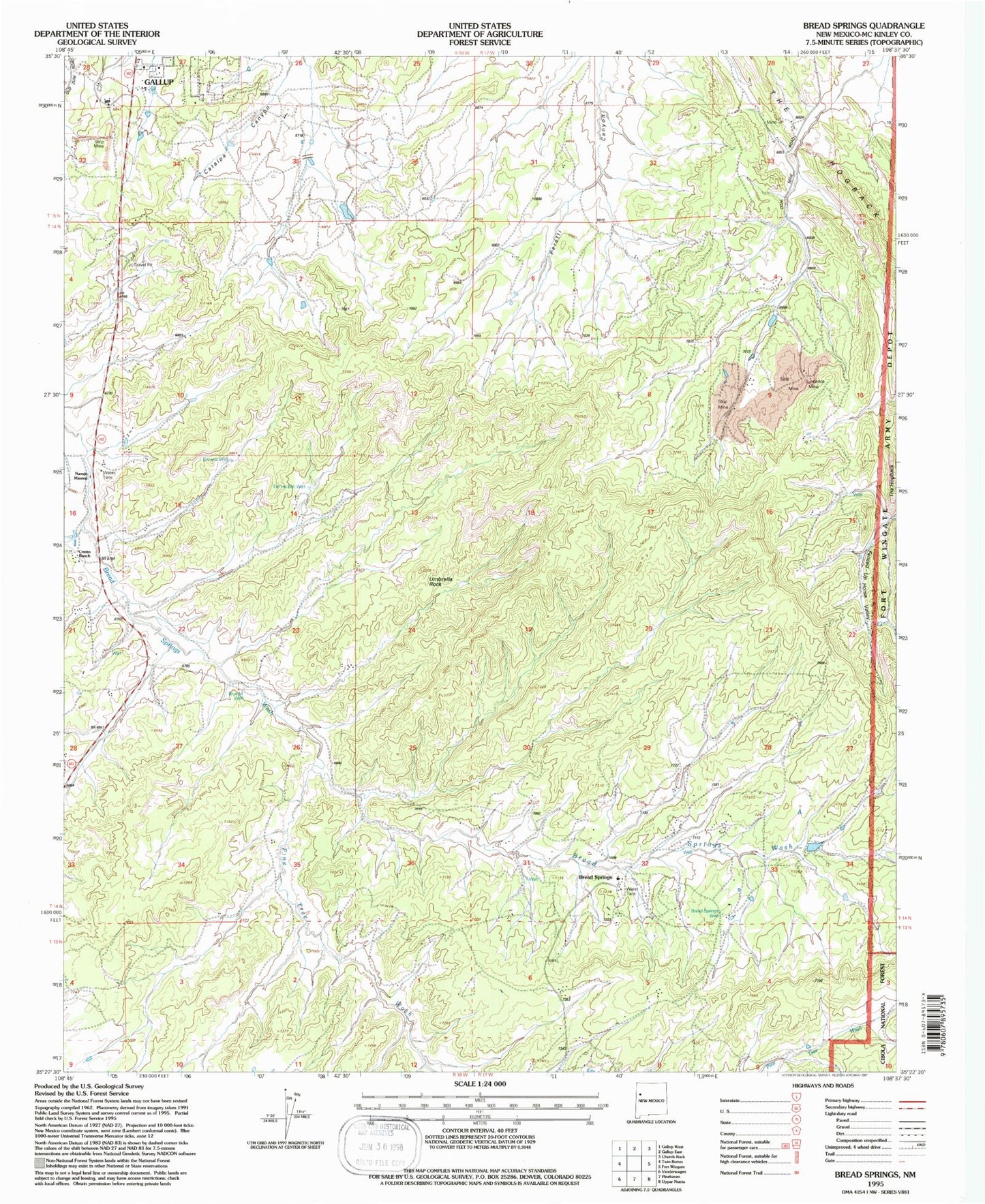
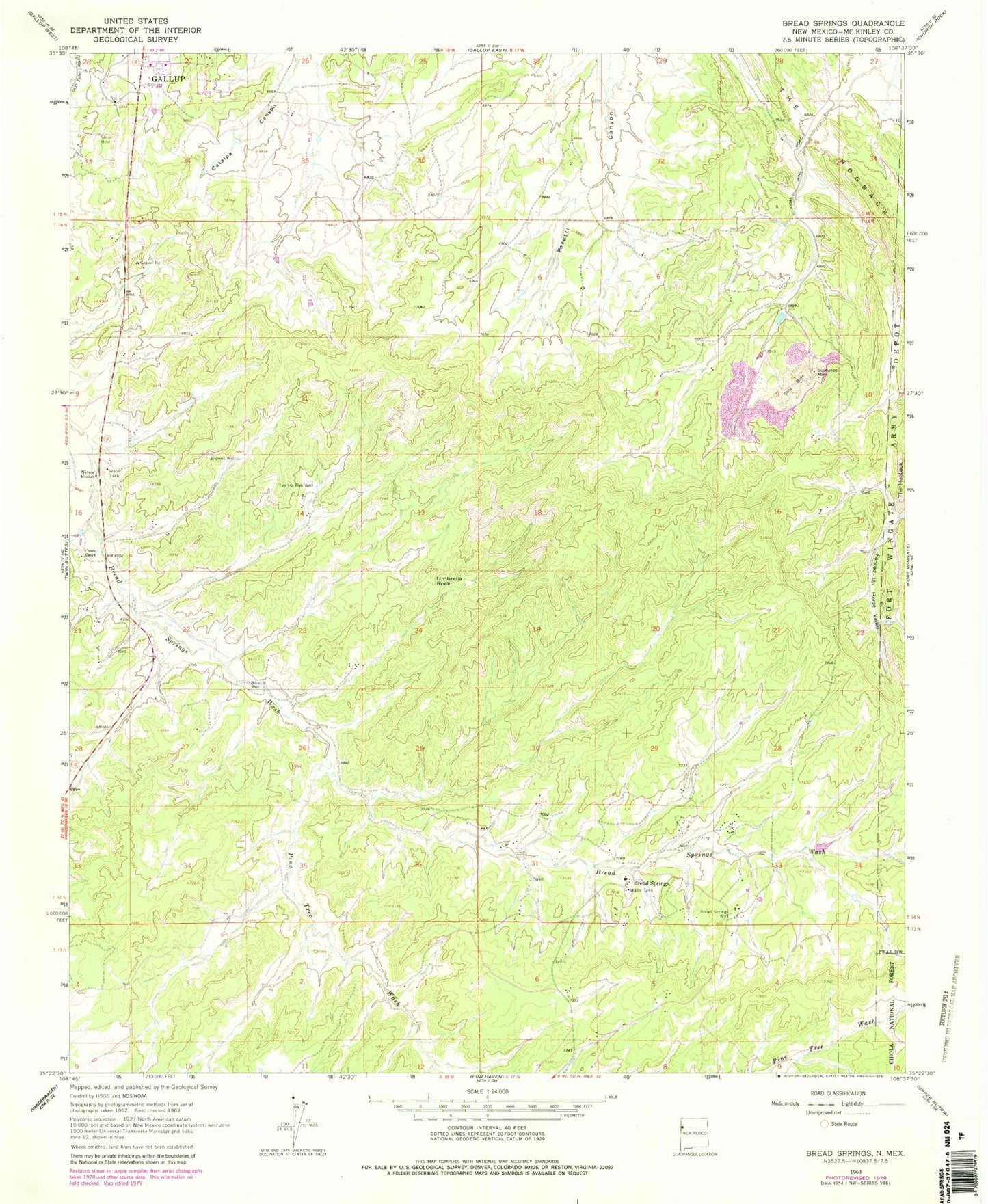
MyTopo
Classic USGS Bread Springs New Mexico 7.5'x7.5' Topo Map
Regular price
$16.95
Regular price
Sale price
$16.95
Unit price
per
Couldn't load pickup availability
Historical USGS topographic quad map of Bread Springs in the state of New Mexico. Map scale may vary for some years, but is generally around 1:24,000. Print size is approximately 24" x 27"
This quadrangle is in the following counties: McKinley.
The map contains contour lines, roads, rivers, towns, and lakes. Printed on high-quality waterproof paper with UV fade-resistant inks, and shipped rolled.
Contains the following named places: Ba-Ha-Li, Blue M Well, Bread Springs, Bread Springs Well, Browns Well, Catalpa Canyon Census Designated Place, Cresto Ranch, Franklin, Hyde Deposit, KQNM-FM (Gallup), Largo Number 4 Mine, Navajo Mission, Pine Tree Wash, Sundance, Sundance Mine, Tah Ha Bah Well, Umbrella Rock