MyTopo
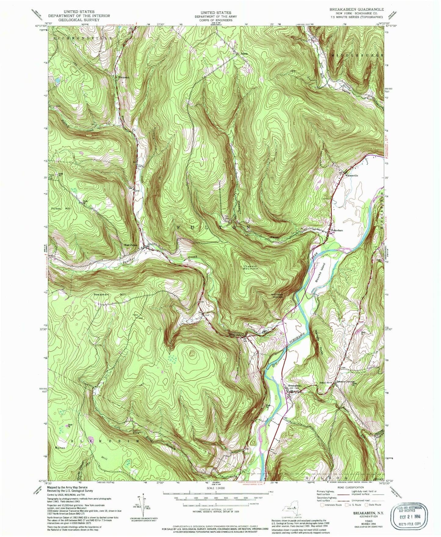
Classic USGS Breakabeen New York 7.5'x7.5' Topo Map
Couldn't load pickup availability
Historical USGS topographic quad map of Breakabeen in the state of New York. Typical map scale is 1:24,000, but may vary for certain years, if available. Print size: 24" x 27"
This quadrangle is in the following counties: Schoharie.
The map contains contour lines, roads, rivers, towns, and lakes. Printed on high-quality waterproof paper with UV fade-resistant inks, and shipped rolled.
Contains the following named places: Bouck Hollow, Boucks Falls, Boucks Island, Breakabeen, Cole Hollow, Ellis Cemetery, Fulton Hill, Fulton Hill Cemetery, Fultonham, Heathen Creek, House Creek, Housons Corners, Keyser Kill, Panther Creek, Pleasant Valley, Rossman Hill, Towpath Mountain, Vintonton, Walhalla Rocks, Warner Hollow, Watsonville, West Fulton, Patria, Schoharie County, School Number 11 (historical), School Number 13 (historical), School Number 9 (historical), Cole Brook, Max V Shaul State Park, Town of Fulton, Patria Cemetery, West Fulton Village Cemetery, Breakabeen Cemetery, Barbers Farm, Fultonham Post Office, West Fulton Post Office, West Fulton Volunteer Fire Department