
MyTopo
Classic USGS Breckenridge Michigan 7.5'x7.5' Topo Map
Couldn't load pickup availability
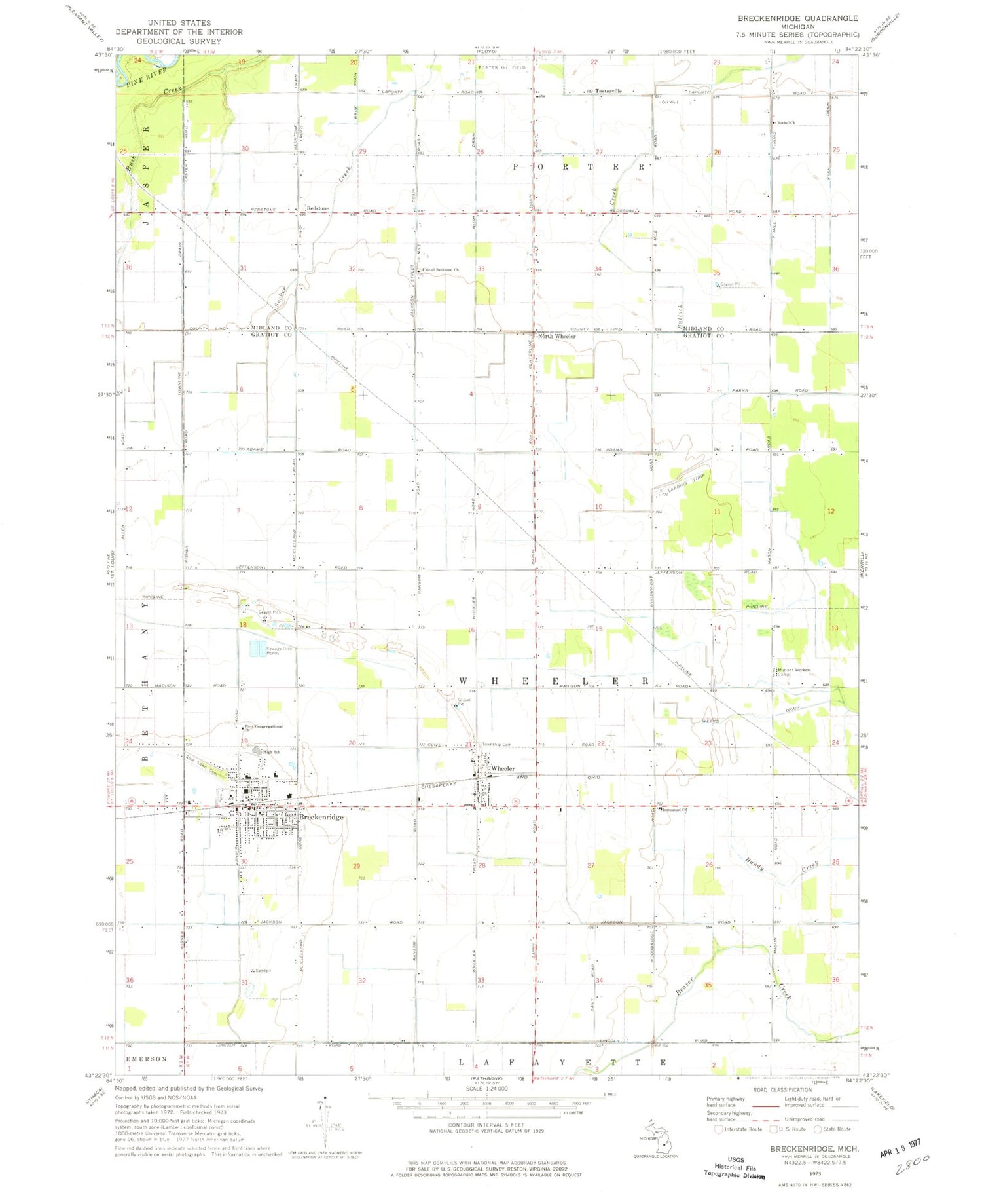
Historical USGS topographic quad map of Breckenridge in the state of Michigan. Map scale may vary for some years, but is generally around 1:24,000. Print size is approximately 24" x 27"
This quadrangle is in the following counties: Gratiot, Midland.
The map contains contour lines, roads, rivers, towns, and lakes. Printed on high-quality waterproof paper with UV fade-resistant inks, and shipped rolled.
Contains the following named places: Amazing Grace Church, Bethel Church, Breckenridge, Breckenridge - Wheeler Township Fire Department, Breckenridge Elementary School, Breckenridge High School, Breckenridge Mobile Home Park, Breckenridge Police Department, Breckenridge Post Office, Breckenridge Station, Breckenridge Wesleyan Church, Bush Drain, Centerline Drain, Countryside United Brethren Church, Family Medical Care, First Congregational Church, Free Methodist Church, Immanuel Church, Jackson Street Drain, North Wheeler, North Wheeler Post Office, Plank Road Museum, Redstone, Redstone Drain, Redstone Post Office, Ridge Golf Course, Rose Lawn Cemetery, Ryan Drain, Saginaw and Gratiot County State Road Historical Marker, Saginaw Valley and Saint Louis Railroad Historical Marker, Teeterville, Townline Drain, Township of Wheeler, United Brethren Church, United Methodist Church, Village of Breckenridge, Weeks Drain, Wheeler, Wheeler Post Office, Wheeler Station, Wheeler Township Cemetery, ZIP Codes: 48615, 48662


