MyTopo
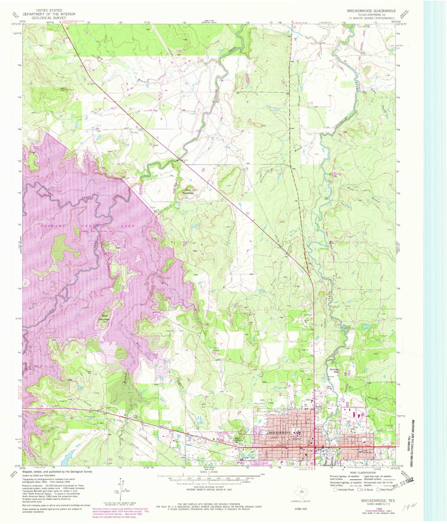
Classic USGS Breckenridge Texas 7.5'x7.5' Topo Map
Couldn't load pickup availability
Historical USGS topographic quad map of Breckenridge in the state of Texas. Map scale may vary for some years, but is generally around 1:24,000. Print size is approximately 24" x 27"
This quadrangle is in the following counties: Stephens.
The map contains contour lines, roads, rivers, towns, and lakes. Printed on high-quality waterproof paper with UV fade-resistant inks, and shipped rolled.
Contains the following named places: Apostolic Lighthouse Church, Bethany Baptist Church, Big Branch, Big Sandy Creek, Breckenridge, Breckenridge Alternative School, Breckenridge Aviation Museum, Breckenridge Cemetery, Breckenridge City Hall, Breckenridge Fire Department, Breckenridge High School, Breckenridge Junior High School, Breckenridge Police Department, Breckenridge Post Office, Buckaroo Field, Church of Christ, Church of God, City of Breckenridge, Coal Mountain, Donkey Mountain, Dry Branch, East Elementary School, First Baptist Church, First Presbyterian Church, Fluehearty Branch, Gore Mountain, Horse Branch, Hubbard Creek Dam, Joe K Boyce Park, KROO-FM (Breckenridge), KSTB-AM (Breckenridge), Miller Park, Mount Olive Baptist Church, North Elementary School, Picketville Cemetery, Robbins Lake, Rush Branch, Sacred Heart Catholic Church, Saint Andrews Episcopal Church, Seventh Day Adventist Church, Sink Creek, South Elementary School, Stephens County Constable's Office, Stephens County Courthouse, Stephens County Jail, Stephens County Sheriff's Office, Stephens Memorial Hospital, Swenson Memorial Museum, Trinity Baptist Church, Turner Branch, Twin Lakes, Walker Branch, Yellow Branch, ZIP Code: 76424