MyTopo
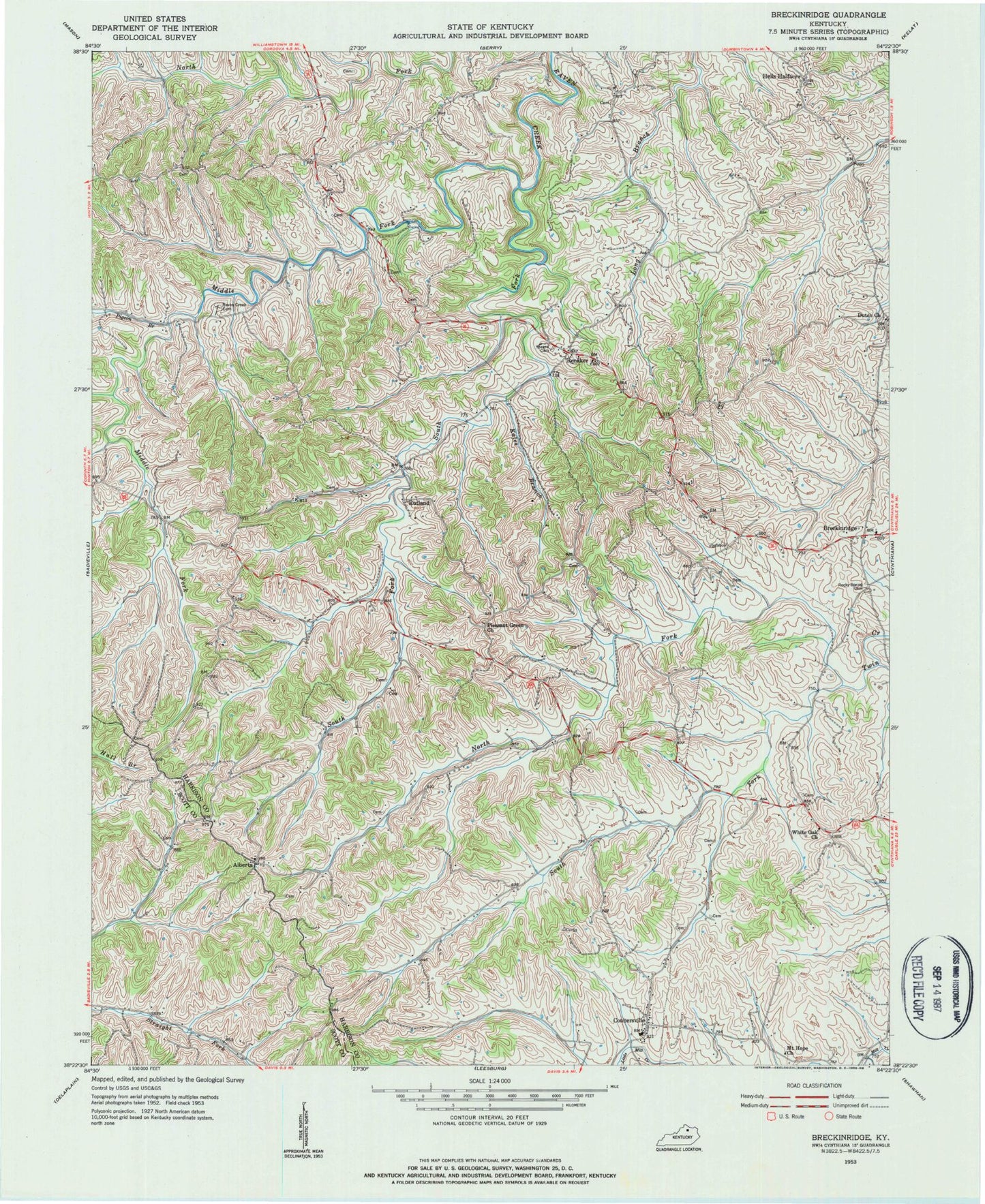
Classic USGS Breckinridge Kentucky 7.5'x7.5' Topo Map
Couldn't load pickup availability
Historical USGS topographic quad map of Breckinridge in the state of Kentucky. Map scale may vary for some years, but is generally around 1:24,000. Print size is approximately 24" x 27"
This quadrangle is in the following counties: Harrison, Scott.
The map contains contour lines, roads, rivers, towns, and lakes. Printed on high-quality waterproof paper with UV fade-resistant inks, and shipped rolled.
Contains the following named places: Alberta, Alberta Post Office, Beard Cemetery, Berry West Division, Breckenridge Post Office, Breckinridge, Connersville, Connersville Post Office, Connersville School, Dutch Chapel, Dutch Church, Harrison County Volunteer Fire Department Station 5, Hells Halfacre, Hoggard Lake, Kales Branch, Kings Cemetery, Middle Fork, Middle Fork Raven Creek, Mount Hope Church, North Fork Twin Creek, Pigeon Branch, Pleasant Green Church, Pleasant Green School, Raven Creek Cemetery, Renaker, Renaker Post Office, Renaker School, Rocky Spring Cemetery, Rutland, Rutland Post Office, Selma Post Office, South Fork Raven Creek, South Fork Twin Creek, Tricum School, White Oak, White Oak Church, White Oak School