MyTopo
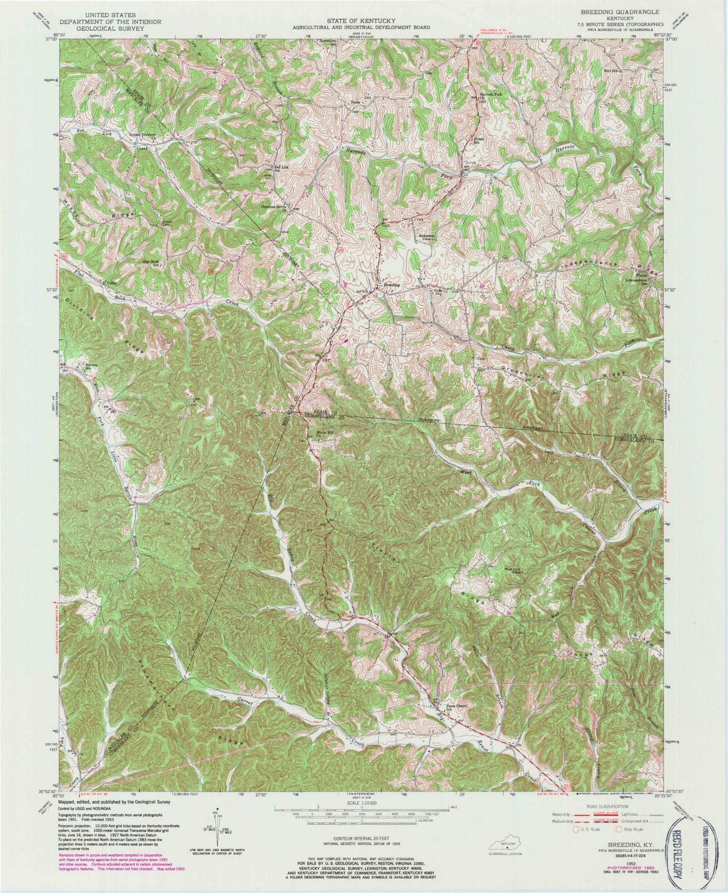
Classic USGS Breeding Kentucky 7.5'x7.5' Topo Map
Couldn't load pickup availability
Historical USGS topographic quad map of Breeding in the state of Kentucky. Map scale may vary for some years, but is generally around 1:24,000. Print size is approximately 24" x 27"
This quadrangle is in the following counties: Adair, Cumberland, Metcalfe.
The map contains contour lines, roads, rivers, towns, and lakes. Printed on high-quality waterproof paper with UV fade-resistant inks, and shipped rolled.
Contains the following named places: Bessie Branch, Bird, Bird School, Breeding, Breeding Area Fire Department, Breeding Post Office, Chestnut Grove Church, Cofer, Estep, Firkin, Firkin School, Flat Rock School, Fudge Cemetery, Garrett Creek, Greenbrier Ridge, Harrods Fork Church, Independence School, Janes Cemetery, Jessee Cemetery, Jones Chapel School, Lacy Branch, Mud Lick Creek, Picnic, Red Lick School, Revena School, Schemerhorn Ridge, Smith Branch, Sulphur Spring Branch, Toria, Traylor Ridge, United Brethren Church, White Hill Church, ZIP Code: 42715