MyTopo
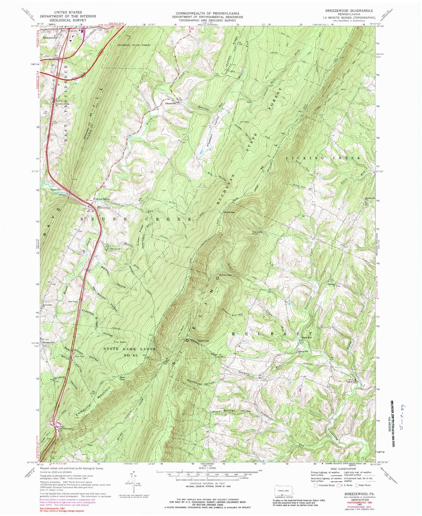
Classic USGS Breezewood Pennsylvania 7.5'x7.5' Topo Map
Couldn't load pickup availability
Historical USGS topographic quad map of Breezewood in the state of Pennsylvania. Map scale may vary for some years, but is generally around 1:24,000. Print size is approximately 24" x 27"
This quadrangle is in the following counties: Bedford, Fulton.
The map contains contour lines, roads, rivers, towns, and lakes. Printed on high-quality waterproof paper with UV fade-resistant inks, and shipped rolled.
Contains the following named places: Akersville, Akersville Cemetery, Bald Hill Trail, Barton Run, Barton Trail, Bear Pond, Bear Wallow Hollow, Betsey Gap, Bold Hill Trail, Breezewood, Breezewood Elementary School, Breezewood Post Office, Brush Creek Valley Cemetery, Buffalo School, Chestnut Bridge Hollow, Crane Run, Crystal Spring, Crystal Spring Camp, Crystal Spring Post Office, Cummings Run, Daves Gap, Deer Hill Trail, Ditch Run Hollow, East Fork Roaring Run, Ebenezer Church, Emmaville, Emmaville Mountain, Ensley Cemetery, Foster Creek, Gapsville, Green Ridge, Haumans Store, Hen Barton Hollow, Jackson Trail, Laurel Run, Little Brush Creek, Maple Hollow, Marshall Hollow, Mc Kendree Church, McKendree Methodist Episcopal Church Cemetery, Mine Gap, Packers Path, Pittman Trail, Pleasant Valley, Poplar Springs Hollow, Roaring Run, Roaring Run Trail, Rock Oak Trail, Rockhouse Hollow, Rohm Cemetery, Sawmill Run, Shaw Cabin Hollow, Sideling Hill Christian Church Cemetery, Sideling Hill Church, Sideling Hill Primitive Baptist Cemetery, Sipes Mill, Slippery Elm Hollow, Smith Hollow, Swope Gap, The Basin, The Bowl, The Little Point, Township of Belfast, Township of Brush Creek, Union Christian Cemetery, West Fork Roaring Run, ZIP Codes: 15533, 15536