MyTopo
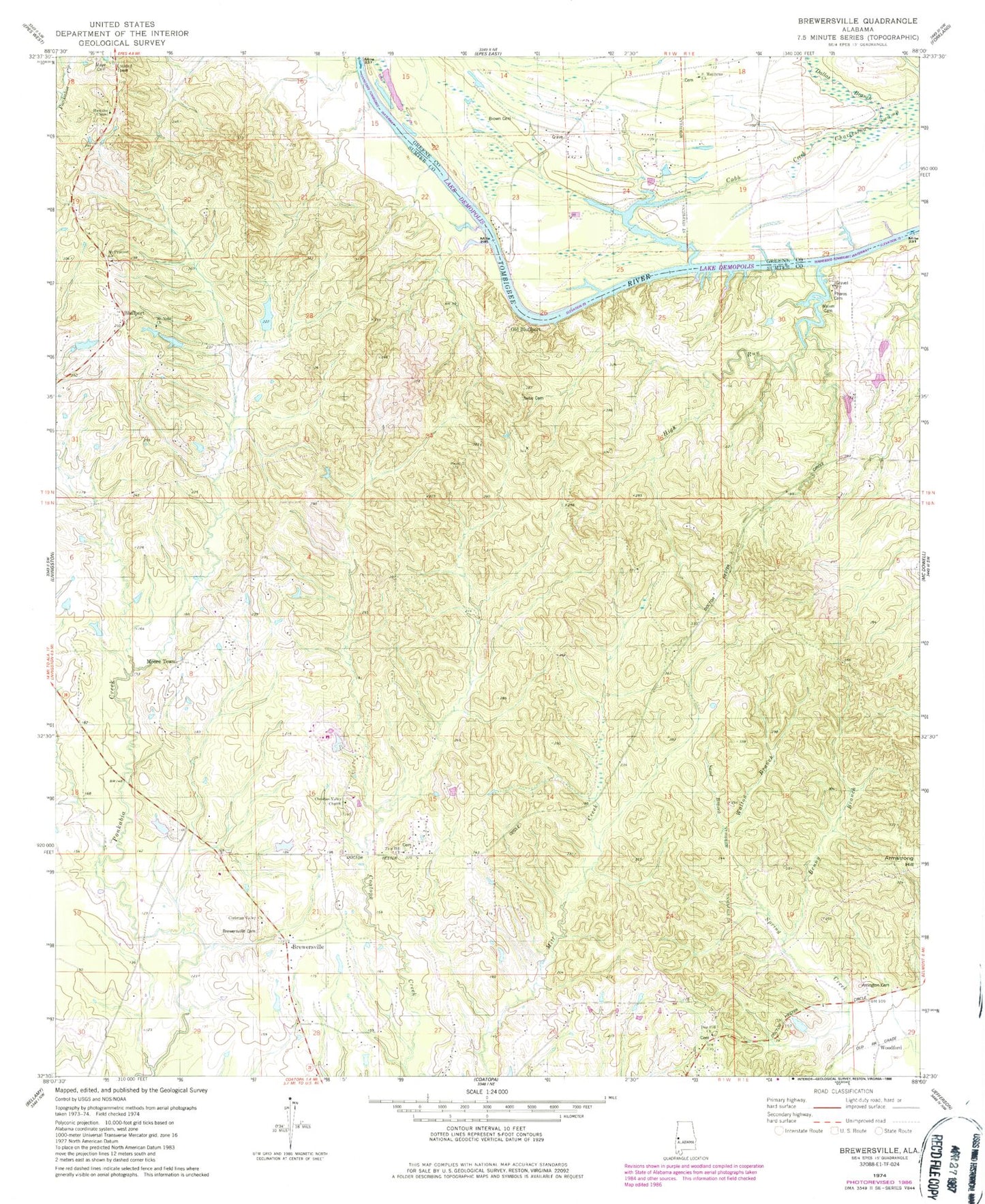
Classic USGS Brewersville Alabama 7.5'x7.5' Topo Map
Couldn't load pickup availability
Historical USGS topographic quad map of Brewersville in the state of Alabama. Map scale may vary for some years, but is generally around 1:24,000. Print size is approximately 24" x 27"
This quadrangle is in the following counties: Greene, Sumter.
The map contains contour lines, roads, rivers, towns, and lakes. Printed on high-quality waterproof paper with UV fade-resistant inks, and shipped rolled.
Contains the following named places: Arrington Cemetery, Benny Branch, Bethel Hill School, Bluff Port Bar, Bluff Port Ferry, Bluff Port Landing, Bluff Port Post Office, Bluffport, Brewersville, Brewersville Cemetery, Brewersville Church, Brown Cemetery, Buzzard Roost Bluff, Caney Slough, Christian Valley Baptist Church, Cobb Creek, Cobbs Branch, Cold Springs Bar, Dallas Branch, Dug Hill, Dug Hill Primitive Baptist Church, Dug Hill School, Dugg Hill Cemetery, Epes Tower, Hawkins, Hawkins Chapel, High Run, Horns Branch, Katherine Allison Dam, Katherine Allison Lake, Kenyon Church, Maye Cemetery, Moore Town, Mount Nebo Primitive Baptist Church, Mount Prospect Church, Neal Cemetery, Nebo Cemetery, Nebo Church, New Port, New Prospect, New Prospect Baptist Church, Old Bluffport, Phares Cemetery, Saint Matthew Baptist Church, Saint Matthew Cemetery, Sand Branch, Soctum Fire Tower, Southern Sportsman Lodge, Taylor Branch, Walker Cemetery, Walton Branch, Woodford, Zion Hill, Zion Hill Methodist Church, Zion School, ZIP Code: 35470