MyTopo
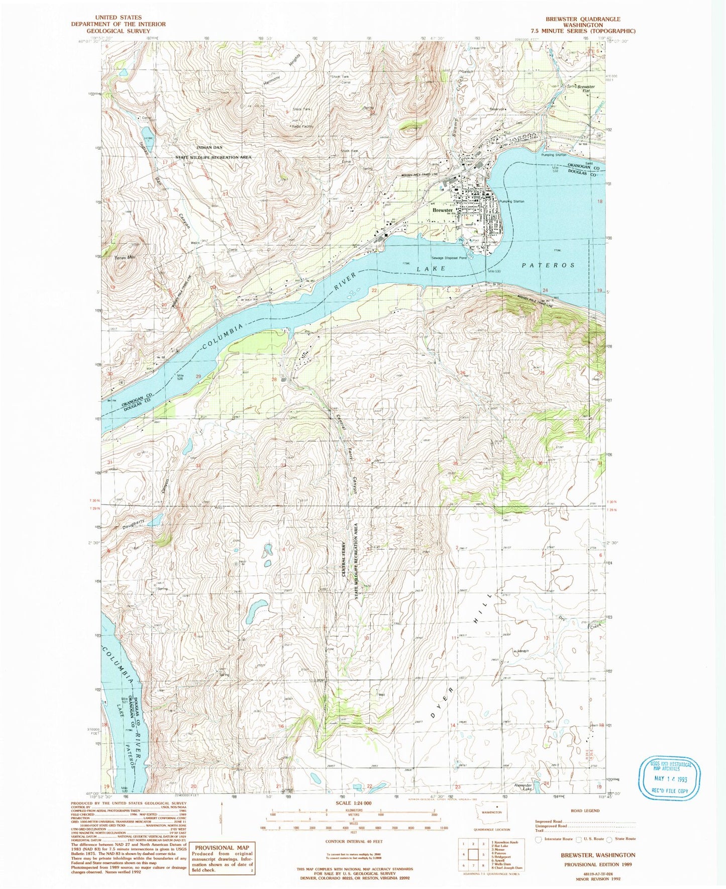
Classic USGS Brewster Washington 7.5'x7.5' Topo Map
Couldn't load pickup availability
Historical USGS topographic quad map of Brewster in the state of Washington. Map scale is 1:24000. Print size is approximately 24" x 27"
This quadrangle is in the following counties: Douglas, Okanogan.
The map contains contour lines, roads, rivers, towns, and lakes. Printed on high-quality waterproof paper with UV fade-resistant inks, and shipped rolled.
Contains the following named places: Alexander Lake, Brewster, Brewster Adventist Church, Brewster Assembly of God Church, Brewster City Fire Department, Brewster Elementary and Junior High School, Brewster Elementary School, Brewster High School, Brewster Junior Academy, Brewster Junior High School, Brewster Police Department, Brewster Post Office, Brewster Sewage Treatment Plant, Calvary Baptist Church, Central Ferry Canyon, Central Ferry State Wildlife Recreation Area, Childrens House, City of Brewster, Columbia Cove Recreational Vehicle Park, Douglas - Okanogan County Fire District 15 Brewster Station 20, Gebbers Dam Number One, Gebbers Dam Number Three, Gebbers Dam Number Two, Harmony House Health Care Center, Indian Dan Canyon, Indian Dan Canyon Dam, Indian Dan Canyon Reservoir, Indian Dan State Wildlife Recreation Area, Inning Field, Lake Pateros, Locust Grove Cemetery, McKie Pond, New Testament Baptist Church, Sacred Heart Catholic Church, Swamp Creek, Tenas Mountain, The Church of Jesus Christ of Latter Day Saints, Three Rivers Hospital, Virginia City (historical)