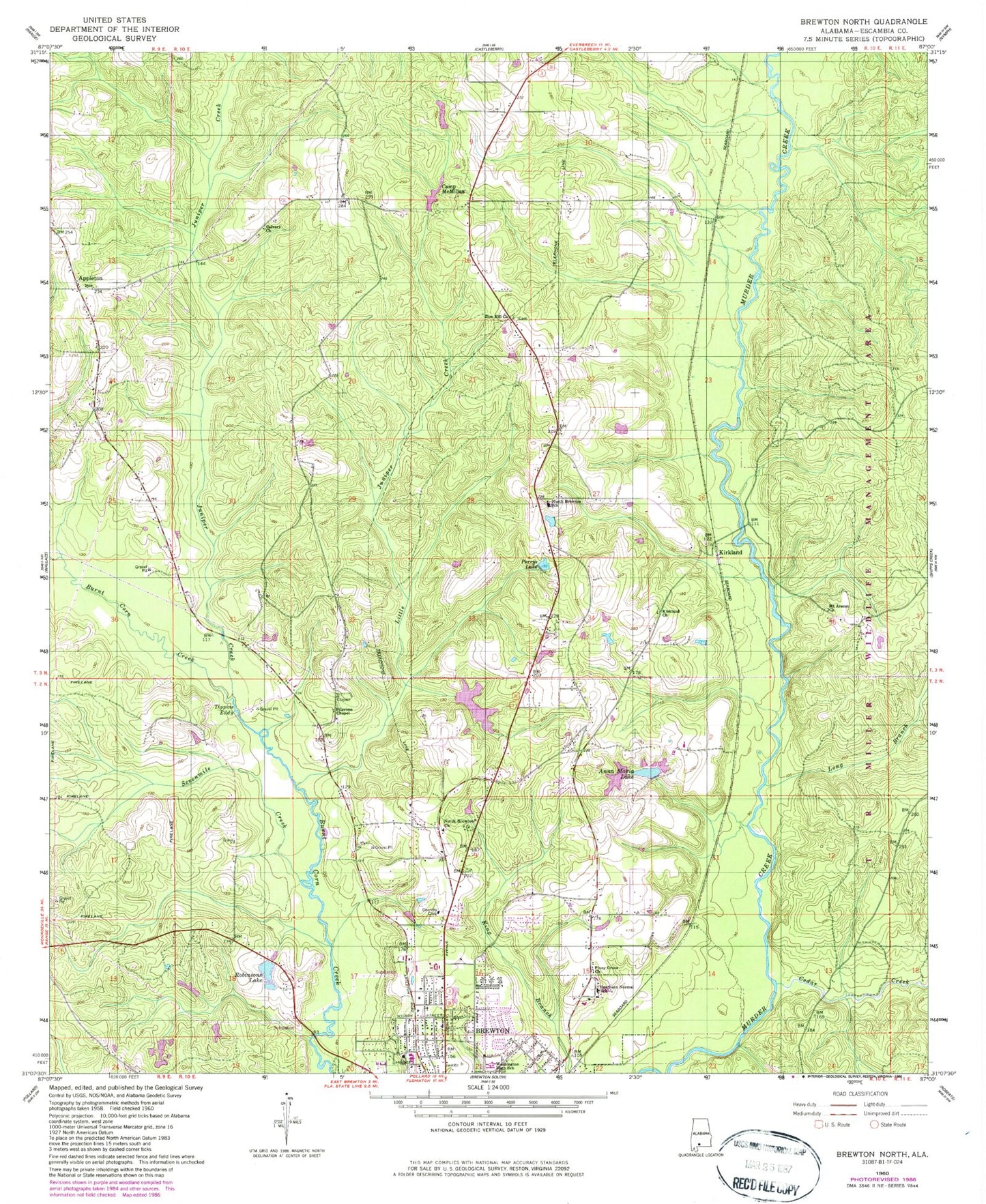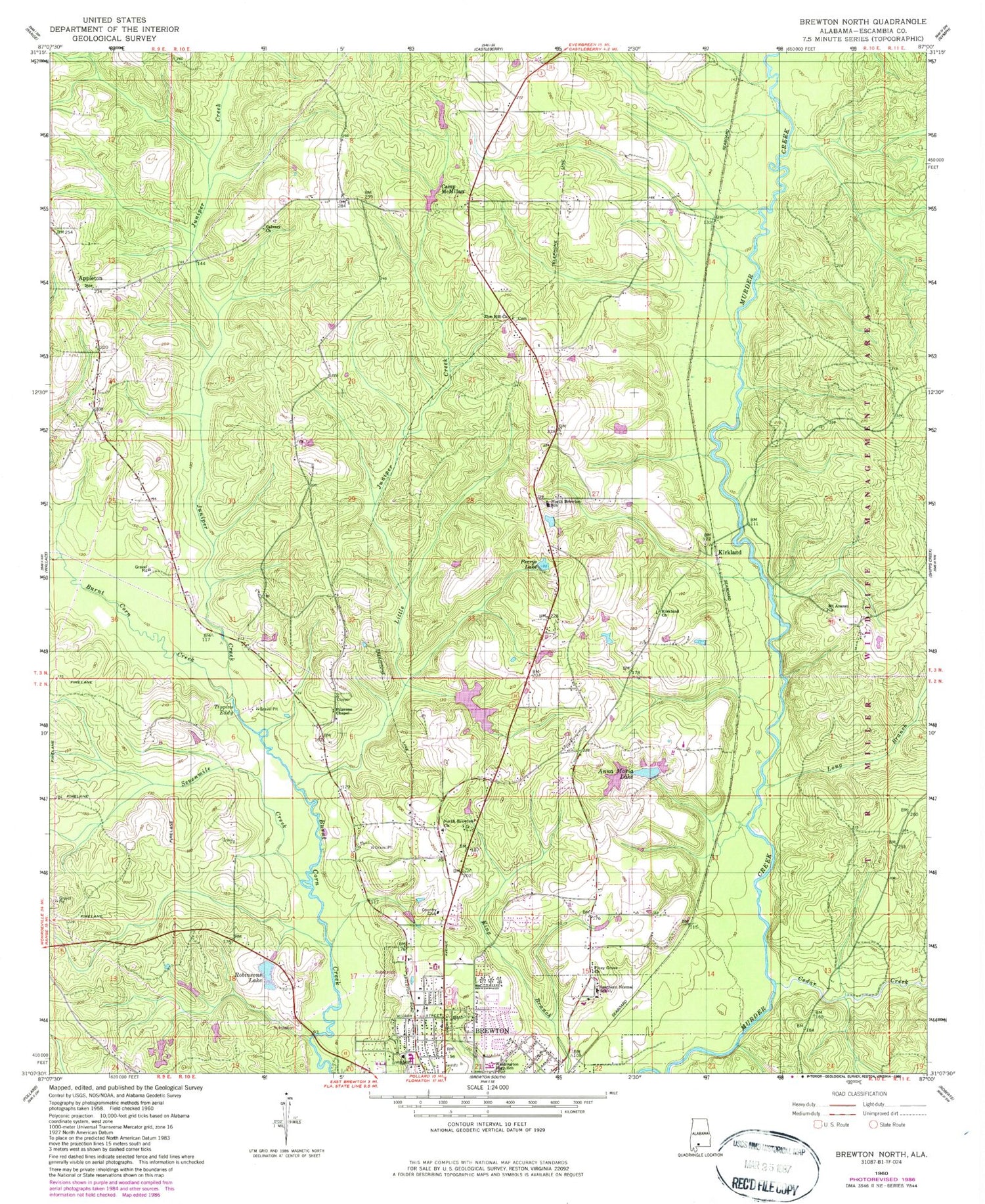
MyTopo
Classic USGS Brewton North Alabama 7.5'x7.5' Topo Map
Couldn't load pickup availability
Historical USGS topographic quad map of Brewton North in the state of Alabama. Map scale is 1:24000. Print size is approximately 24" x 27"
This quadrangle is in the following counties: Escambia.
The map contains contour lines, roads, rivers, towns, and lakes. Printed on high-quality waterproof paper with UV fade-resistant inks, and shipped rolled.
Contains the following named places: Anna Maria Lake, Appleton, Appleton School (historical), Appleton Volunteer Fire Department, Ashley and Jays Watermill (historical), Brewton Agricultural Experiment Station, Brewton Country Club, Brewton Middle School, Calvary Cemetery, Calvary Church, Camp McMillan, Careys and Stallworths Mill (historical), Cedar Creek, Center New Grove School (historical), Country Club of Brewton, D W McMillan Memorial Hospital, Dogwood Hills Golf Resort, E J Moran Number One Dam, E J Moran Number Two Dam, Escambia County Health Department, Fair Plain Church (historical), Friendship Church, H R Sherrer Dam, Huxford Dam, Juniper Creek, Kirkland, Kirkland Church, Lake Huxford, Lake McMillan, Little Juniper Creek, Long Branch, Lynn School (historical), Macedonia Church, McMillan Dam, Moran Lake One, Moran Lake Two, Mount Ararat Church, Mount Olive Church, North Brewton Baptist Church, North Brewton Elementary School, Perrys Lake, Pilgrims Chapel, Pilgrims Chapel Church, Pilgrims Church (historical), Piney Grove Baptist Church, Point Pleasant School (historical), Robinson Dam, Robinsons Lake, Saint Stephens Episcopal Church, Sevenmile Creek, Southern Normal High School, T R Miller High School, The Meadows of Brewton Nursing Home, Tippins Eddy, Victory Christian Center Church, W R Sherrer Lake, Weavers Cemetery, Zion Church Cemetery, Zion Hill Baptist Church