

MyTopo
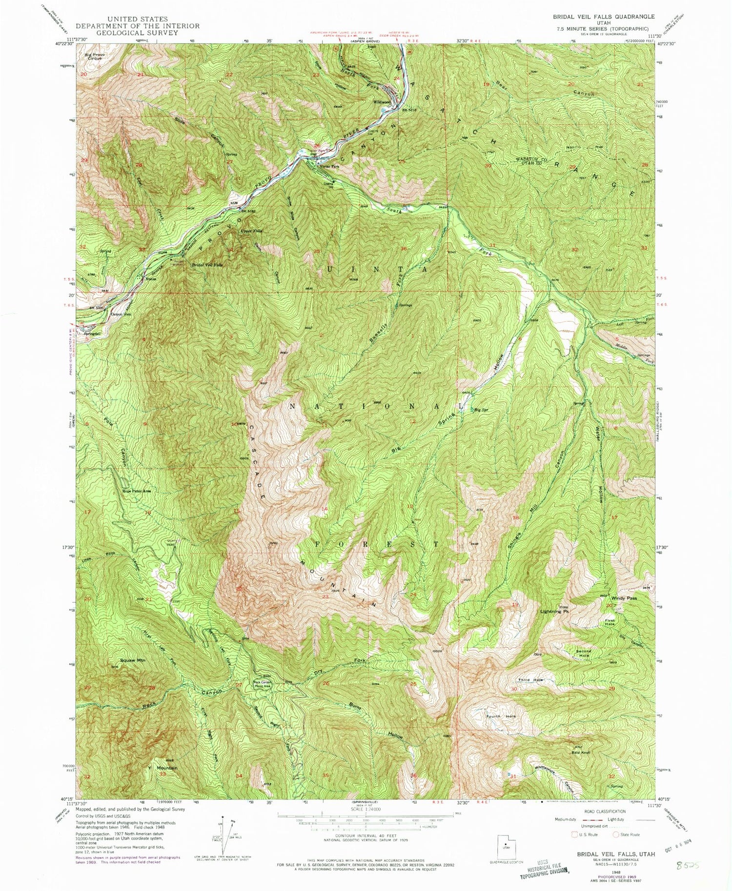
Classic USGS Bridal Veil Falls Utah 7.5'x7.5' Topo Map
Couldn't load pickup availability
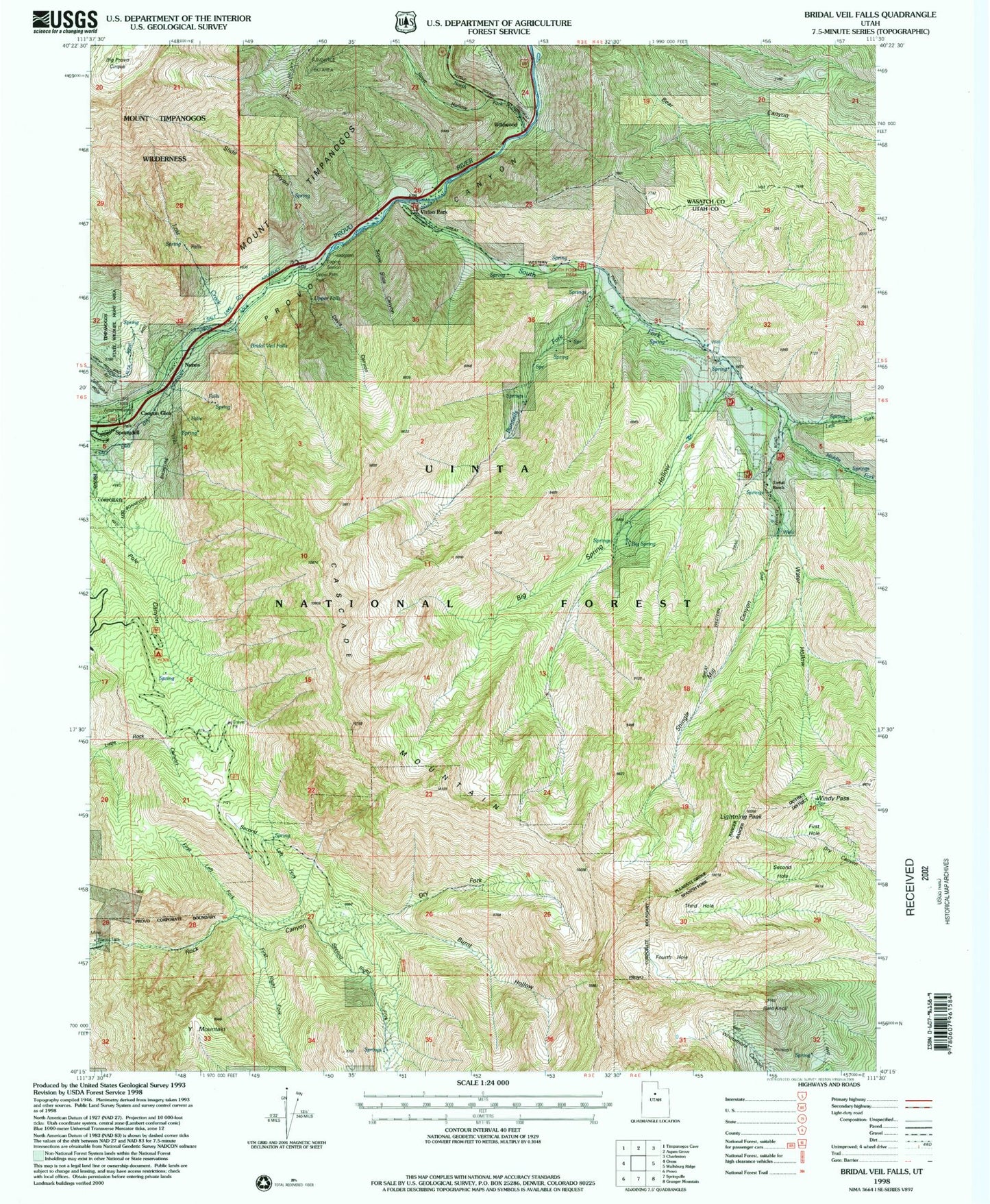
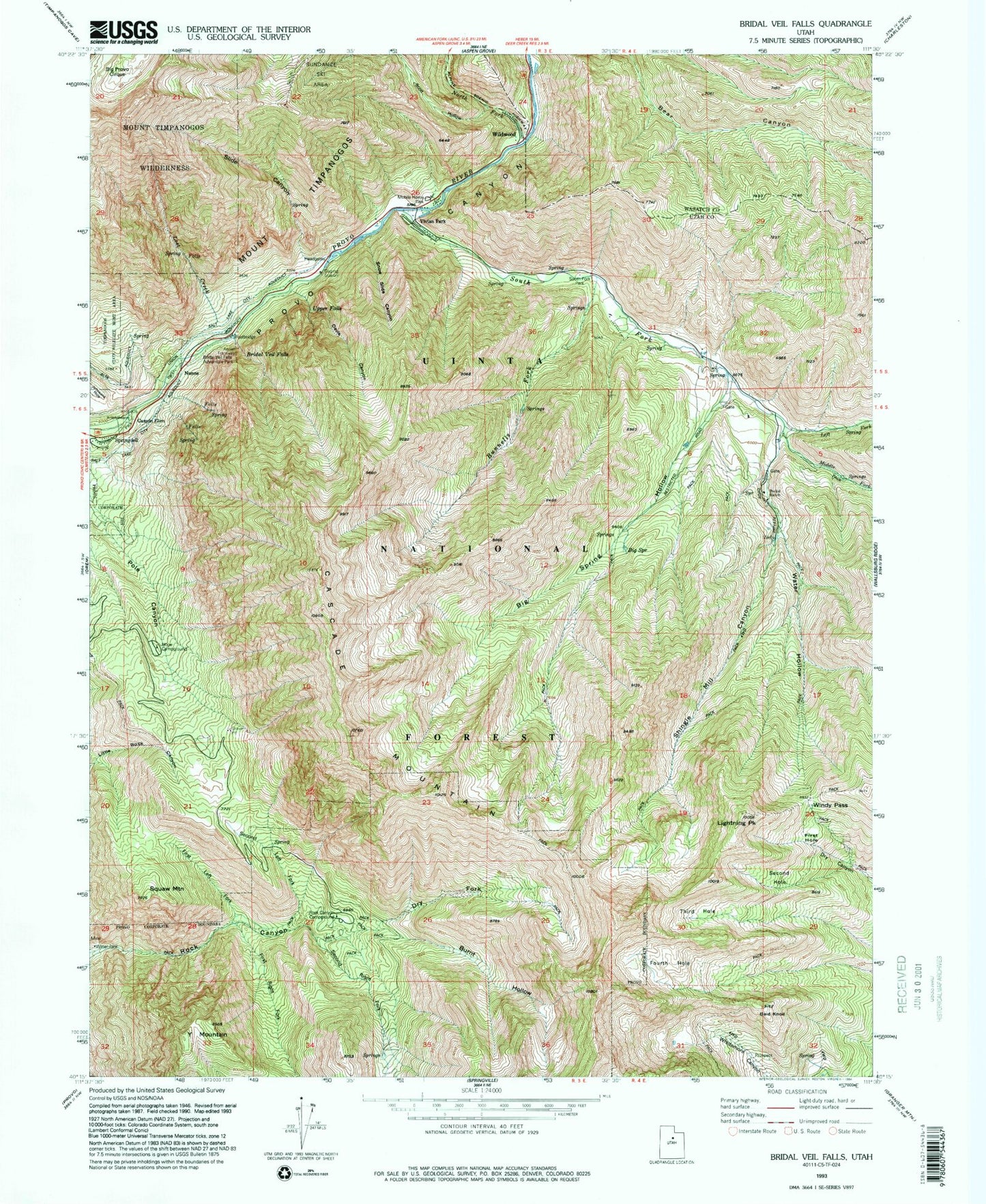
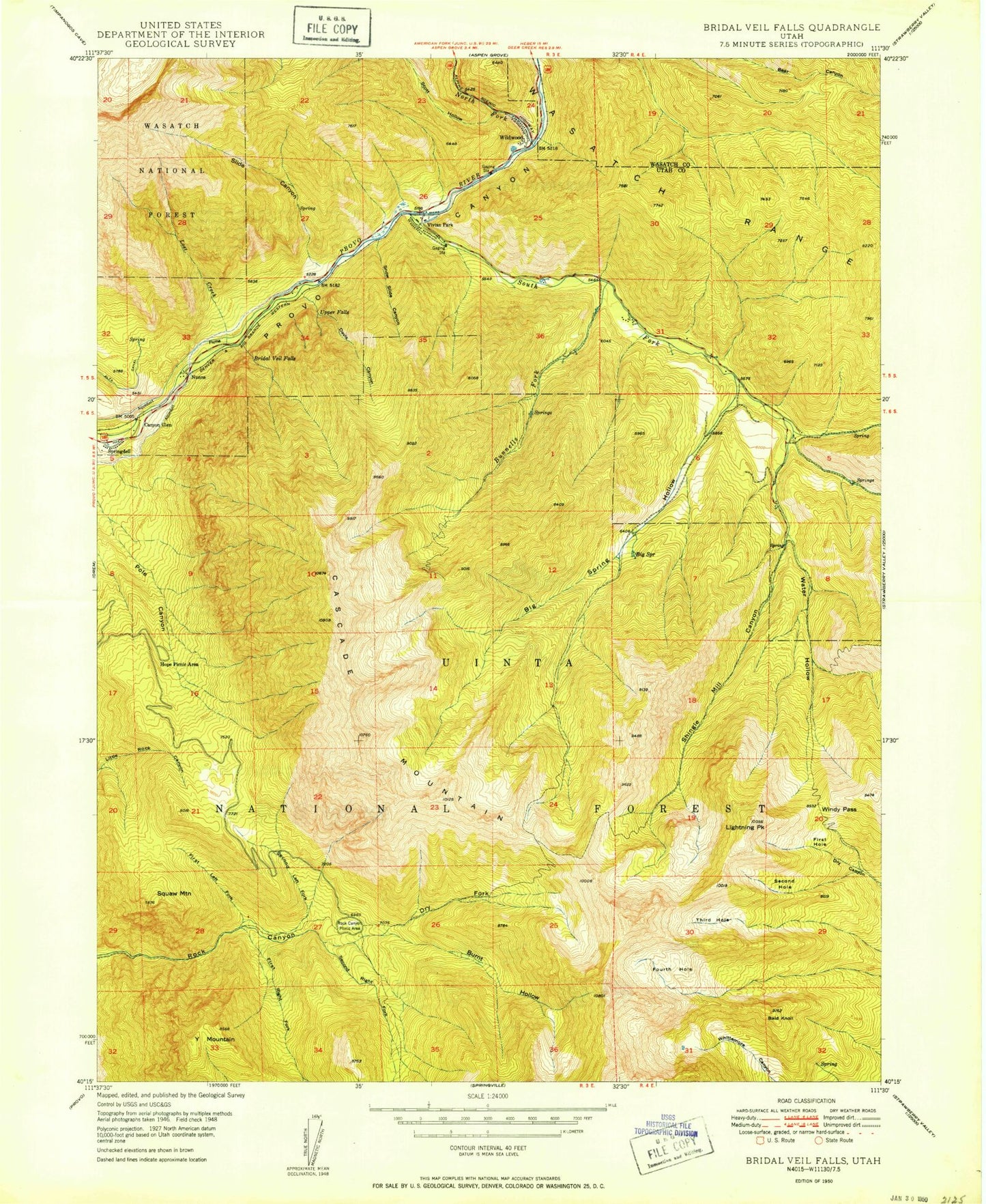
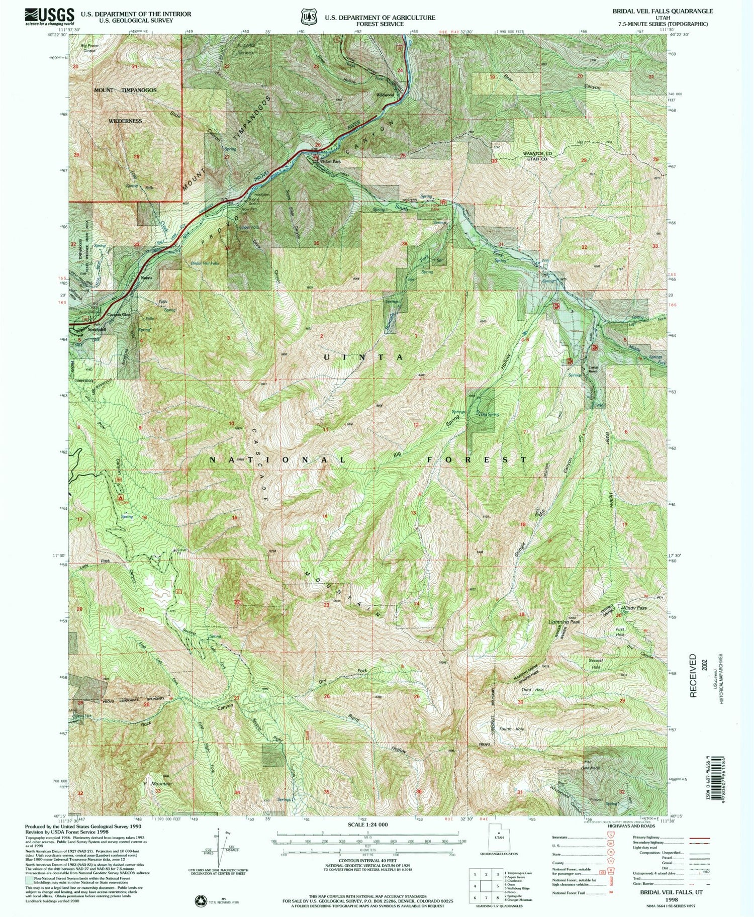
Historical USGS topographic quad map of Bridal Veil Falls in the state of Utah. Typical map scale is 1:24,000, but may vary for certain years, if available. Print size: 24" x 27"
This quadrangle is in the following counties: Utah, Wasatch.
The map contains contour lines, roads, rivers, towns, and lakes. Printed on high-quality waterproof paper with UV fade-resistant inks, and shipped rolled.
Contains the following named places: Bald Knoll, Big Provo Cirque, Big Spring, Big Spring Hollow, Bridal Veil Falls, Bunnells Fork, Burnt Hollow, Canyon Glen, Cascade Mountain, Davis Canyon, Dry Fork, First Hole, First Left Fork Rock Canyon, First Right Fork Rock Canyon, Fourth Hole, Hope Picnic Area, Left Fork South Fork Provo River, Lightning Peak, Lost Creek, Middle Fork South Fork Provo River, North Fork Provo River, Nunns, Rock Canyon Picnic Area, Scott Hollow, Second Hole, Second Left Fork Rock Canyon, Second Right Fork Rock Canyon, Shingle Mill Canyon, Slide Canyon, Snow Slide Canyon, South Fork Provo River, Springdell, Squaw Mountain, Third Hole, Upper Falls, Vivian Park, Water Hollow, Wildwood, Windy Pass, Y Mountain, Frazier Trailer Park, Timpanogos Glacier (historical), Mountain Range Campground, Canyon Glen Picnic Area, Bridal Veil Falls Sky Ride, Rotary Park, Rotary Park Picnic Area, Trefoil Ranch, Vivian Park Post Office (historical), Freedom Peak, Shingle Mill Peak, Bald Knoll, Big Provo Cirque, Big Spring, Big Spring Hollow, Bridal Veil Falls, Bunnells Fork, Burnt Hollow, Canyon Glen, Cascade Mountain, Davis Canyon, Dry Fork, First Hole, First Left Fork Rock Canyon, First Right Fork Rock Canyon, Fourth Hole, Hope Picnic Area, Left Fork South Fork Provo River, Lightning Peak, Lost Creek, Middle Fork South Fork Provo River, North Fork Provo River, Nunns, Rock Canyon Picnic Area, Scott Hollow, Second Hole, Second Left Fork Rock Canyon, Second Right Fork Rock Canyon, Shingle Mill Canyon, Slide Canyon, Snow Slide Canyon, South Fork Provo River, Springdell, Squaw Mountain, Third Hole, Upper Falls, Vivian Park, Water Hollow, Wildwood, Windy Pass, Y Mountain, Frazier Trailer Park, Timpanogos Glacier (historical), Mountain Range Campground, Canyon Glen Picnic Area, Bridal Veil Falls Sky Ride, Rotary Park, Rotary Park Picnic Area, Trefoil Ranch, Vivian Park Post Office (historical), Freedom Peak, Shingle Mill Peak, Bald Knoll, Big Provo Cirque, Big Spring, Big Spring Hollow, Bridal Veil Falls, Bunnells Fork, Burnt Hollow, Canyon Glen, Cascade Mountain, Davis Canyon, Dry Fork, First Hole, First Left Fork Rock Canyon, First Right Fork Rock Canyon, Fourth Hole, Hope Picnic Area, Left Fork South Fork Provo River, Lightning Peak, Lost Creek, Middle Fork South Fork Provo River, North Fork Provo River, Nunns, Rock Canyon Picnic Area, Scott Hollow, Second Hole, Second Left Fork Rock Canyon, Second Right Fork Rock Canyon, Shingle Mill Canyon, Slide Canyon, Snow Slide Canyon, South Fork Provo River, Springdell, Squaw Mountain, Third Hole, Upper Falls, Vivian Park, Water Hollow, Wildwood, Windy Pass, Y Mountain, Frazier Trailer Park, Timpanogos Glacier (historical), Mountain Range Campground, Canyon Glen Picnic Area, Bridal Veil Falls Sky Ride, Rotary Park, Rotary Park Picnic Area, Trefoil Ranch, Vivian Park Post Office (historical), Freedom Peak, Shingle Mill Peak