MyTopo
Classic USGS Bridge Creek Draw Oregon 7.5'x7.5' Topo Map
Couldn't load pickup availability
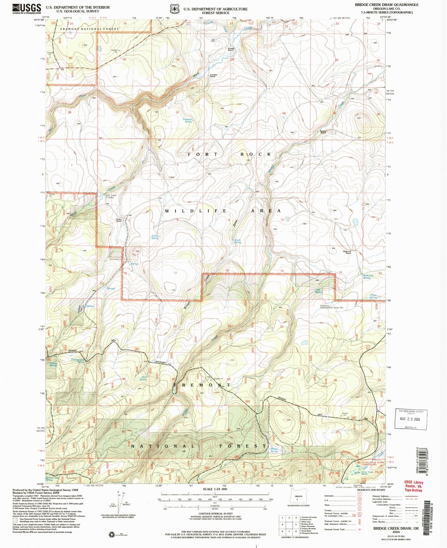
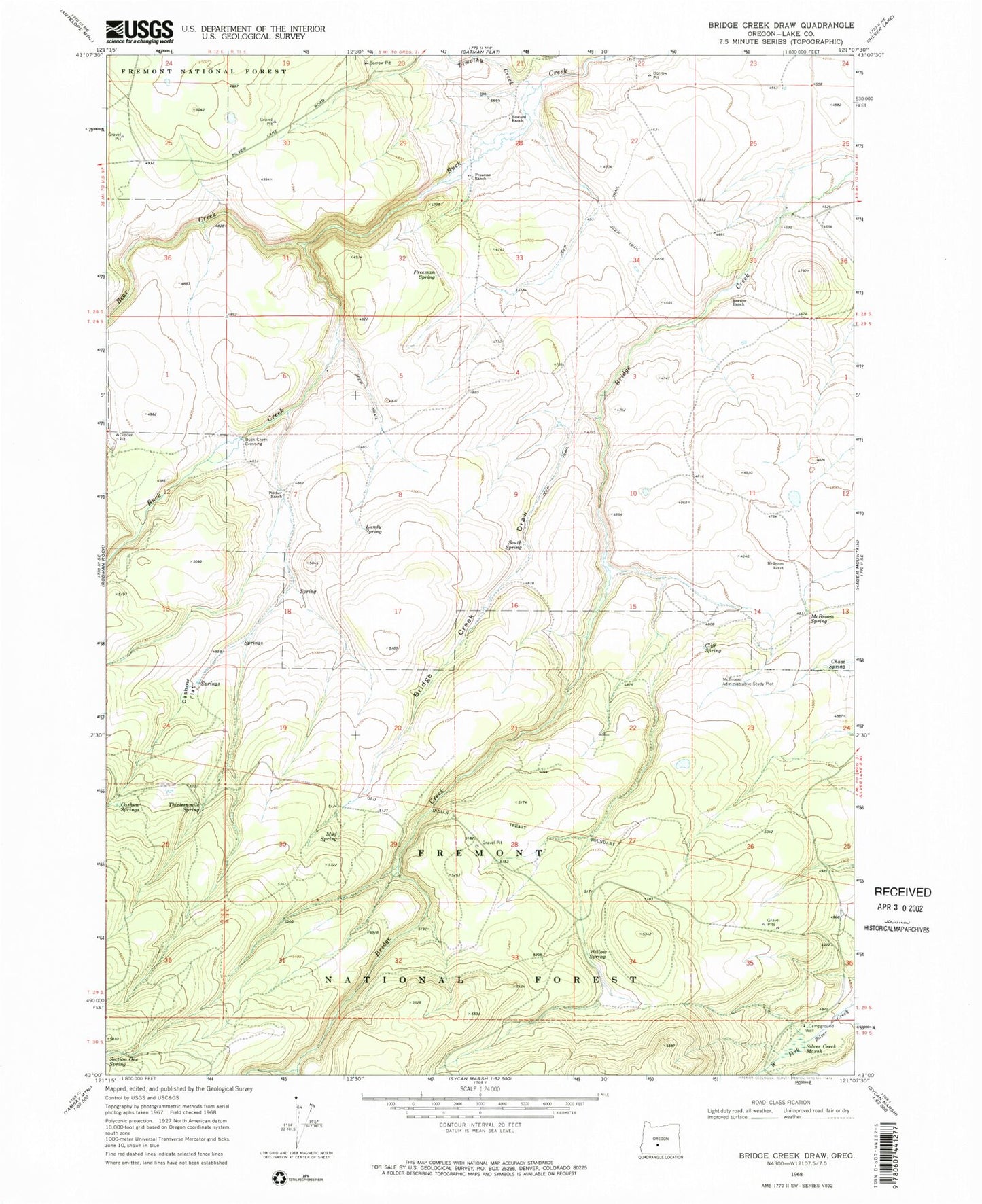
Historical USGS topographic quad map of Bridge Creek Draw in the state of Oregon. Map scale may vary for some years, but is generally around 1:24,000. Print size is approximately 24" x 27"
This quadrangle is in the following counties: Lake.
The map contains contour lines, roads, rivers, towns, and lakes. Printed on high-quality waterproof paper with UV fade-resistant inks, and shipped rolled.
Contains the following named places: Basalt Reservoir, Bear Creek, Brewer Ranch, Bridge Creek Draw, Bridge Creek Waterhole, Buck Creek Crossing, Cashow Flat, Cashow Springs, Chase Spring, Cliff Spring, D Emery Ranch, Freeman Ranch, Freeman Spring, Howard Ranch, Lower Buck Creek Recreation Site, Lundy Spring, McBroom Administrative Study Plot, McBroom Ranch, McBroom Spring, Mud Spring, Pitcher Ranch, Porterville Post Office, Silver Creek Marsh, Silver Creek Marsh Recreation Site, South Spring, South Spring Reservoir, Staked Waterhole, Ted Reservoir, Thirteenmile Spring, Timothy Creek, Willow Spring