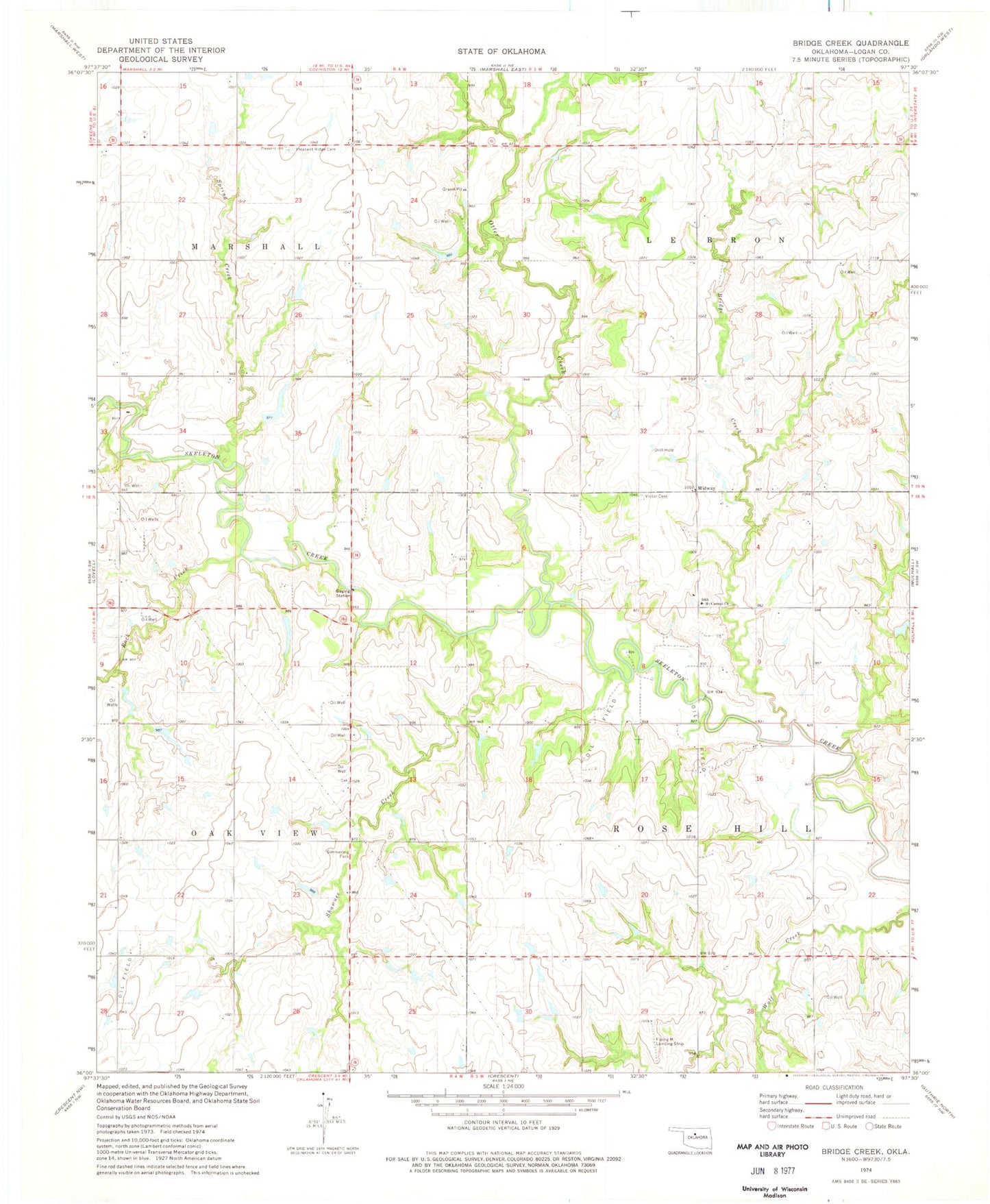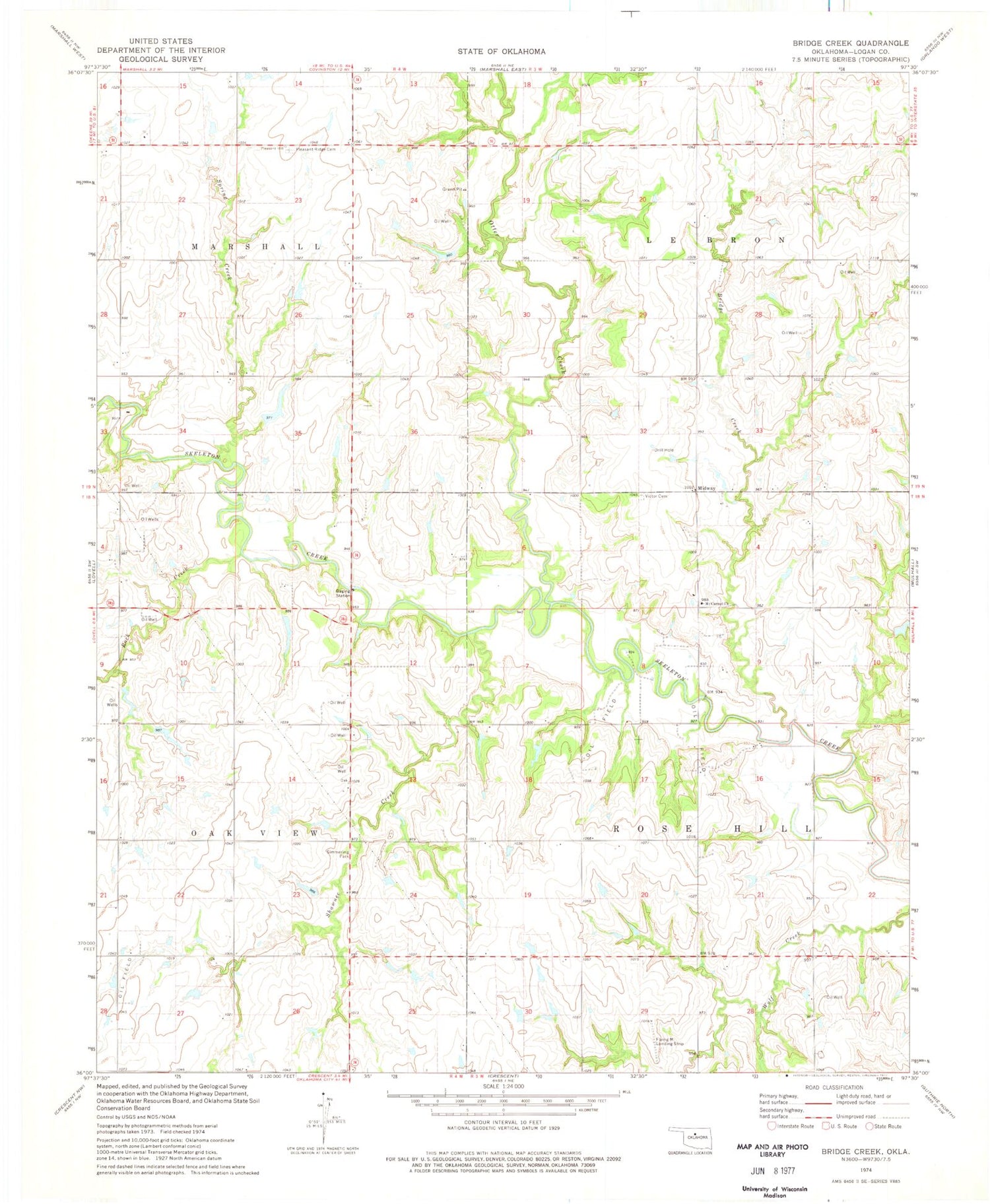
MyTopo
Classic USGS Bridge Creek Oklahoma 7.5'x7.5' Topo Map
Couldn't load pickup availability
Historical USGS topographic quad map of Bridge Creek in the state of Oklahoma. Map scale may vary for some years, but is generally around 1:24,000. Print size is approximately 24" x 27"
This quadrangle is in the following counties: Logan.
The map contains contour lines, roads, rivers, towns, and lakes. Printed on high-quality waterproof paper with UV fade-resistant inks, and shipped rolled.
Contains the following named places: Bridge Creek, Midway, Mount Carmel Church, Oknoname 083039 Dam, Oknoname 083039 Reservoir, Oknoname 083052 Dam, Oknoname 083052 Reservoir, Oknoname 083054 Dam, Oknoname 083054 Reservoir, Oknoname 083055 Dam, Oknoname 083055 Reservoir, Otter Creek, Pleasant Ridge Cemetery, Rock Creek, Shawnee Creek, Simmering Park, Spring Creek, Township of LeBron, Township of Marshall, Township of Oak View, Township of Rose Hill, Victor Cemetery