MyTopo
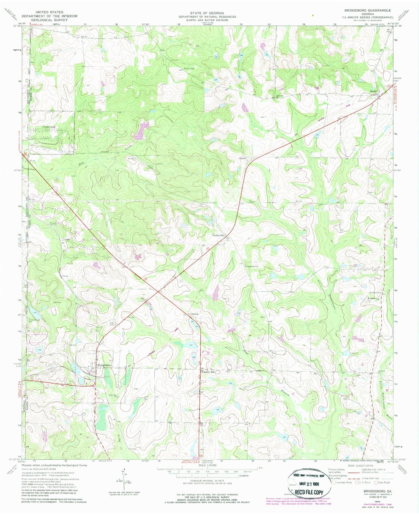
Classic USGS Bridgeboro Georgia 7.5'x7.5' Topo Map
Couldn't load pickup availability
Historical USGS topographic quad map of Bridgeboro in the state of Georgia. Map scale may vary for some years, but is generally around 1:24,000. Print size is approximately 24" x 27"
This quadrangle is in the following counties: Dougherty, Mitchell, Worth.
The map contains contour lines, roads, rivers, towns, and lakes. Printed on high-quality waterproof paper with UV fade-resistant inks, and shipped rolled.
Contains the following named places: Alfords, Bay Branch, Bethany Church, Bridgeboro, Bridgeboro Division, Bridgeboro Missionary Baptist Church, Bridgeboro Volunteer Fire Department Station 3, Chapel Hill Cemetery, Chapel Hill Church, Crestwood, Evergreen Cemetery, Evergreen Church, Evergreen School, Fellowship Church, Friendship Church, Friendship School, Gantts, Gintown, Gordy, Gordy Volunteer Fire Department Station 4, Groveland Estates, Hopewell Church, Indian Cove, Jenkins Lake, Jenkins Lake Dam, Liberty Hill, Livingston, Morris Hill School, Mount Pisgah Church, New Bethel Church, Parker Cemetery, Parkerville, Parkerville Cemetery, Parkerville School, Pritchard Lake, Pritchard Lake Dam, Rocky Mount Cemetery, Sears Lake, Sears Lake Dam, Varnadoe Lake, Varnadoe Lake Dam, Varnadoe North Lake, Varnadoe North Lake Dam