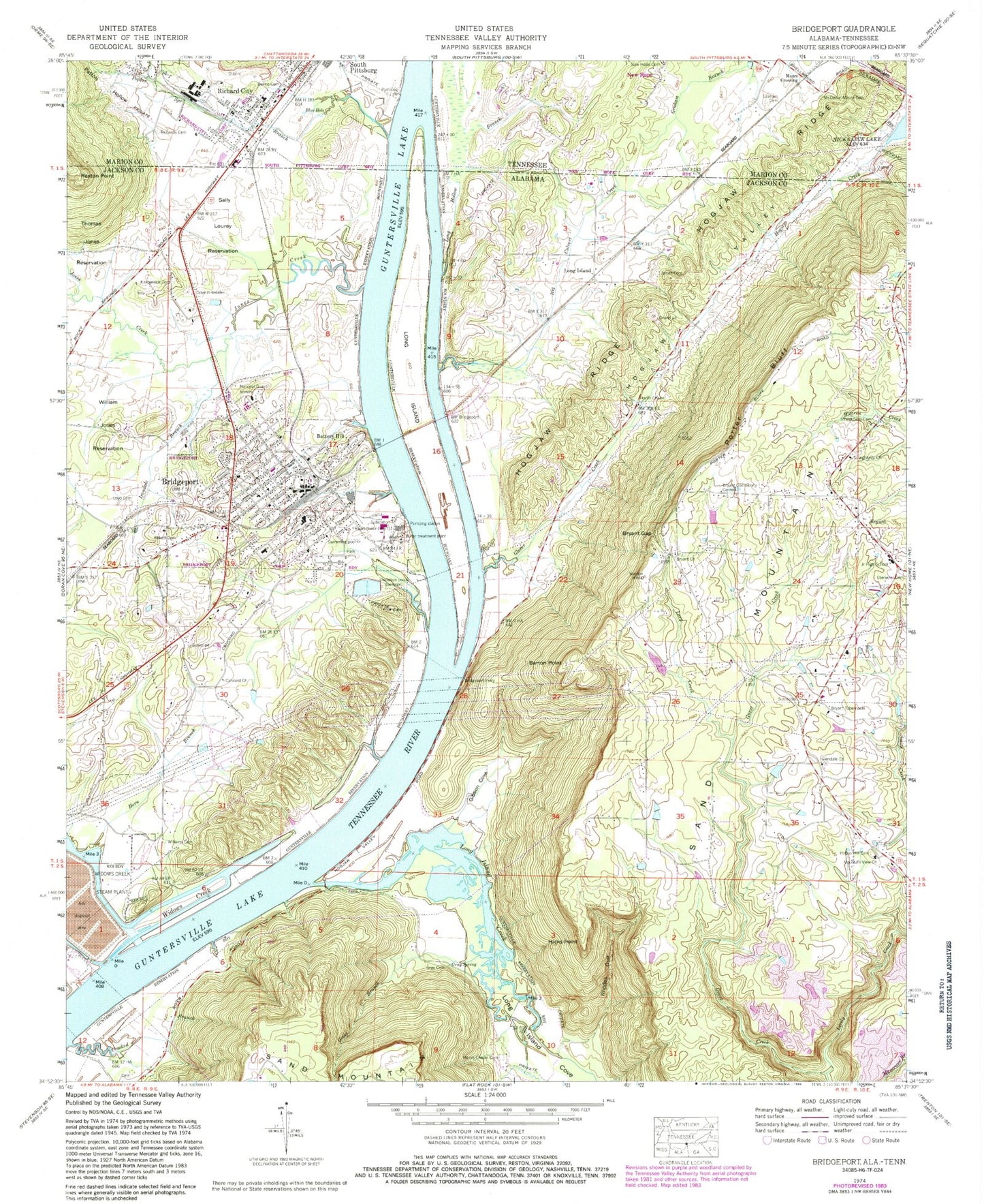

MyTopo
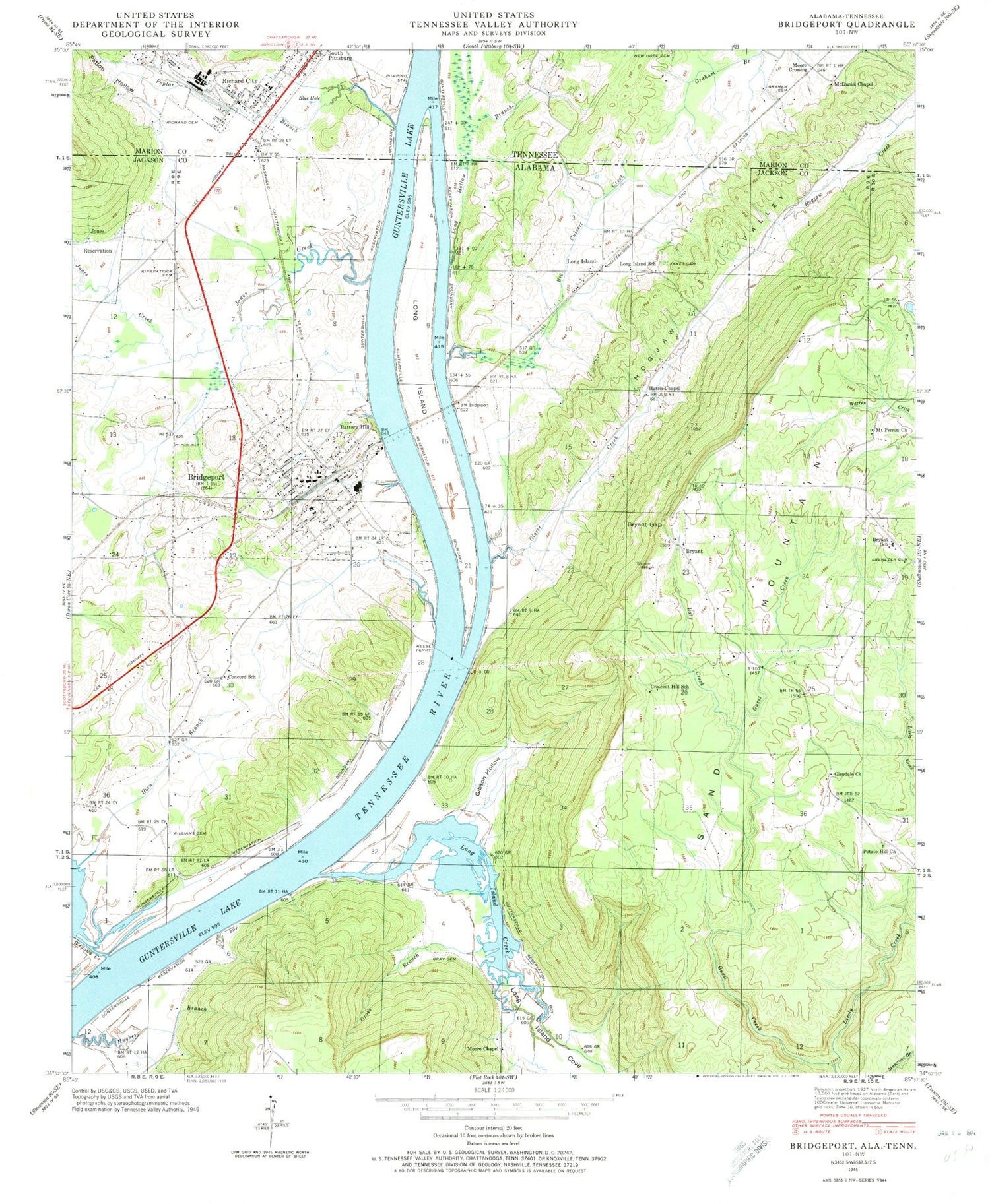
Classic USGS Bridgeport Alabama 7.5'x7.5' Topo Map
Couldn't load pickup availability
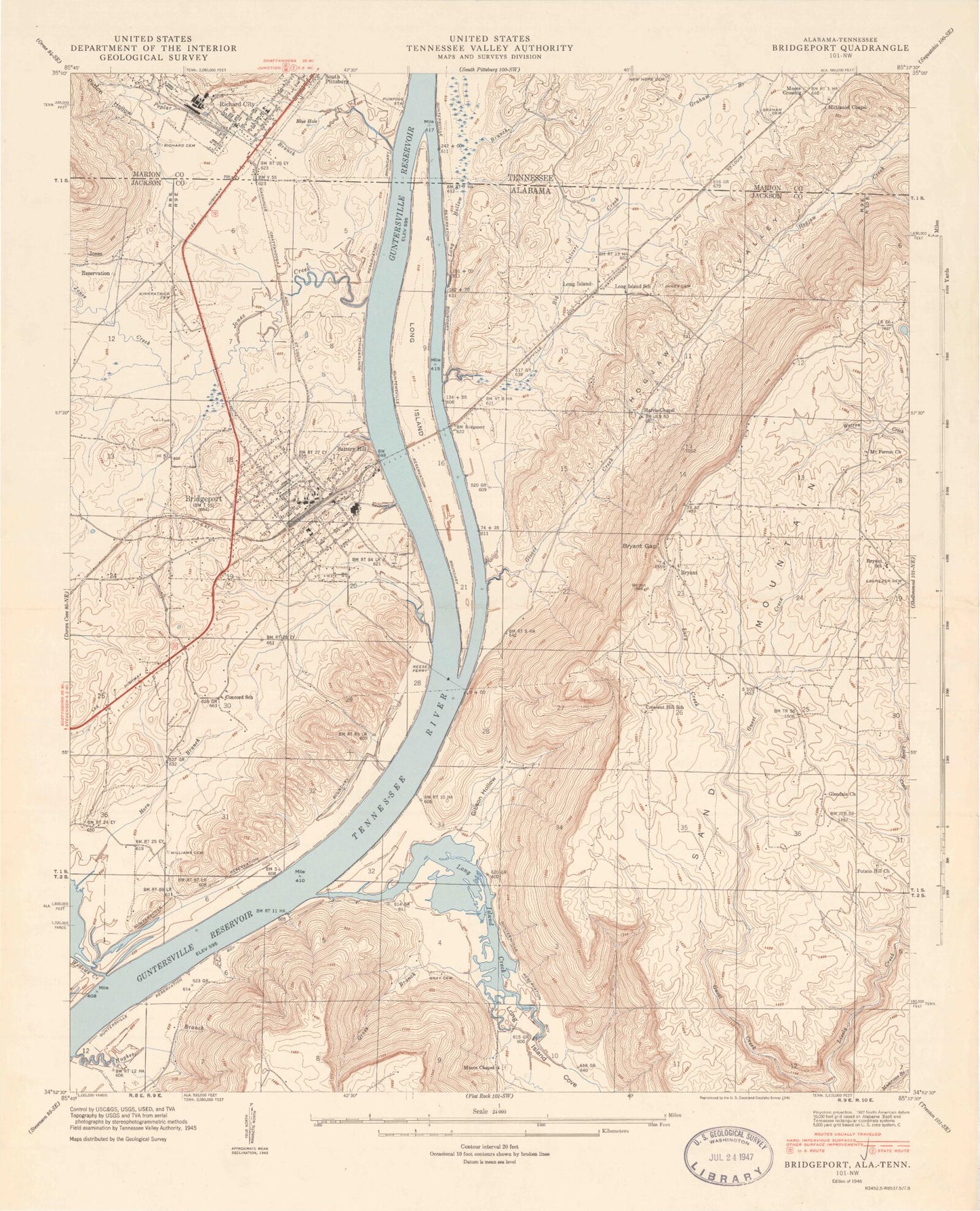
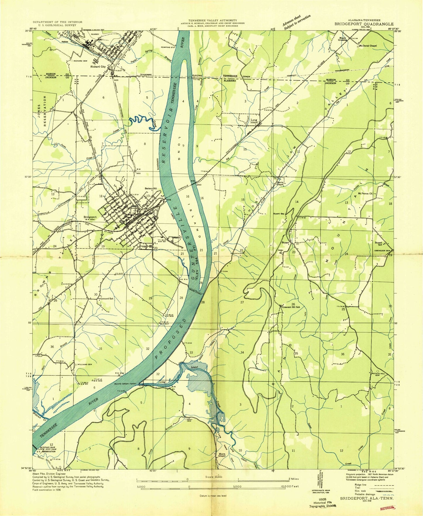
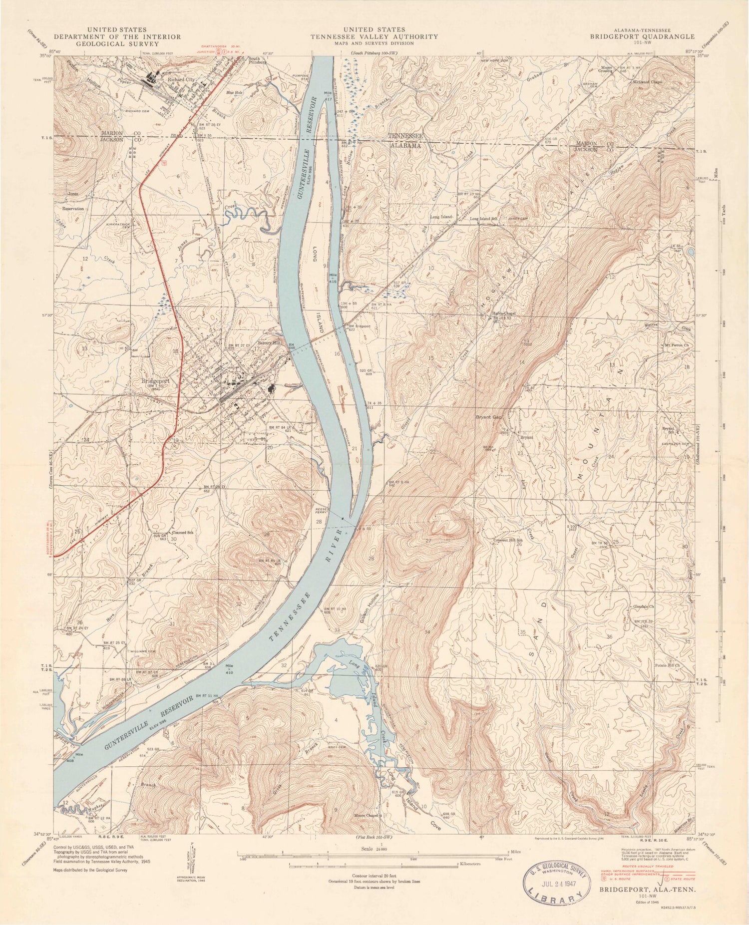
Historical USGS topographic quad map of Bridgeport in the states of Alabama, Tennessee. Map scale may vary for some years, but is generally around 1:24,000. Print size is approximately 24" x 27"
This quadrangle is in the following counties: Jackson, Marion.
The map contains contour lines, roads, rivers, towns, and lakes. Printed on high-quality waterproof paper with UV fade-resistant inks, and shipped rolled.
Contains the following named places: Abbott Cemetery, Barton Point, Battery Hill, Beene Cemetery, Big Culvert Creek, Blue Hole, Bridgeport, Bridgeport Baptist Church, Bridgeport Bar, Bridgeport Community Park, Bridgeport Elementary School, Bridgeport High School, Bridgeport Police Department, Bridgeport Post Office, Bridgeport United Methodist Church, Bridgeport Volunteer Fire Department, Bryant, Bryant Church, Bryant Community Center, Bryant Gap, Bryant Junior High School, Bryant Post Office, Bryant Tabernacle, City of Bridgeport, Concord Church, Concord School, Copenhagen, Cresent Hill School, Crooked Branch, Ebenezer Cemetery, First Baptist Church, First Baptist Church of Bridgeport, Gibson Cove, Glendale Church, Glover Creek, Graham Cemetery, Gray Cemetery, Gray Spring, Gross Branch, Guest Creek, Harris Chapel, Hembrees Bar, Hembrees Landing, Hicks Point, Hogjaw Creek, Hogjaw Ridge, Hogjaw Valley, Horn Branch, Indian Hill Farm Airport, Irondale Branch, Irondale Volunteer Fire Department, Island Bar, Island Creek Ferry, James Cemetery, Jones Creek, King Cove, Kirkpatrick Cemetery, Lary Creek, Lively Creek, Long Hollow Branch, Long Island, Long Island Cove, Long Island Creek, Long Island School, Loyd Cemetery, McDaniel - Moore Cemetery, McDaniel Chapel, Moore Chapel, Moore Chapel Cemetery, Moore Crossing, Mount Perron Church, Mountain View Church, Patton Hollow, Poplar Spring Branch, Porter Bluff, Potato Hill Cemetery, Reese Ferry, Reese Ferry Landing, Rexton Point, Rhodes Gulf, Richard City, Richard City Church of Christ, Richard City Cumberland Presbyterian Church, Richard City First Baptist Church, Richard City Industrial Park, Richard Hardy Memorial School, Richards Cemetery, Rock Spring Post Office, Sally Lourey Reservation, Straightway Cemetery, Straightway Church, Tennessee River Institute, Tri - Community Volunteer Fire Department Bryant Station, Tri - Community Volunteer Fire Department Bryant Station 2, Upper Bar, Walker Family Cemetery, WBTS-AM (Bridgeport), Widows Bar, Widows Creek, Williams Cemetery, Williams Landing, ZIP Code: 35958