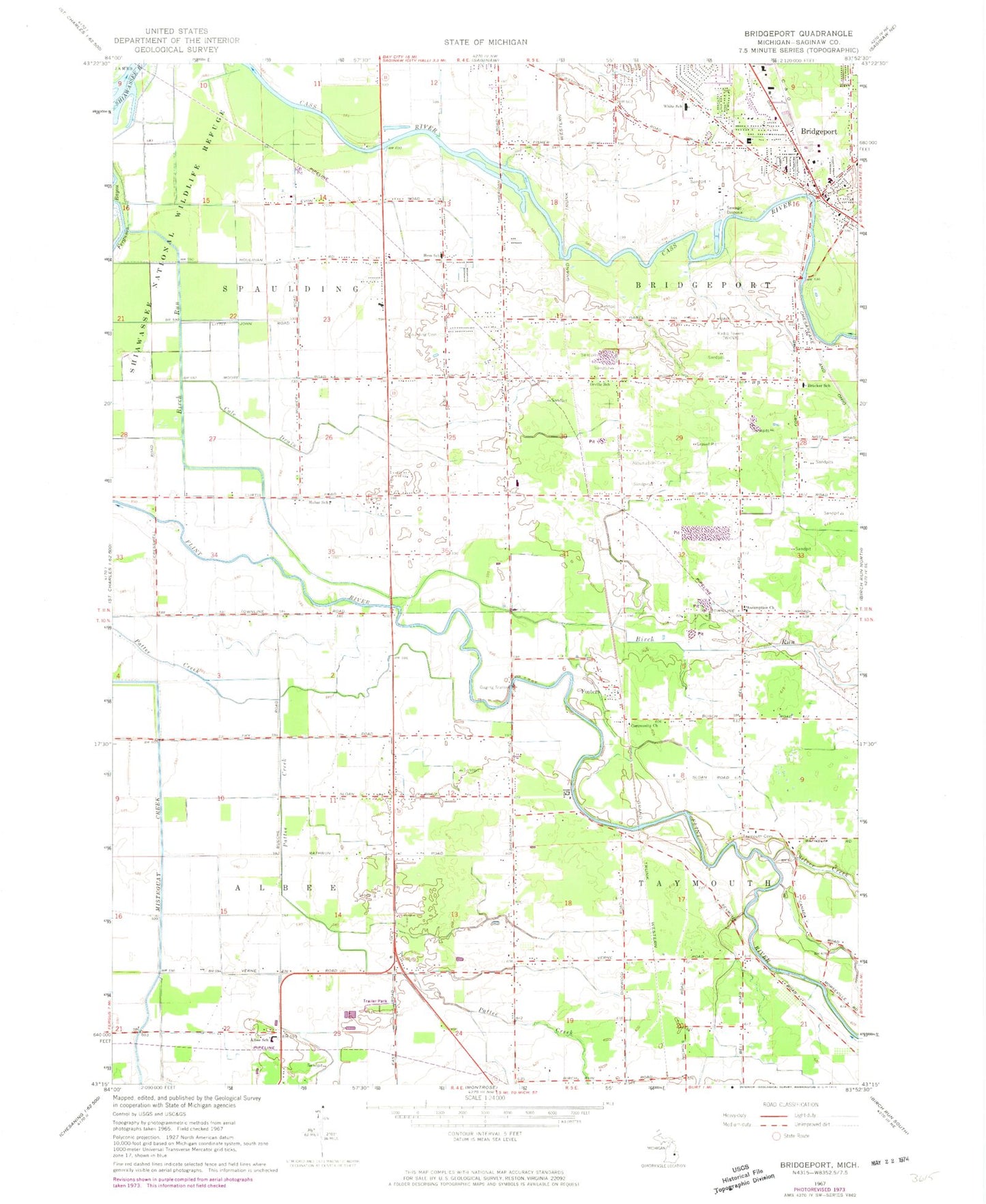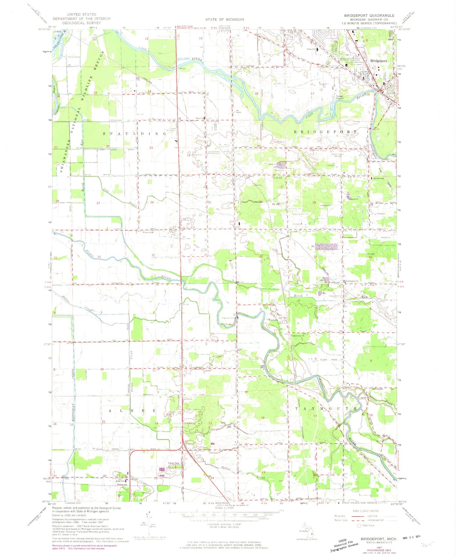
MyTopo
Classic USGS Bridgeport Michigan 7.5'x7.5' Topo Map
Couldn't load pickup availability
Historical USGS topographic quad map of Bridgeport in the state of Michigan. Map scale may vary for some years, but is generally around 1:24,000. Print size is approximately 24" x 27"
This quadrangle is in the following counties: Saginaw.
The map contains contour lines, roads, rivers, towns, and lakes. Printed on high-quality waterproof paper with UV fade-resistant inks, and shipped rolled.
Contains the following named places: Albee School, Albee Township Fire Department, Assumption Cemetery, Assumption Church, Birch Run, Bortle Drain, Bridgeport, Bridgeport Census Designated Place, Bridgeport Community Church, Bridgeport Fire Department, Bridgeport Mobile Home Park, Bridgeport Post Office, Bridgeport Public Library, Bridgeport Station, Brucker School, Calvary Community Church, Charter Township of Bridgeport, Cole Drain, Davis Park, Faith Lutheran Church, Ferguson Bayou, Fosters, Fosters Post Office, Hess School, Hess School Historical Marker, Lyle Park, Mahar School, Martin G. Atkins Elementary School, Oak Grove Cemetery, Orville School, Parkwood Village Mobile Home Park, Price Nature Center, Saint Christopher's Church, Saint Mark's Episcopal Church, Sheridan Road Baptist Church, Silver Creek, Spaulding Cemetery, Spaulding Township Fire Department, Spaulding Township Police Department, Spring Brook Drain, Taymouth Cemetery, Township of Albee, Township of Spaulding, Verne Post Office, Village Park, White School, WKNX-AM (Frankenmuth), WTLZ-FM (Saginaw), ZIP Code: 48417