MyTopo
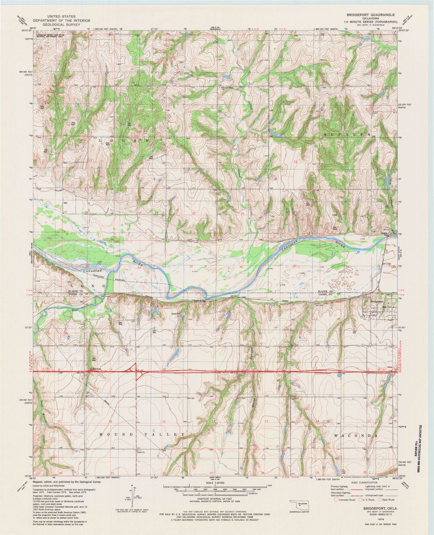
Classic USGS Bridgeport Oklahoma 7.5'x7.5' Topo Map
Couldn't load pickup availability
Historical USGS topographic quad map of Bridgeport in the state of Oklahoma. Map scale may vary for some years, but is generally around 1:24,000. Print size is approximately 24" x 27"
This quadrangle is in the following counties: Blaine, Caddo.
The map contains contour lines, roads, rivers, towns, and lakes. Printed on high-quality waterproof paper with UV fade-resistant inks, and shipped rolled.
Contains the following named places: Bethel Cemetery, Bridgeport, City of Bridgeport, Deer Creek, Fire Canyon, Lariat Creek, Oknoname 015023 Dam, Oknoname 015023 Reservoir, Oknoname 015024 Dam, Oknoname 015024 Reservoir, Pleasant Ridge Church, Sugar Creek Site 16 Dam, Sugar Creek Site 16 Reservoir, Sugar Creek Site 17 Dam, Sugar Creek Site 17 Reservoir, Sugar Creek Site 18 Dam, Sugar Creek Site 18 Reservoir, Sugar Creek Site 19 Dam, Sugar Creek Site 19 Reservoir, Sugar Creek Site 27 Dam, Sugar Creek Site 27 Reservoir, Sugar Creek Site 28 Dam, Sugar Creek Site 28 Reservoir, TK Airport, Township of Mound Valley, White Canyon