MyTopo
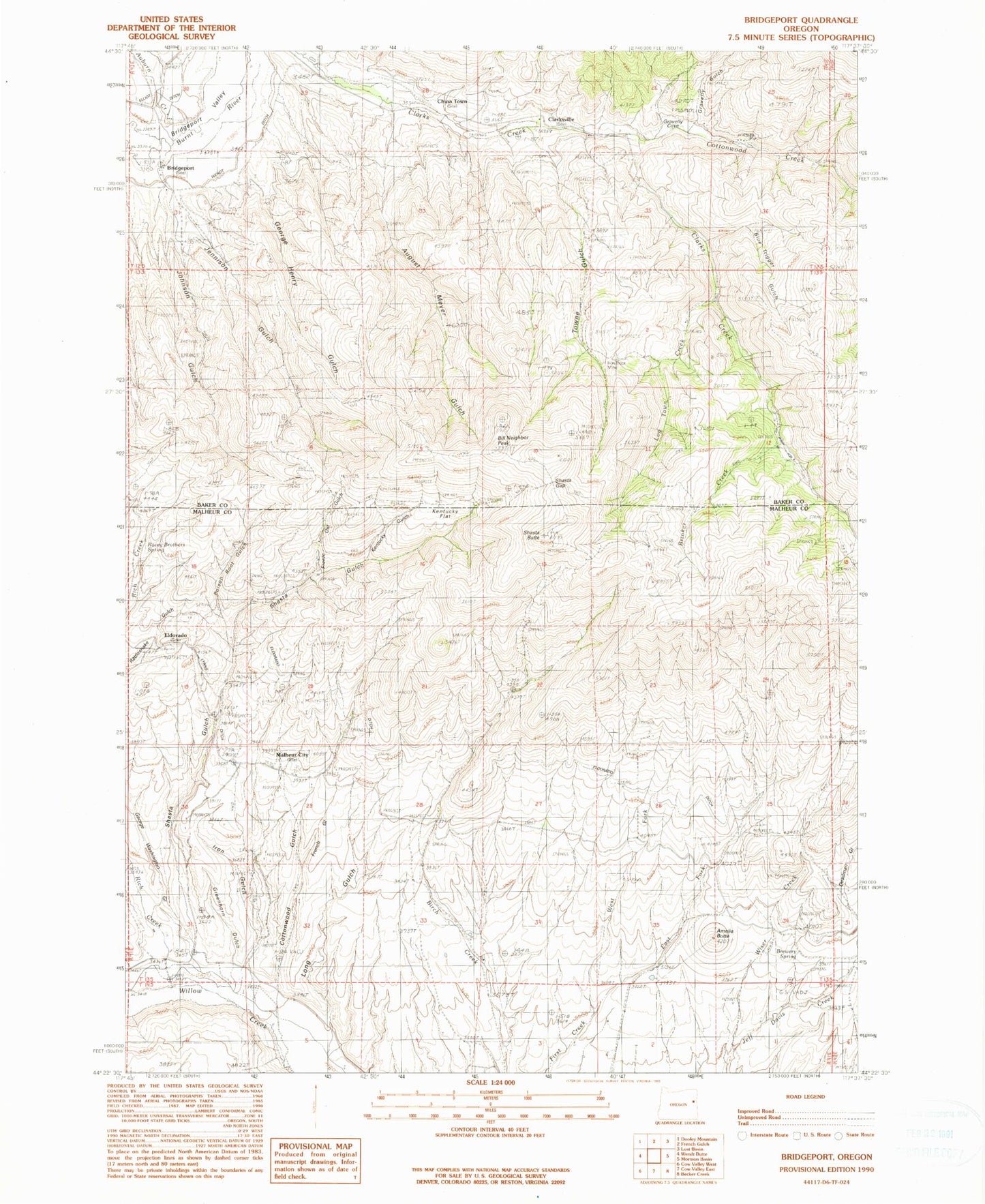
Classic USGS Bridgeport Oregon 7.5'x7.5' Topo Map
Couldn't load pickup availability
Historical USGS topographic quad map of Bridgeport in the state of Oregon. Map scale may vary for some years, but is generally around 1:24,000. Print size is approximately 24" x 27"
This quadrangle is in the following counties: Baker, Malheur.
The map contains contour lines, roads, rivers, towns, and lakes. Printed on high-quality waterproof paper with UV fade-resistant inks, and shipped rolled.
Contains the following named places: Amelia Butte, Auburn Creek, August Meyer Gulch, Bill Neighbor Peak, Birch Creek Ditch, Blue Trigger Gulch, Brewery Spring, Bridgeport, Bridgeport Cemetery, Bridgeport Post Office, Brinker Creek, China Town, Clarksville, Clarksville Cemetery, Clarksville Post Office, Cottonwood Creek, Cottonwood Gulch, Deadman Gulch, East Fork First Creek, El Dorado Post Office, Eldorado, Freeze Out Gulch, French Gulch, George Henry Gulch, George Washington Gulch, Gravelly Cove, Gravelly Gulch, Greenhorn Gulch, Iron Door Mine, Iron Gulch, Jennison Gulch, Johnson Gulch, Kentucky Flat, Kentucky Gulch, Log Town Creek, Long Gulch, Lynns Ditch, Malheur Cemetery, Malheur City, Malheur Post Office, Marble Creek, Morfitt Ditch, Poison Root Gulch, Quartz Gulch, Racey Brothers Spring, Rich Creek, Sargent Place, Shasta Butte, Shasta Gap, Shasta Gulch, Shasta Spring, Towne Gulch, Tub Spring, Wendt Ditch, West Fork First Creek, Wiser Creek