MyTopo
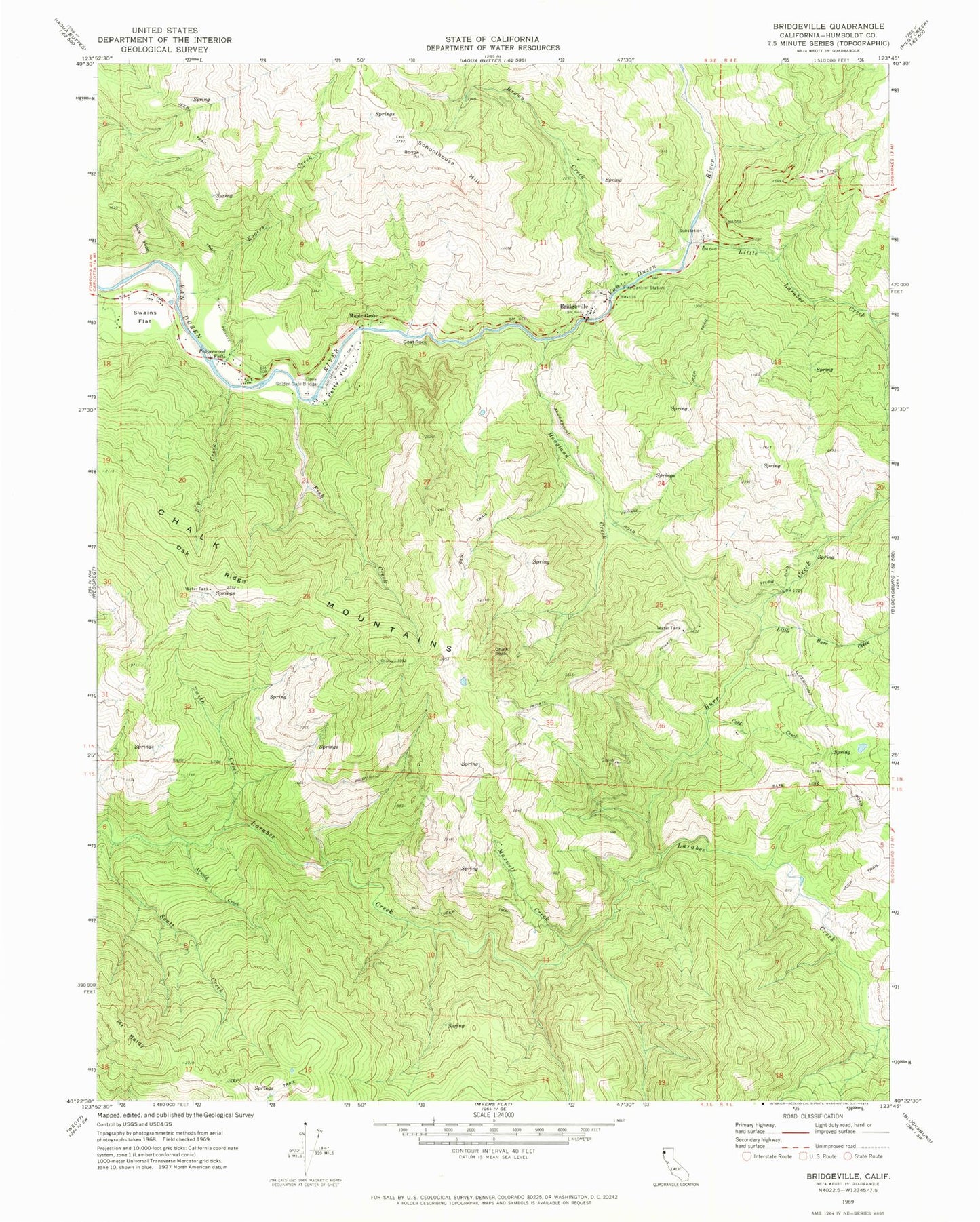
Classic USGS Bridgeville California 7.5'x7.5' Topo Map
Couldn't load pickup availability
Historical USGS topographic quad map of Bridgeville in the state of California. Map scale may vary for some years, but is generally around 1:24,000. Print size is approximately 24" x 27"
This quadrangle is in the following counties: Humboldt.
The map contains contour lines, roads, rivers, towns, and lakes. Printed on high-quality waterproof paper with UV fade-resistant inks, and shipped rolled.
Contains the following named places: Arnold Creek, Bar W Ranch, Barnwell Ranch, Blue Slide, Bridgeville, Bridgeville Cemetery, Bridgeville Elementary School, Bridgeville Post Office, Bridghman Ranch, Brown Creek, Burr Creek, Burr Creek School, California Department of Forestry and Fire Protection Bridgeville Station, Chalk Mountains, Chalk Rock, Cold Creek, Diamond Ranch, Fish Creek, Goat Rock, Hoagland Creek, Jackmans Ranch, Little Burr Creek, Little Golden Gate Bridge, Little Larabee Creek, Maple Grove, Maxwell Creek, Mill Creek, Mount Baldy, Oak Ridge, Pepperwood Falls, Petty Flat, Pip Creek, Rogers Creek, Schoolhouse Hill, Scott Creek, Smith Creek, Sturm Ranch, Swains Flat, ZIP Code: 95569