
MyTopo
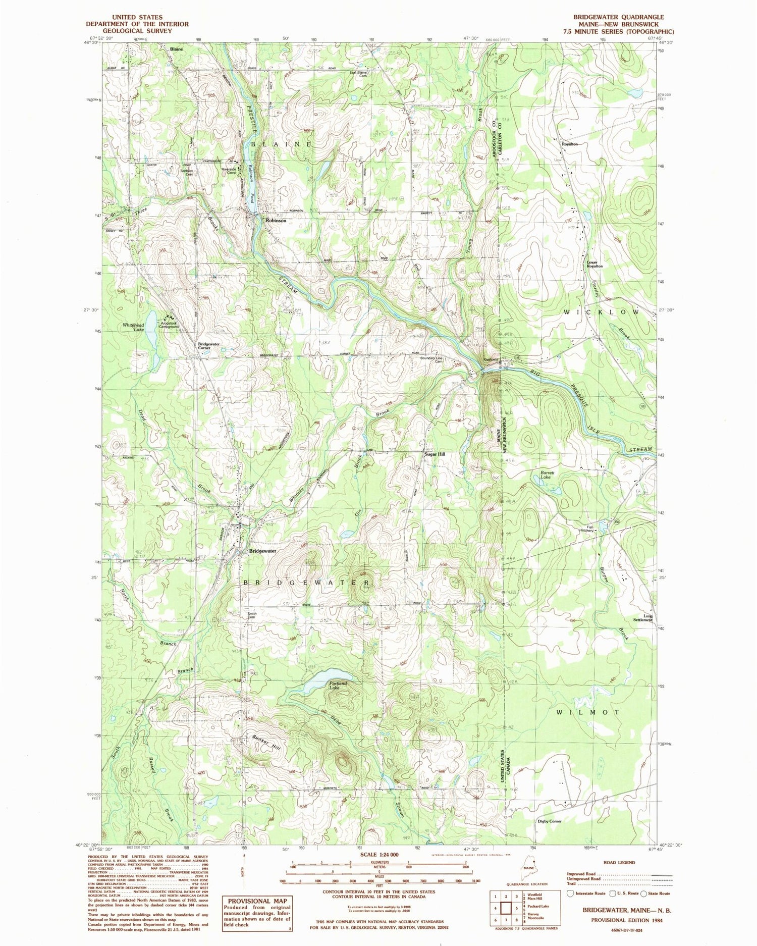
Classic USGS Bridgewater Maine 7.5'x7.5' Topo Map
Couldn't load pickup availability
Historical USGS topographic quad map of Bridgewater in the state of Maine. Map scale is 1:24000. Print size is approximately 24" x 27"
This quadrangle is in the following counties: Aroostook.
The map contains contour lines, roads, rivers, towns, and lakes. Printed on high-quality waterproof paper with UV fade-resistant inks, and shipped rolled.
Contains the following named places: Aroostook Campground, Blaine Census Designated Place, Boundary Line Cemetery, Bridgewater, Bridgewater Corner, Bridgewater Corner Cemetery, Bridgewater Fire Department, Bridgewater Grammar School (historical), Bridgewater Post Office, Bunker Hill, Dead Brook, East Blaine Cemetery, Flagstaff School, Gin Brook, North Branch Three Brooks, North Branch Whitney Brook, Portland Lake, Prestile Stream, Riverside Camp, Robinson, Robinson Dam, Russell Brook, Sanborn Cemetery, Smith Cemetery, Snow Settlement, South Branch Three Brooks, South Branch Whitney Brook, Sugar Hill, Tapley Cemetery, Three Brooks, Town of Blaine, Town of Bridgewater, Whitehead Lake, Whitney Brook, Young Brook


