MyTopo
Classic USGS Bridgewater Michigan 7.5'x7.5' Topo Map
Couldn't load pickup availability
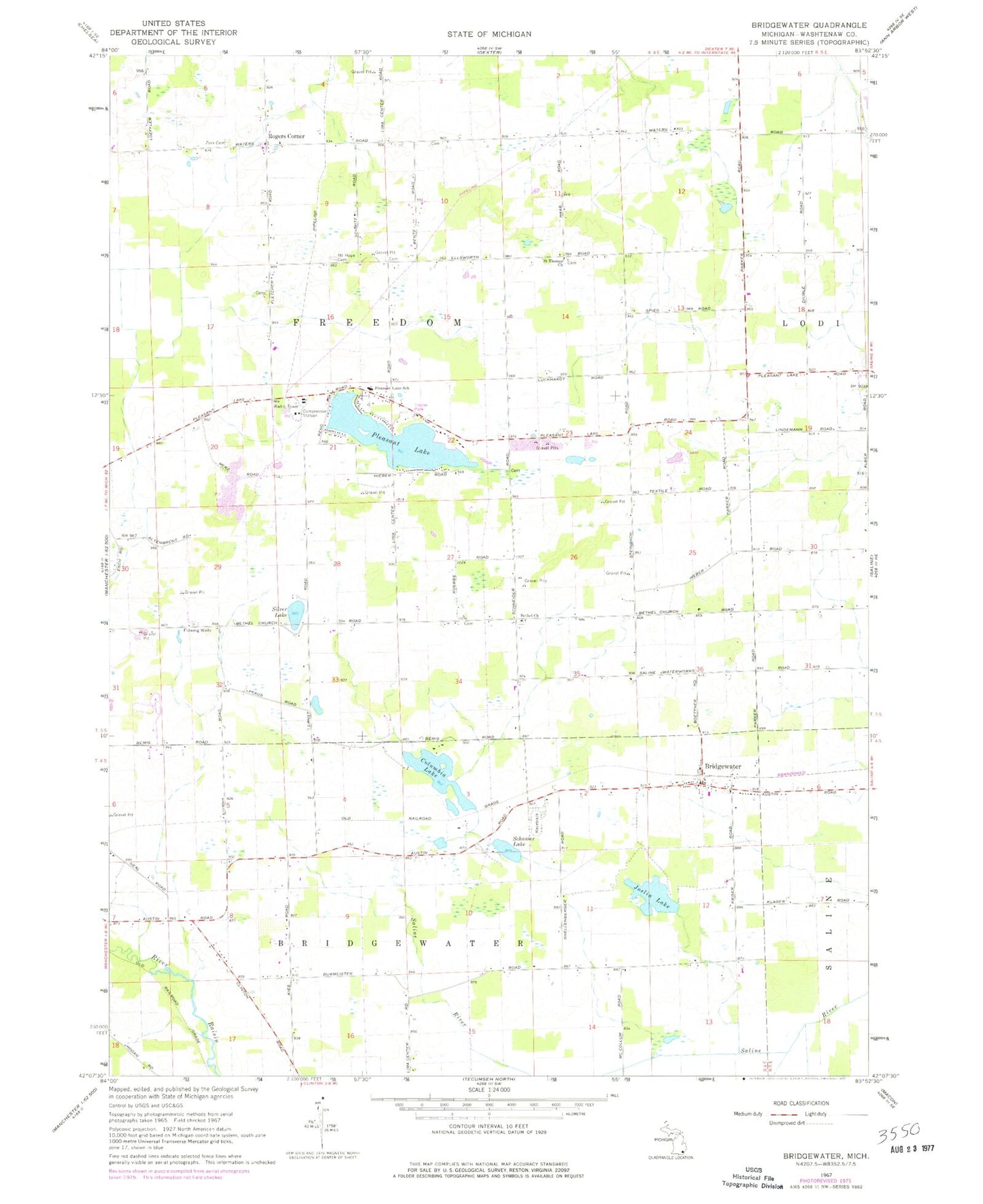
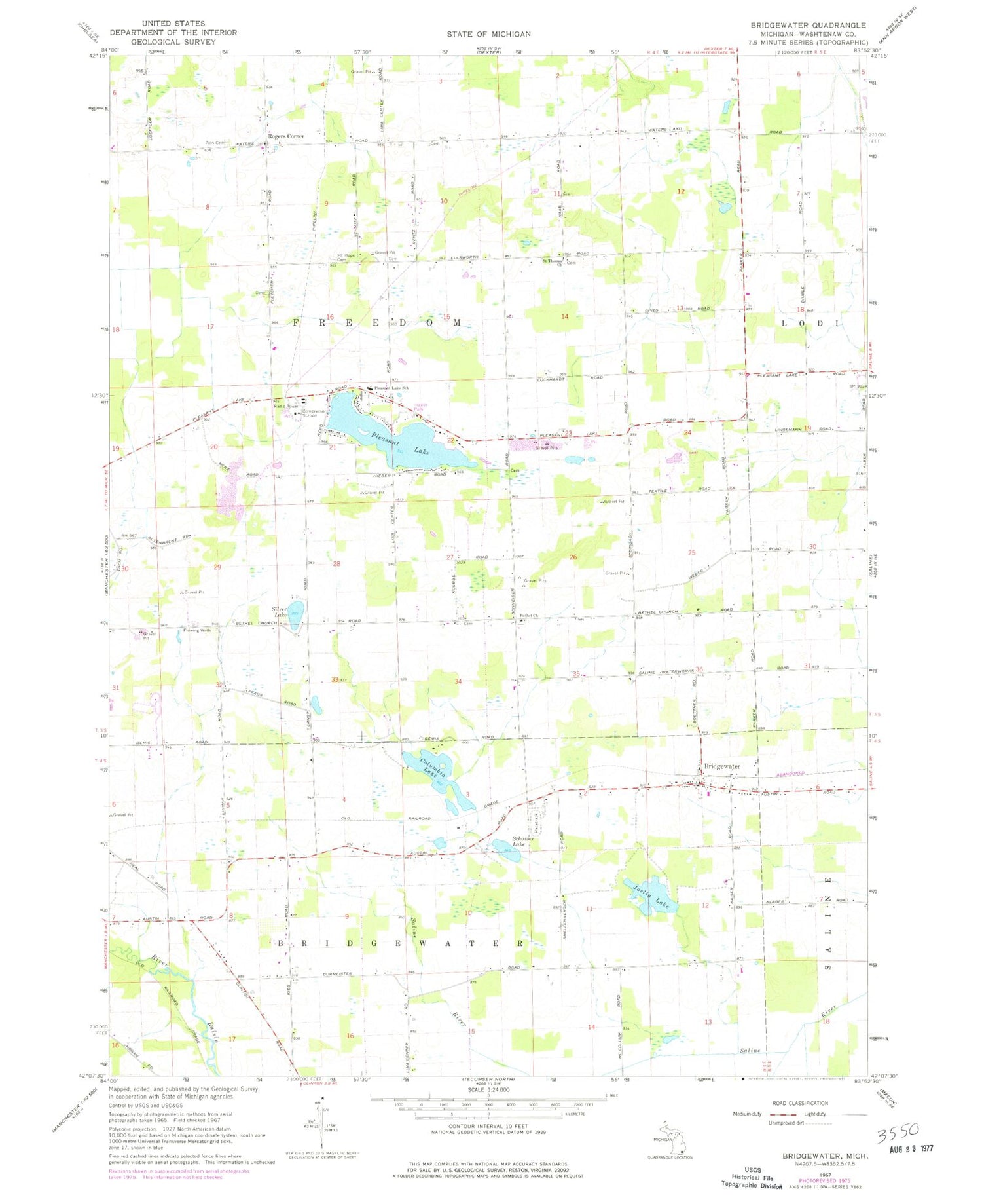
Historical USGS topographic quad map of Bridgewater in the state of Michigan. Map scale may vary for some years, but is generally around 1:24,000. Print size is approximately 24" x 27"
This quadrangle is in the following counties: Washtenaw.
The map contains contour lines, roads, rivers, towns, and lakes. Printed on high-quality waterproof paper with UV fade-resistant inks, and shipped rolled.
Contains the following named places: Bethel Church, Bethel Church Cemetery, Bethel Church Historical Marker, Bridgewater, Bridgewater Post Office, Bridgewater Station, Columbia Lake, Fletcher Road Cemetery, Fredonia Post Office, Freedom Emanuel Evangelical Memorial Cemetery, Freedom Township Cemetery, Hickory Sticks Golf Course, Joslin Lake, Mount Hope Cemetery, Pleasant Lake, Pleasant Lake School, Rogers Corner, Rogers Corners Addition Cemetery, Saint Francis' Catholic Cemetery, Saint John United Church, Saint John's Lutheran Cemetery, Saint Thomas Church, Saint Thomas' Lutheran Cemetery, Schasser Lake, Schneider Road Cemetery, Shellenberger Road Cemetery, Silver Lake, Thomas Church Historical Marker, Township of Freedom, Weinsburg Post Office, Zion Lutheran Cemetery, Zion Lutheran Church, Zion Lutheran Church Historical Marker