
MyTopo
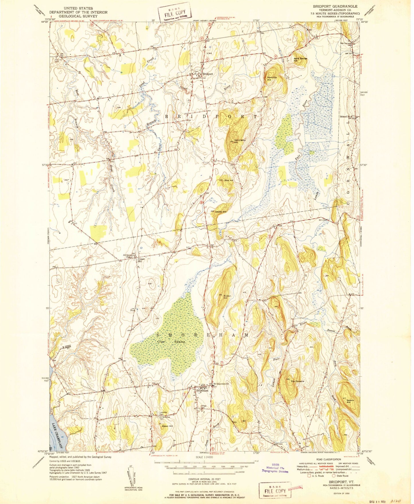
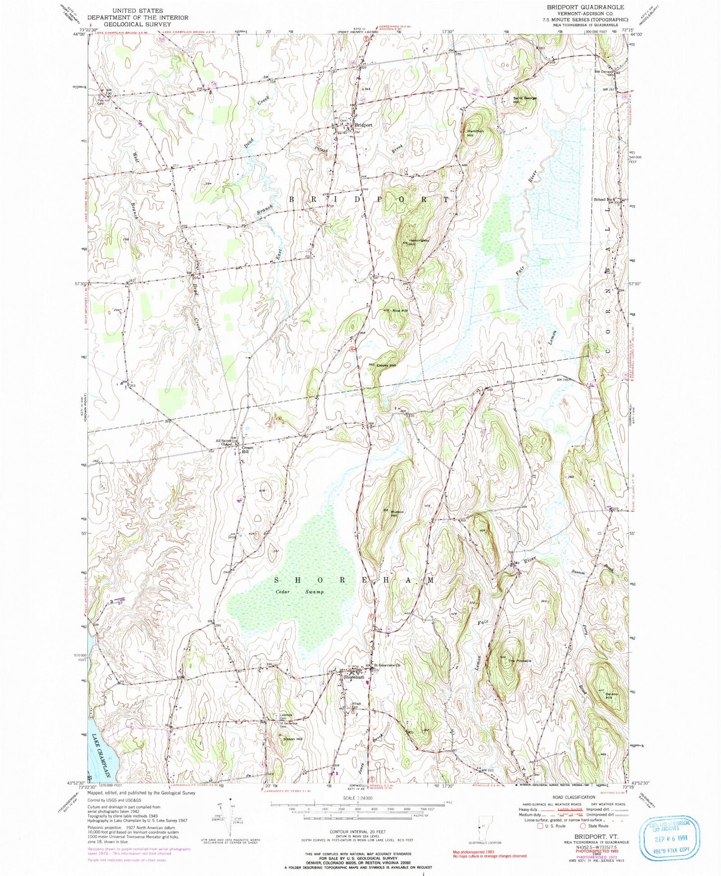
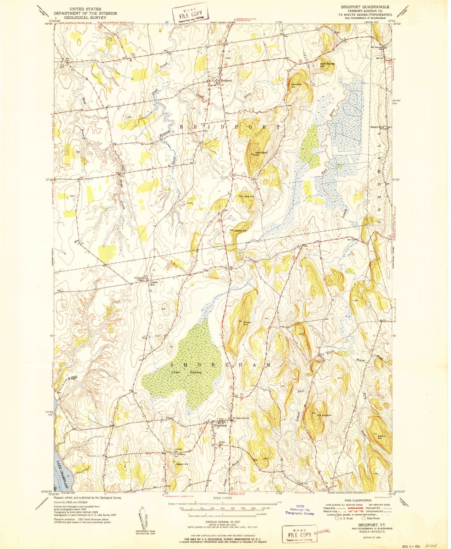
Classic USGS Bridport Vermont 7.5'x7.5' Topo Map
Couldn't load pickup availability
Historical USGS topographic quad map of Bridport in the state of Vermont. Map scale may vary for some years, but is generally around 1:24,000. Print size is approximately 24" x 27"
This quadrangle is in the following counties: Addison, Essex.
The map contains contour lines, roads, rivers, towns, and lakes. Printed on high-quality waterproof paper with UV fade-resistant inks, and shipped rolled.
Contains the following named places: All Saint Chapel, Bascom Brook, Bridport, Bridport Central Cemetery, Bridport Central School, Bridport Congregational Church, Bridport Post Office, Bridport Public Library, Bridport Volunteer Fire Department, Callender Cemetery, Cedar Swamp, Cloyes Hill, Cream Hill, Delano Hill, District Six Schoolhouse, Fair Bridge, Hamilton Hill, Hemingway Hill, Knapp Cemetery, Lakeview Cemetery, Melrose Springs Airfield, Mutton Hill, Northwest Cornwall Cemetery, Perry Brook, Pine Hill Cemetery, Platt Memorial Library, Potash Brook, Rice Hill, Richville Dam, Richville Pond, Russell Cemetery, Saint Bernadette Church, Saint Genevieve Cemetery, Saint Genevieve Church, Saint George Hill, School Number 6, Shoreham, Shoreham Congregational Church, Shoreham Elementary School, Shoreham Fire Department, Shoreham Post Office, Sisson Hill, Symon Airport, The Pinnacle, Torrey Airport, Town of Bridport, Town of Shoreham, Watch Point, ZIP Codes: 05734, 05770