
MyTopo
Classic USGS Brier Creek Landing Georgia 7.5'x7.5' Topo Map
Couldn't load pickup availability
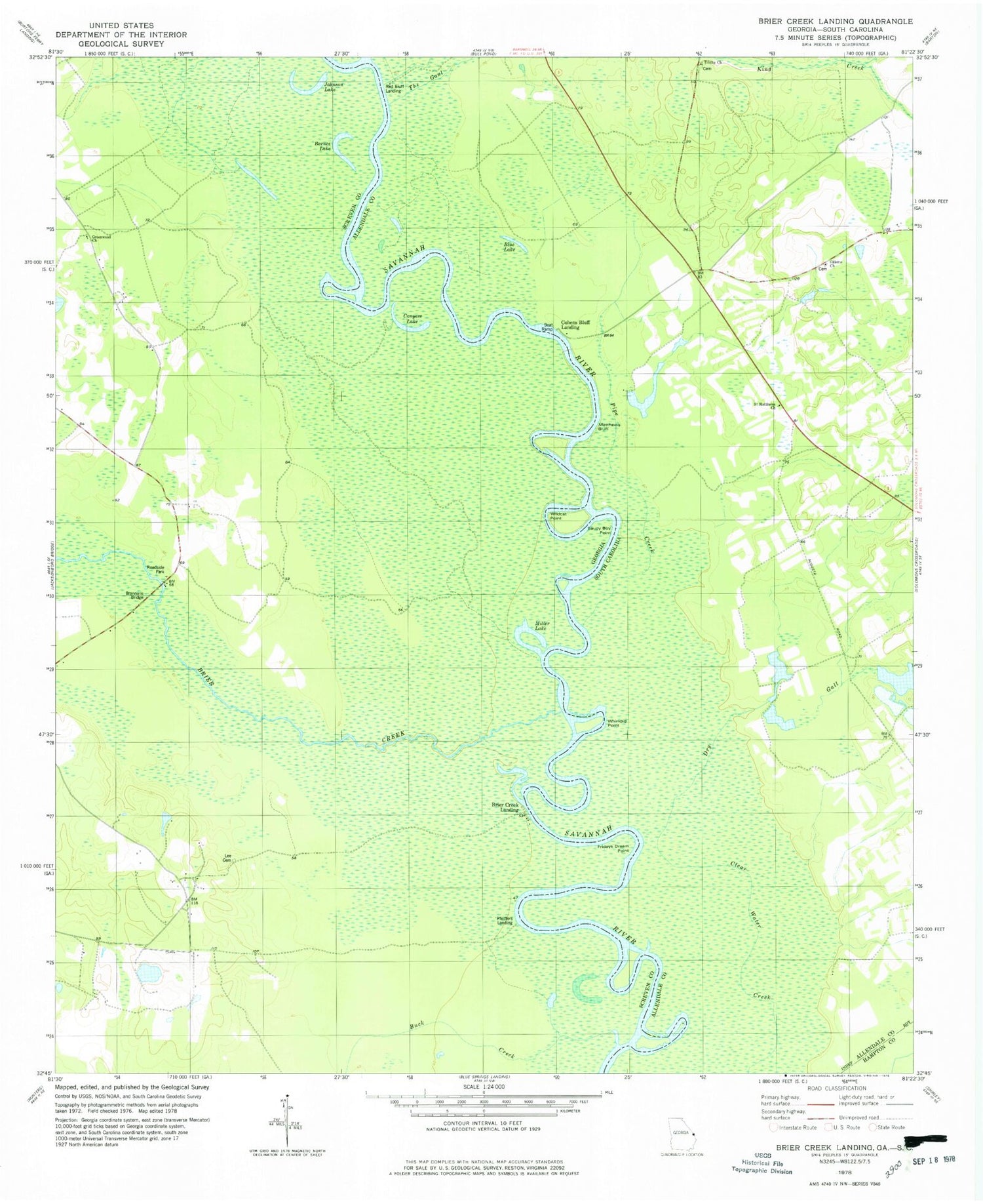
Historical USGS topographic quad map of Brier Creek Landing in the states of Georgia, South Carolina. Typical map scale is 1:24,000, but may vary for certain years, if available. Print size: 24" x 27"
This quadrangle is in the following counties: Allendale, Hampton, Screven.
The map contains contour lines, roads, rivers, towns, and lakes. Printed on high-quality waterproof paper with UV fade-resistant inks, and shipped rolled.
Contains the following named places: Barnes Lake, Buck Creek, Conyers Lake, Fridays Dream Point, Greenwood Church, Johnson Lake, Lee Cemetery, Miller Lake, Saucy Boy Point, Whirligig Point, Brier Creek Landing, Pfeiffers Landing, Hagan Pond Dam, Hagan Pond, Pfeiffer (historical), Brannons Bridge, Brier Creek, Dry Gall, King Creek, The Gaul, Blue Lake, Matthews Bluff, Pipe Creek, Trinity Church, Wildcat Point, Cohens Bluff Landing, Red Bluff Landing, Grotan School (historical), Red Bluff Point, Rosenwald School (historical), Trinity Cemetery, Gillette Church, Cohens Bluff, Ruddell (historical), Saint Matthews Church


