MyTopo
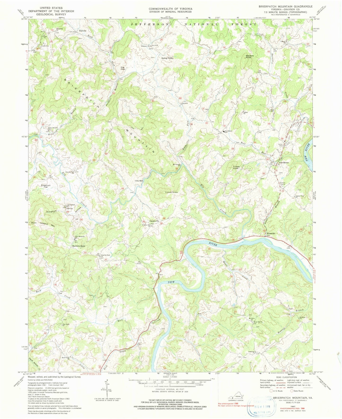
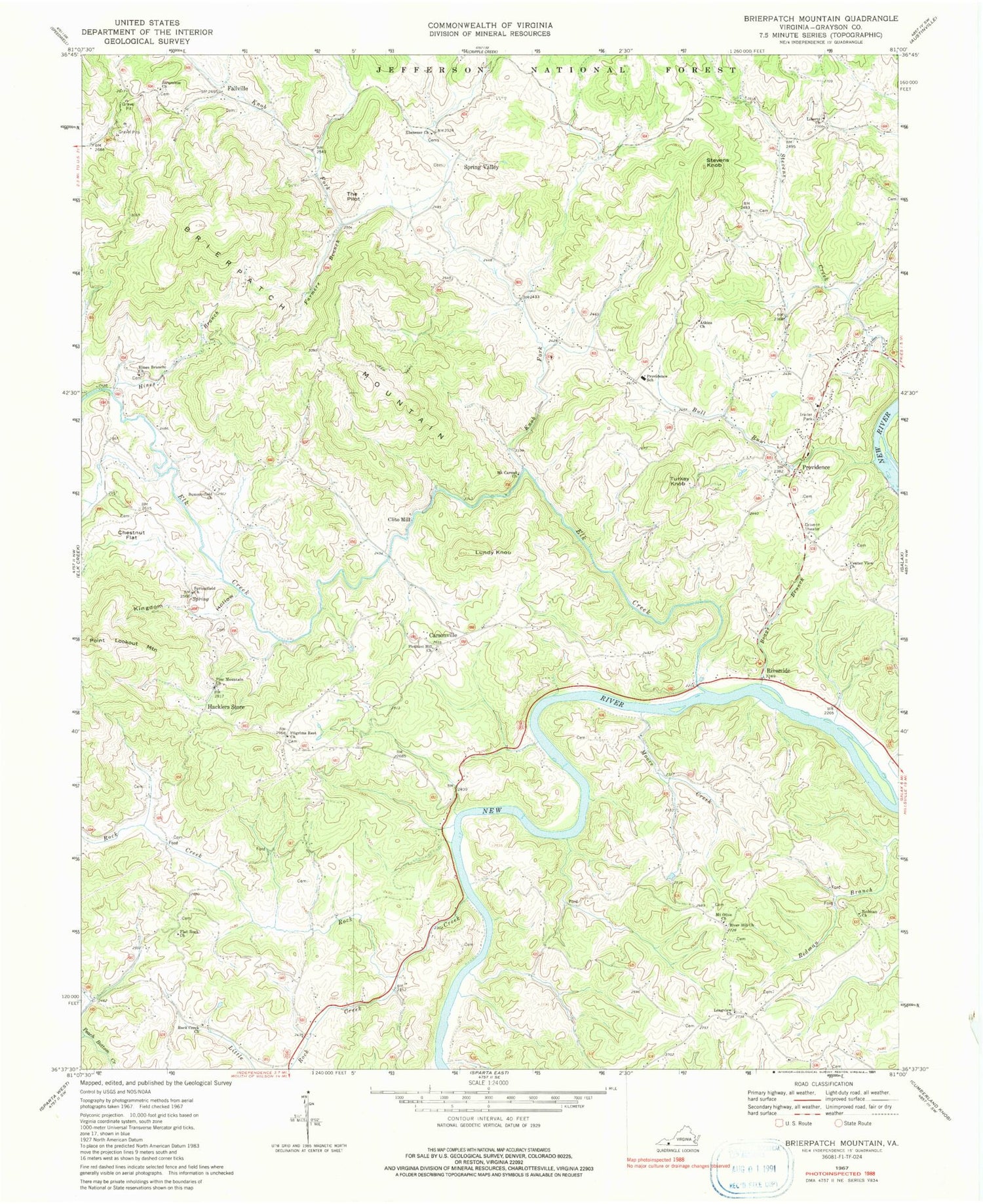
Classic USGS Brierpatch Mountain Virginia 7.5'x7.5' Topo Map
Couldn't load pickup availability
Historical USGS topographic quad map of Brierpatch Mountain in the state of Virginia. Map scale may vary for some years, but is generally around 1:24,000. Print size is approximately 24" x 27"
This quadrangle is in the following counties: Grayson.
The map contains contour lines, roads, rivers, towns, and lakes. Printed on high-quality waterproof paper with UV fade-resistant inks, and shipped rolled.
Contains the following named places: Atkins Church, Baxter Ferry, Boags Branch, Brierpatch Mountain, Bull Run, Carsonville, Catrons Mill, Cattrons Mill, Center View Church, Chestnut Flat, Clito Mill, Dell School, Ebenezer Cemetery, Ebenezer Church, Elk Creek, Eureka School, Falls Branch, Fallville, Farmers Branch, Flat Rock Church, Flat Rock School, Hacklers Store, Hines Branch, Hines Branch Church, Hole School, Jerusalem Cemetery, Jerusalem Church, Johns Creek School, Kingdom Hollow, Knob Fork, Laurel Spring School, Liberty Church, Little Rock Creek, Longview Church, Lundy Knob, Moore Creek, Moore Ferry, Moore School, Mount Carmel Church, Mount Carmel School, Mount Olive Church, Mountain View School, Pilgrims Rest Church, Pine Mountain Church, Pleasant Hill Church, Providence, Providence Cemetery, Providence Church, Providence District, Providence Elementary School, Quaker Church, Rectors Store, Redman Church, River Hill Church, Riverside, Rock Creek, Rock Creek Church, Spring Valley, Springfield Church, Stevens Knob, Summerfield Church, Summerfield School, Taylor Chapel, The Pilot, Turkey Knob, Warrick Cemetery, ZIP Code: 24330