MyTopo
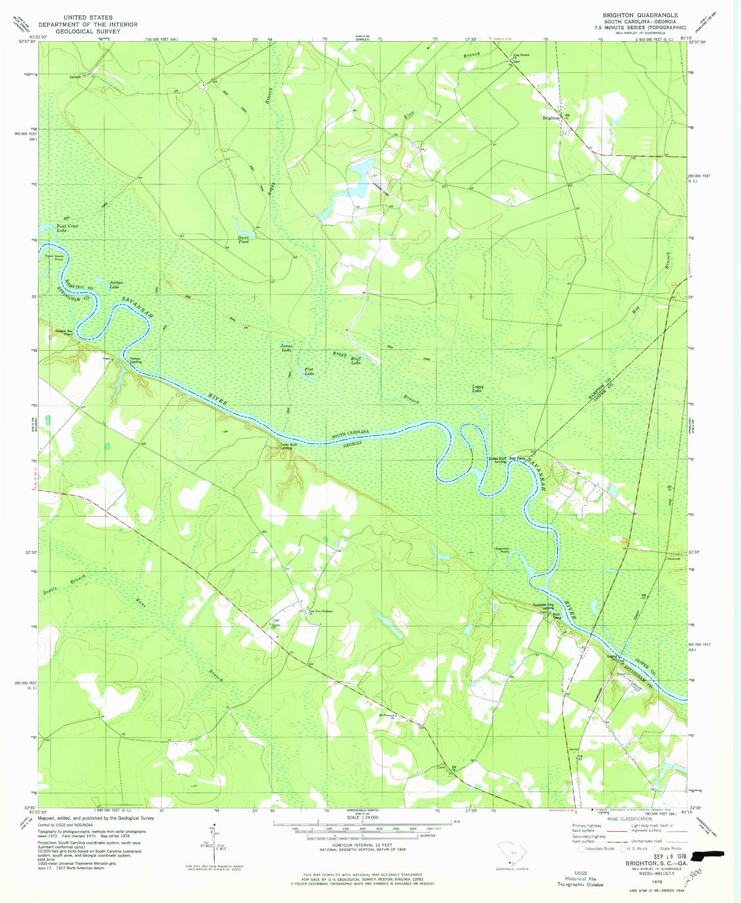
Classic USGS Brighton South Carolina 7.5'x7.5' Topo Map
Couldn't load pickup availability
Historical USGS topographic quad map of Brighton in the states of South Carolina, Georgia. Map scale is 1:24000. Print size is approximately 24" x 27"
This quadrangle is in the following counties: Effingham, Hampton, Jasper.
The map contains contour lines, roads, rivers, towns, and lakes. Printed on high-quality waterproof paper with UV fade-resistant inks, and shipped rolled.
Contains the following named places: Bluff Lake, Boggy Branch, Boggy Swamp, Brighton, Camel Lake, Cedar Bluff Landing, Devils Branch, Dunn Pond, Flat Lake, Fowl Craw Lake, Fowl Craw Point, Goldwires Reach, Goldwires Reach, Hamilton Ridge CLub, Hodges Pond, Hodges Pond Dam, Hog Branch, Hognose Point, James Lake, James W Webb Wildlife Center and Game Management Area, Jordan Lake, King Branch, King Branch Church, Lakeside Farms Pond, Lakeside Farms Pond Dam, Lebanon School (historical), Loggy Lake, Manigault Branch, Morgan Cemetery, Mount Pleasant Church, Mount Zion Church, Myers (historical), New Zion Holiness Church, Palachucola Club (historical), Palichucola Bluff, Pallachucola School (historical), Paugramorga Club, Rabbit Bar Point, Ryal Cemetery, Sand Ridge School (historical), Sandy Point, Stokes Bluff, Stokes Bluff Landing, Taylor Church, Taylor School (historical), Tuckasee King Landing, Webster Lake, Wildlife Lake Number One D-2609 Dam, Wildlife Lake Number Two D-2610 Dam