
MyTopo
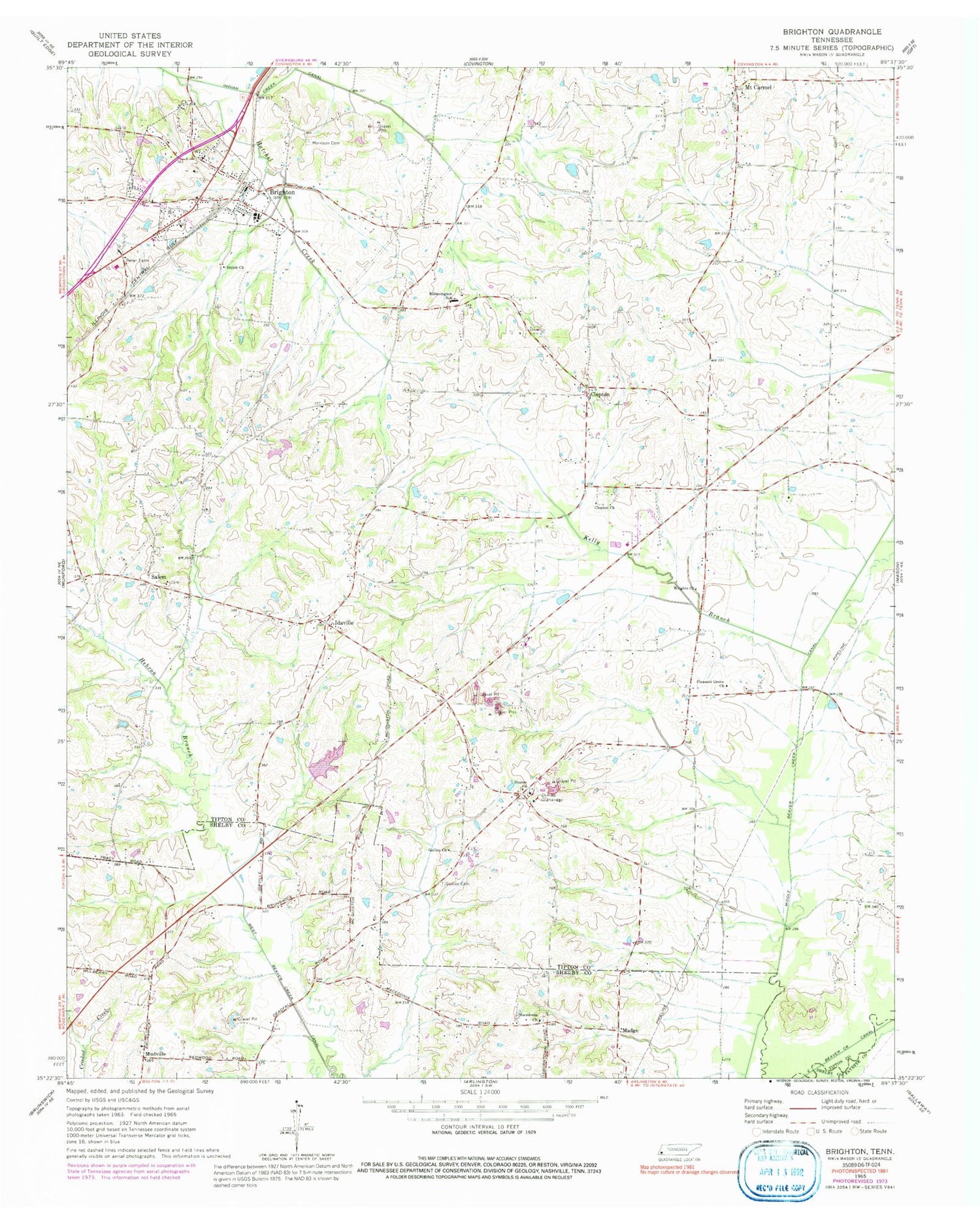
Classic USGS Brighton Tennessee 7.5'x7.5' Topo Map
Couldn't load pickup availability
Historical USGS topographic quad map of Brighton in the state of Tennessee. Map scale may vary for some years, but is generally around 1:24,000. Print size is approximately 24" x 27"
This quadrangle is in the following counties: Fayette, Shelby, Tipton.
The map contains contour lines, roads, rivers, towns, and lakes. Printed on high-quality waterproof paper with UV fade-resistant inks, and shipped rolled.
Contains the following named places: Anthony School, Bloomington School, Brighton, Brighton Baptist Church, Brighton City Hall, Brighton Community Center, Brighton Division, Brighton Elementary School, Brighton Fire Department, Brighton Police Department, Brighton Post Office, Brighton School, Center School, Clopton, Clopton Cemetery, Clopton Church, Commissioner District 9, Dixon School, Dunlap Orphanage, Elmoro School, Galilee Cemetery, Galilee Church, Hatchel Creek, Hebron Branch, Idaville, Kelly Branch, Lake Ellen, Lake Ellen Dam, Macedonia Church, Macedonia United Methodist Church Cemetery, Madge, Morrison Cemetery, Mount Carmel, Mount Carmel Presbyterian Church, Mount Carmel School, Mount Tipton Christian Methodist Episcopal Church, Mudville, Parsons Field, Pleasant Grove Baptist Church, Pleasant Union Church, Pleasant Union Cumberland Presbyterian Cemetery, Rosemark Cemetery, Salem, Salem Associated Reformed Presbyterian Church, Salem School, Sharon Church, Sharon School, Shiloh Church, Smith Branch, Three Star Volunteer Fire Department, Town of Brighton, Wrights Church, ZIP Code: 38011


