MyTopo
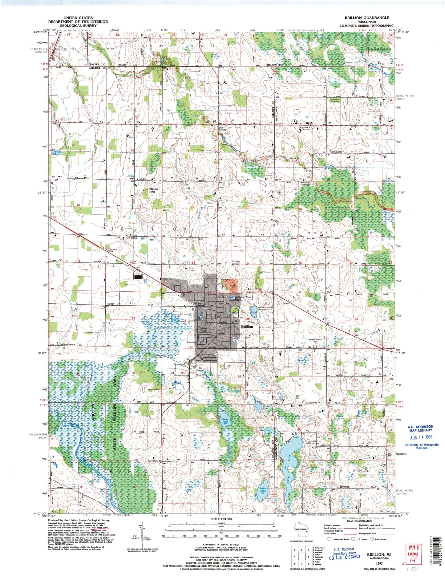
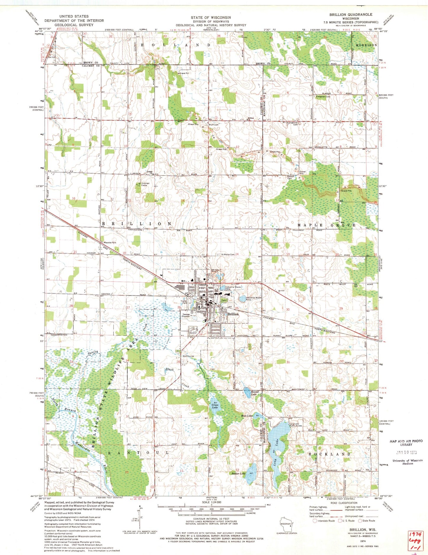
Classic USGS Brillion Wisconsin 7.5'x7.5' Topo Map
Couldn't load pickup availability
Historical USGS topographic quad map of Brillion in the state of Wisconsin. Map scale may vary for some years, but is generally around 1:24,000. Print size is approximately 24" x 27"
This quadrangle is in the following counties: Brown, Calumet, Manitowoc.
The map contains contour lines, roads, rivers, towns, and lakes. Printed on high-quality waterproof paper with UV fade-resistant inks, and shipped rolled.
Contains the following named places: Alcott School, Becker Lake, Black Creek, Bluff Cemetery, Boot Lake, Brillion, Brillion Church, Brillion City Hall, Brillion Community Cemetery - South, Brillion Elementary School, Brillion Fire Department, Brillion High School, Brillion Middle School, Brillion Police Department, Brillion Post Office, Brillion Public Library, Brillion Quarry, Brillion State Wildlife Area, Brillion Wastewater Treatment Plant, Carson School, City of Brillion, Emmanuel Evangelical Cemetery, Emmanuel Evangelical Church, Faith United Methodist Church, Friedens Evangelical Church, Gold Cross Ambulance Service Brillion, Grass Lake, Hillcrest Camp, Holy Family Catholic School, Holy Family Parish Cemetery, Holy Trinity Church, K and K Dairy, Kasson - Evergreen Cemetery, Long Lake, Long Lake Public Access, Long Lake School, Maple Grove School, Micke Dairy, Ran - Rose Farms, Round Lake, Saint Bartholomew Lutheran Church, Saint Mary's Cemetery, Saint Marys Roman Catholic Church, Spring Creek, Town of Brillion, Trinity Evangelical Lutheran Church, Trinity Evangelical Lutheran School, Trinity Lutheran Cemetery - South, United Church, WEZR-FM (Brillion), ZIP Code: 54110