MyTopo
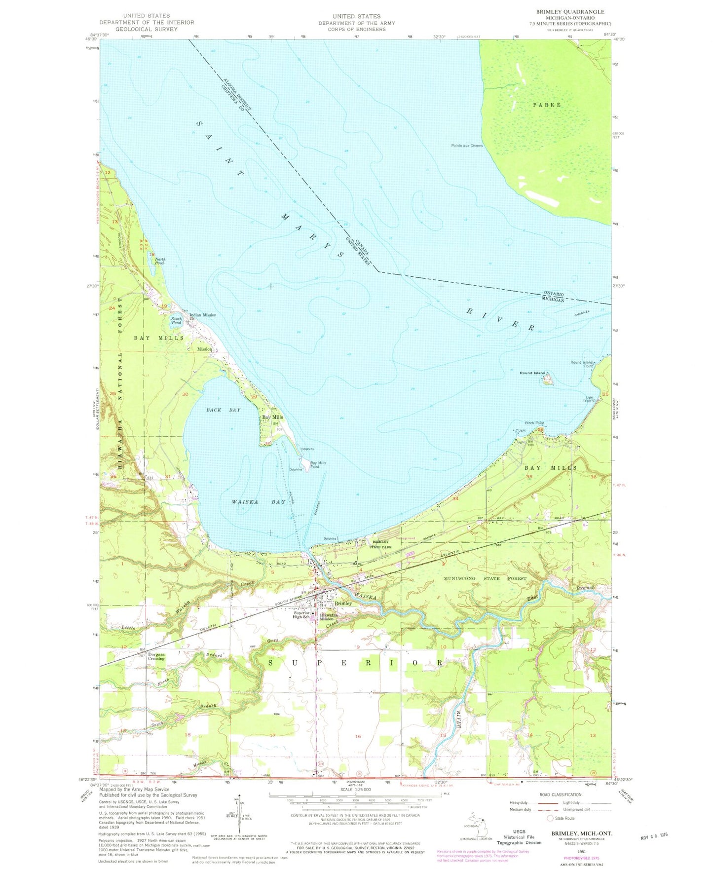
Classic USGS Brimley Michigan 7.5'x7.5' Topo Map
Couldn't load pickup availability
Historical USGS topographic quad map of Brimley in the state of Michigan. Map scale may vary for some years, but is generally around 1:24,000. Print size is approximately 24" x 27"
This quadrangle is in the following counties: Chippewa.
The map contains contour lines, roads, rivers, towns, and lakes. Printed on high-quality waterproof paper with UV fade-resistant inks, and shipped rolled.
Contains the following named places: Back Bay, Bay Mills, Bay Mills Charter School, Bay Mills Community College, Bay Mills Emergency Connection, Bay Mills Medical Clinic, Bay Mills Point, Bay Mills Post Office, Bay Mills Reservation, Bayview Cemetery, Birch Point, Blessed Kateri Tekakwitha Church, Brimley, Brimley Baptist Church, Brimley Census Designated Place, Brimley Middle / High School, Brimley Post Office, Brimley State Park, Brimley Station, Chippewa Landing Ramp, Dorgans Crossing, East Branch Waiska River, First Congregational Church, Gordons Landing Ramp, Hiawatha Mission, Indian Mission Church, Little Waiska Creek, Mission, North Branch Orrs Creek, North Pond, Old Indian Burial Ground, Orrs Creek, Point Iroquois Shoals, Round Island, Round Island Point, Saint Francis Xavier Church, South Branch Orrs Creek, South Pond, Superior Township Volunteer Fire Department, Waiska Bay, Waiska River, Wheels of History Museum, Wild Bluff Golf Course