MyTopo
Classic USGS Brimson Minnesota 7.5'x7.5' Topo Map
Couldn't load pickup availability
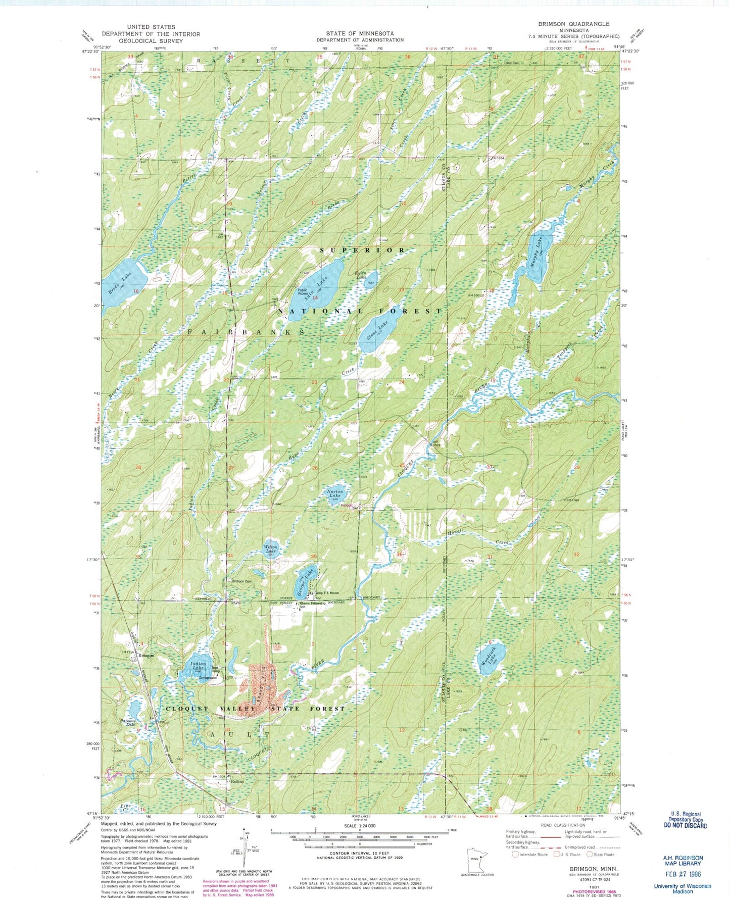
Historical USGS topographic quad map of Brimson in the state of Minnesota. Map scale may vary for some years, but is generally around 1:24,000. Print size is approximately 24" x 27"
This quadrangle is in the following counties: Lake, St. Louis.
The map contains contour lines, roads, rivers, towns, and lakes. Printed on high-quality waterproof paper with UV fade-resistant inks, and shipped rolled.
Contains the following named places: Breda Creek, Breda Lake, Brimson, Brimson Area Volunteer Fire Department, Brimson Cemetery, Brimson Post Office, Brimson Station, Camp F E House, George Lake, Howell Creek, Hypo Creek, Indian Creek, Indian Lake, Indian Lake Campground, Kylen Lake, Langley River, Murphy Creek, Murphy Lake, Murphy Lake Number 1 Dam, Nelson Creek, Norton Lake, Papoose Lake, Petrell Post Office, Rhema Fellowship School, Rollins, Sale Lake, Store Creek, Toimi Cemetery, Toimi Creek, Tommila Lake, Trappers Creek, Wilson Lake, Woodcock Lake