MyTopo
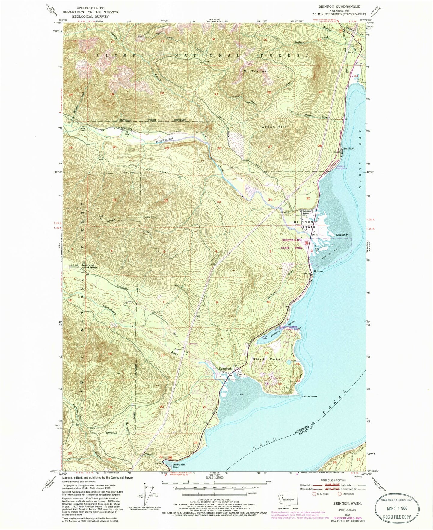
Classic USGS Brinnon Washington 7.5'x7.5' Topo Map
Couldn't load pickup availability
Historical USGS topographic quad map of Brinnon in the state of Washington. Map scale is 1:24000. Print size is approximately 24" x 27"
This quadrangle is in the following counties: Jefferson, Kitsap.
The map contains contour lines, roads, rivers, towns, and lakes. Printed on high-quality waterproof paper with UV fade-resistant inks, and shipped rolled.
Contains the following named places: Black Point, Boston Point, Brinnon, Brinnon Census Designated Place, Brinnon Community Church, Brinnon Flats, Brinnon Post Office, Brinnon School, Corrigenda Guard Station, Cove Recreational Vehicle Park, Dosewallips Flats, Dosewallips River, Dosewallips River Bridge, Dosewallips State Park, Dosewallips State Park Campground, Duckabush, Duckabush River, Duckabush River Bridge, Green Hill, Halfway Recreational Vehicle Park, Interrorem Guard Station, Interrorem Picnic Area, Jackson Creek, Jefferson County Fire District 4 Brinnon Fire Department Station 4 - 1 Headquarters, Jefferson County Fire District 4 Brinnon Fire Department Station 4 - 2 Duckabush, Jefferson County Fire District 4 Brinnon Fire Department Station 4 - 3 Maury Anderson, Lackawanna Beach, Marple Creek, McDaniel Cove, McDonald Creek, Mount Jupiter Trail, Mount Turner, Pleasant Harbor, Pleasant Harbor Marina, Pleasant Harbor State Marine Park, Quatsap Point, Right Smart Cove, Rocky Brook, Seal Rock, Seal Rock Campground, South Fork Fulton Creek, Spencer Creek, Sylopash Point, Turner Creek, Walkers Creek, Wilson Creek