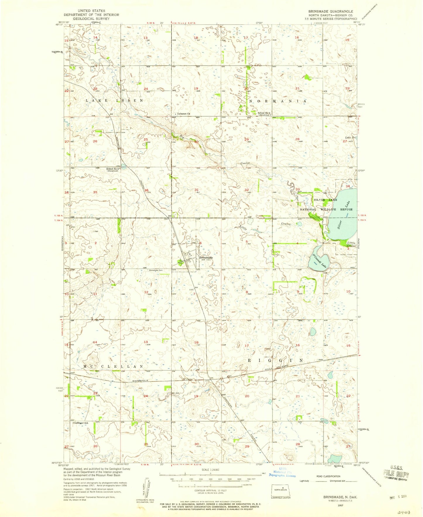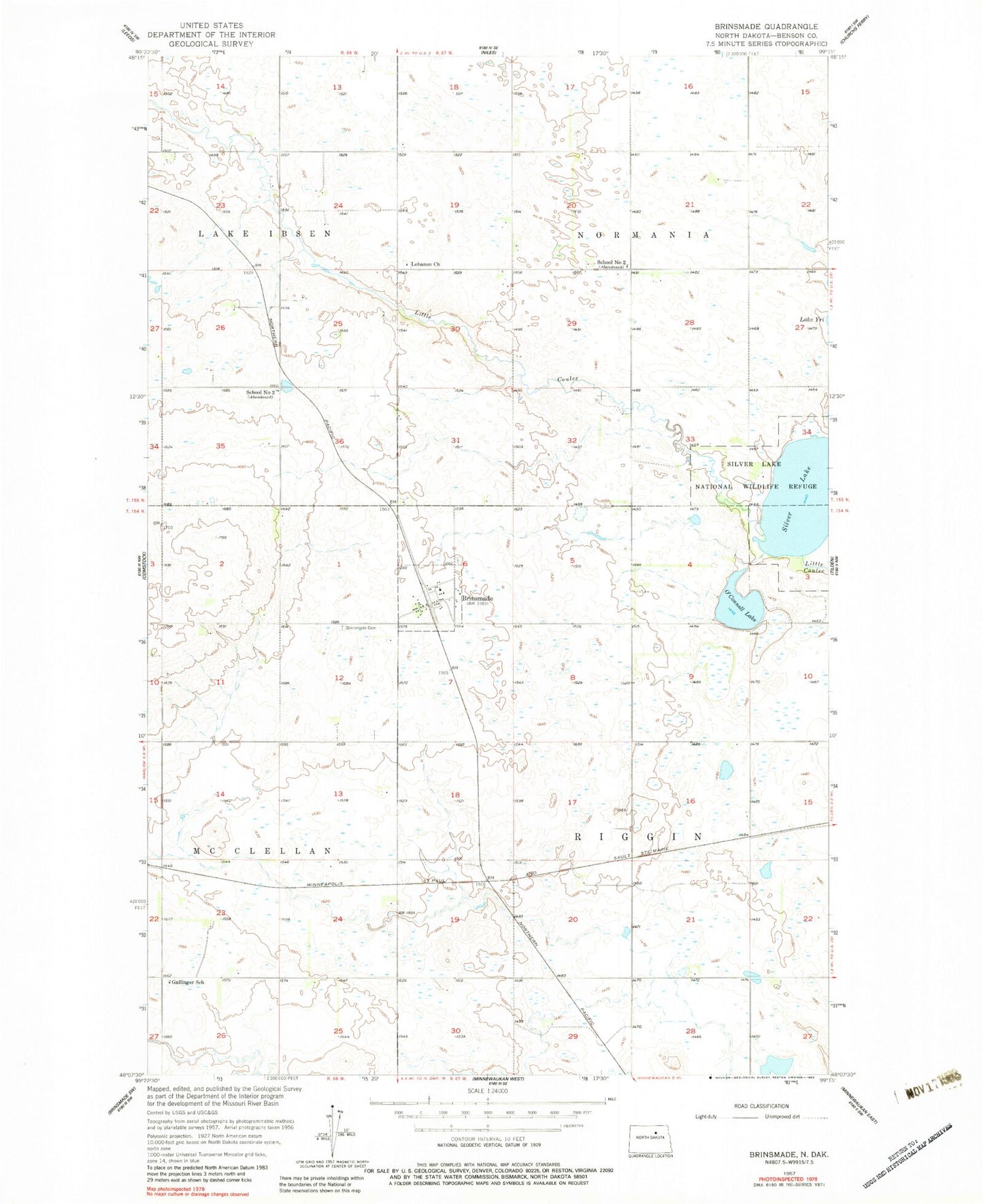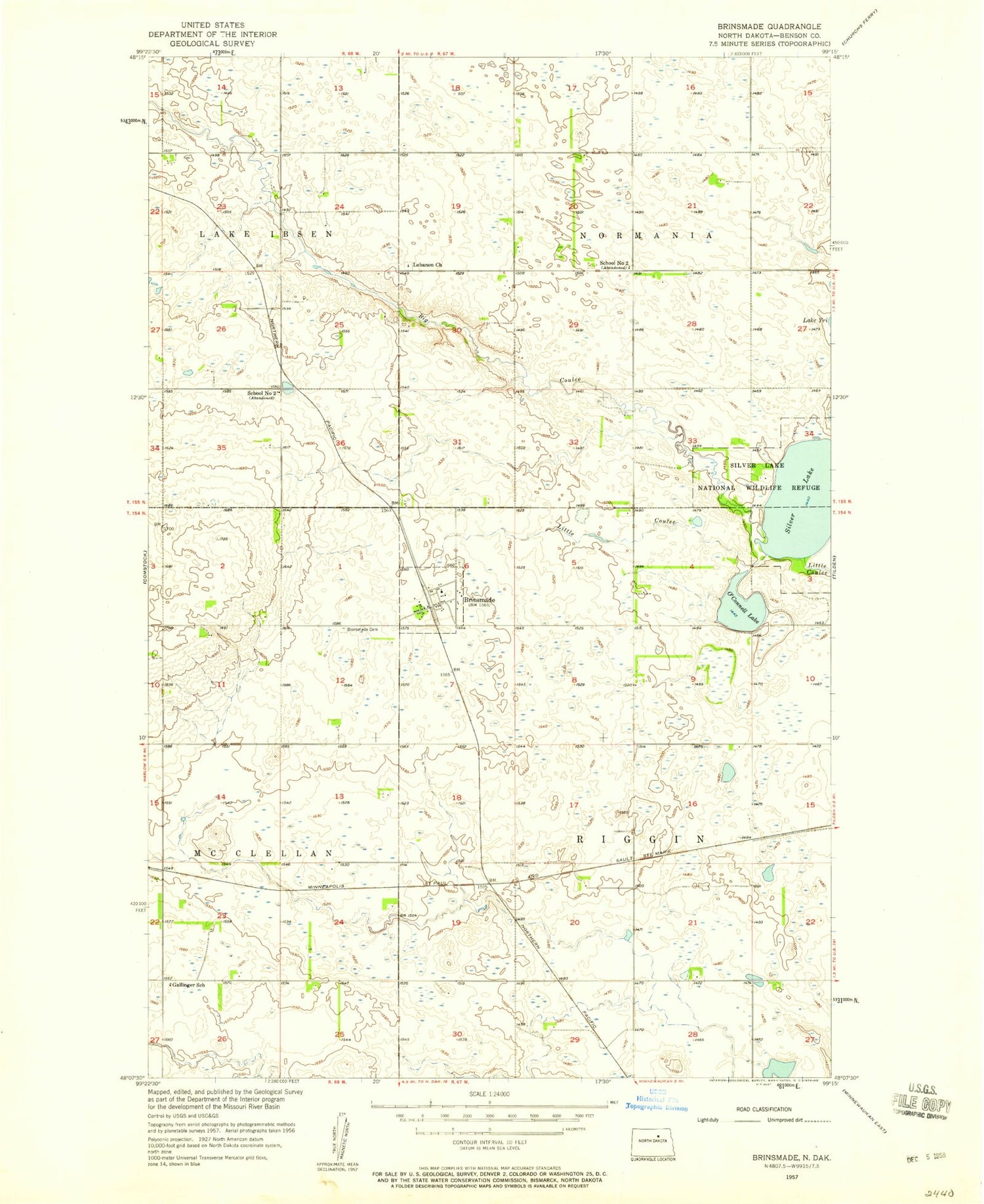
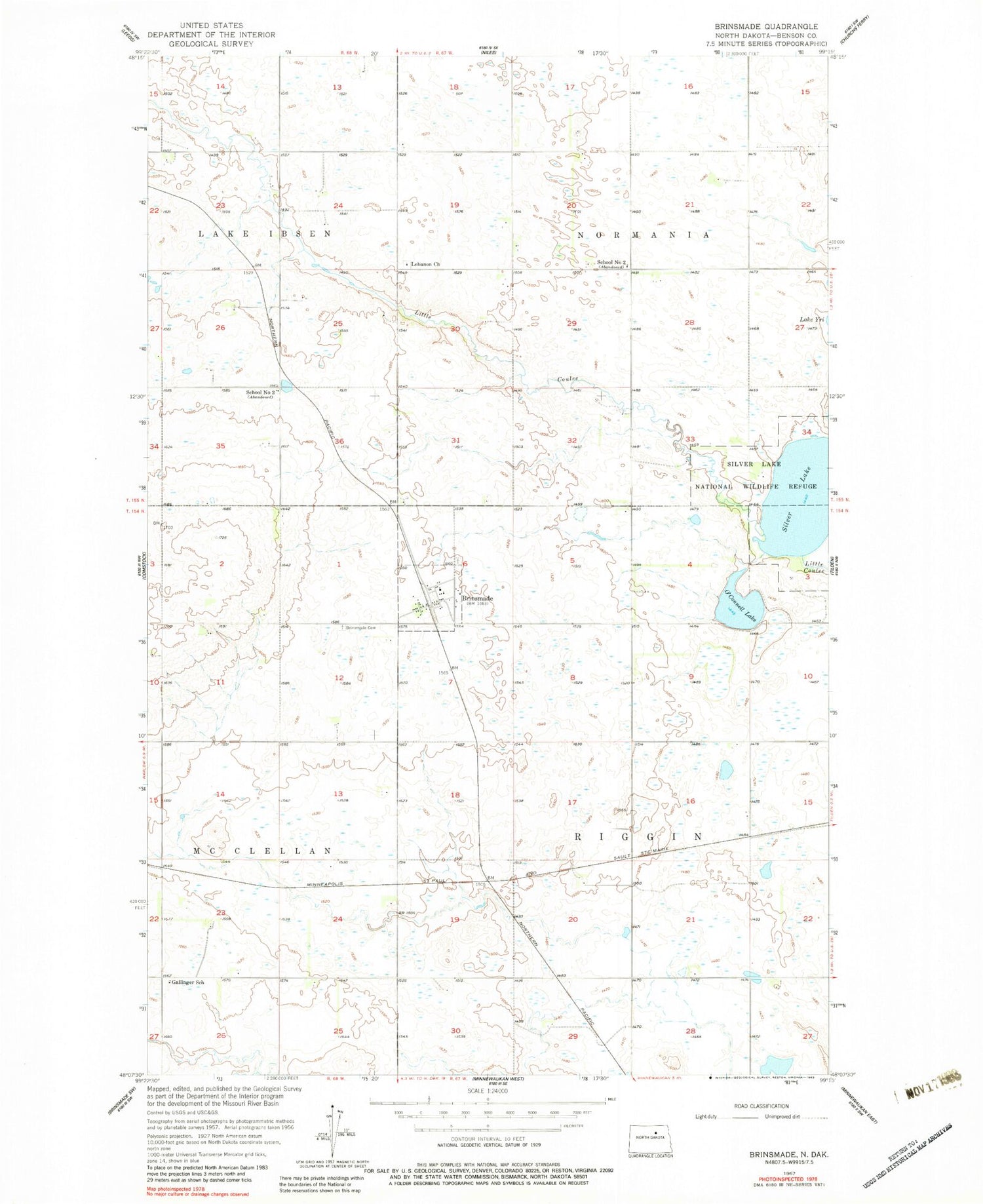
MyTopo
Classic USGS Brinsmade North Dakota 7.5'x7.5' Topo Map
Regular price
$16.95
Regular price
Sale price
$16.95
Unit price
per
Couldn't load pickup availability
Historical USGS topographic quad map of Brinsmade in the state of North Dakota. Map scale may vary for some years, but is generally around 1:24,000. Print size is approximately 24" x 27"
This quadrangle is in the following counties: Benson.
The map contains contour lines, roads, rivers, towns, and lakes. Printed on high-quality waterproof paper with UV fade-resistant inks, and shipped rolled.
Contains the following named places: Big Coulee, Brinsmade, Brinsmade Lutheran Cemetery, City of Brinsmade, Gallinger School, Lebanon Cemetery, Lebanon Church, O'Connell Lake, Saint John's Catholic Cemetery, School Number 2, Silver Lake, Township of Normania