MyTopo
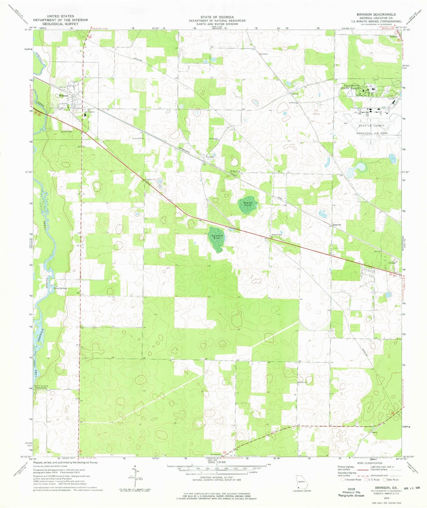
Classic USGS Brinson Georgia 7.5'x7.5' Topo Map
Couldn't load pickup availability
Historical USGS topographic quad map of Brinson in the state of Georgia. Map scale may vary for some years, but is generally around 1:24,000. Print size is approximately 24" x 27"
This quadrangle is in the following counties: Decatur.
The map contains contour lines, roads, rivers, towns, and lakes. Printed on high-quality waterproof paper with UV fade-resistant inks, and shipped rolled.
Contains the following named places: Bainbridge Air Base Contract School, Bainbridge Army Air Field, Bainbridge State Hospital, Bainbridge Substance Abuse Treatment Center, Bethel Church, Bethel Church Cemetery, Brinson, Brinson Division, Brinson Family Historic District, Brinson Post Office, Buzzard Roost, Cyrene, Decatur County Fire and Rescue Department, Decatur County Fire and Rescue Station 250, Decatur County Industrial Air Park, Hanover, Highway Church, Jackson Cemetery, Kingdom Hall, Mount Olive Church, Mount Pleasant Church, Mount Zion Church, New Salem Church, Oak Academy, Simms Pond, Smiths Landing, Swanwall Church, Thompson Cemetery, Town of Brinson, Yates Springs, ZIP Code: 39825