MyTopo
Classic USGS Brisben New York 7.5'x7.5' Topo Map
Couldn't load pickup availability
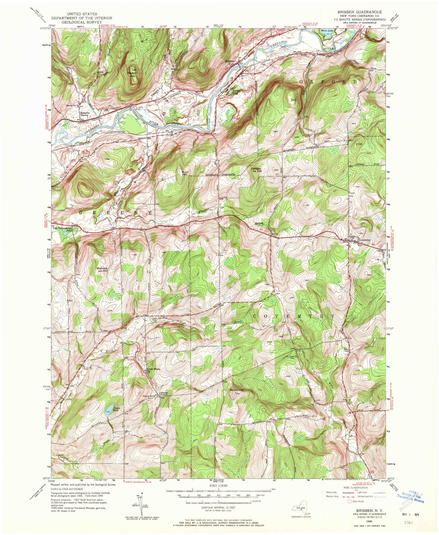
Historical USGS topographic quad map of Brisben in the state of New York. Typical map scale is 1:24,000, but may vary for certain years, if available. Print size: 24" x 27"
This quadrangle is in the following counties: Chenango.
The map contains contour lines, roads, rivers, towns, and lakes. Printed on high-quality waterproof paper with UV fade-resistant inks, and shipped rolled.
Contains the following named places: Bobell Hill, Borden Pond, Brisben, Buck Hill, Cohoon Hill, Coventry, Glen Road Brook, Harbor Hill, Johnson Corners, Little White Church, Mill Brook, Chapel Cemetery, Sacketts Harbor, Spring Brook, Tillotson Creek, Truitt Pond, Upper Page Brook Cemetery, Van Valkenburgh Pond, Warn Lake, Watrous Hill, Wheeler Brook, Wylie Cemetery, School Number 13 (historical), School Number 24 (historical), Town of Coventry, Brisben Baptist Church Cemetery, Brisben Baptist Church, Chenango Valley Ranch, Shadyside Farm, Coventry Union Cemetery, Greene Assembly of God, Coventry Volunteer Fire Company, Brisben Fire Department House