MyTopo
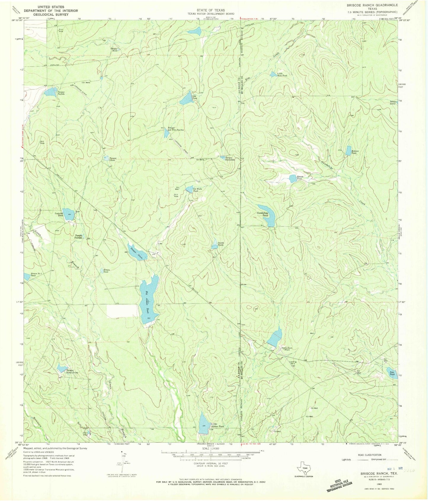
Classic USGS Briscoe Ranch Texas 7.5'x7.5' Topo Map
Couldn't load pickup availability
Historical USGS topographic quad map of Briscoe Ranch in the state of Texas. Map scale may vary for some years, but is generally around 1:24,000. Print size is approximately 24" x 27"
This quadrangle is in the following counties: La Salle, McMullen.
The map contains contour lines, roads, rivers, towns, and lakes. Printed on high-quality waterproof paper with UV fade-resistant inks, and shipped rolled.
Contains the following named places: Alexander Lake Number 1 Dam, Alexander Lake Number 2, Alexander Lake Number 2 Dam, Alexander Lake Number 3 Dam, Big Alamo Lake Dam, Big Alamo Tank, Blanco Tank, Blanco Tank Dam, Bounds Lake, Bounds Lake Dam, Briscoe Ranch, Brown Lake, Brown Lake Dam, Brown Number 1 Tank, Brown Tank, Double Tanks, Guadalupe Tank, Guadalupe Tank Dam, Headquarters Tank, Headquarters Tank Dam, Lesterjet Tank, Little Alamo Lake Dam, Little Alamo Tank, Little Mule Tank, Number Five Tank, Oil Wells Tank, Pozo Tank, Pozo Tank Dam, Retama Tank, Retama Tank Dam, Salt Tank, Tanque Escondido, Tanque Grava, Tanque Las Tres Puertas, Tanque Llano, Tanque Mula, Tanque Noche Triste, Tanque Noche Triste Tank Dam, Tanque Porfido, Tanque Trampa