MyTopo
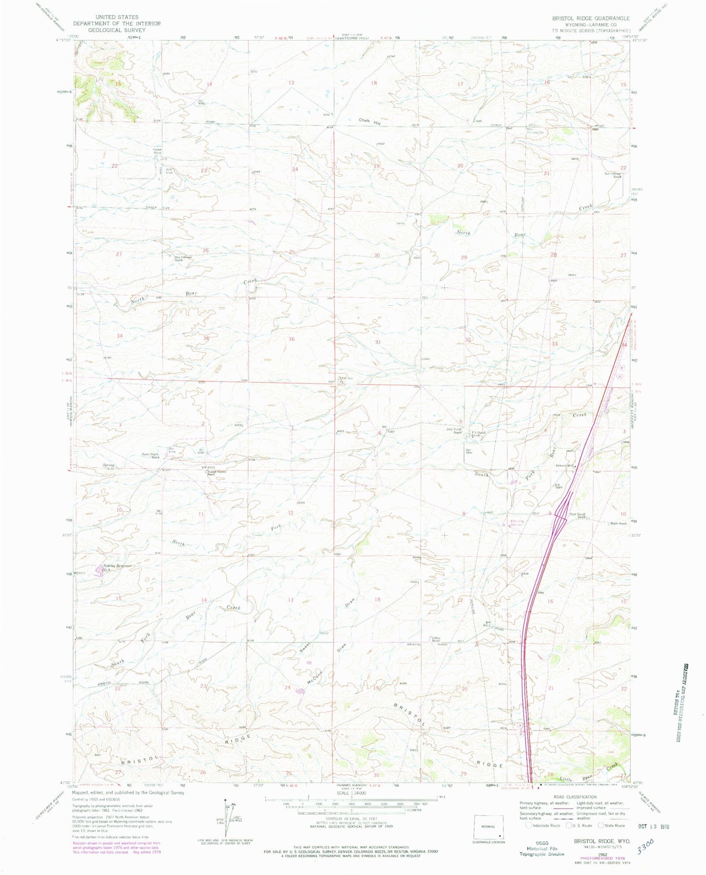
Classic USGS Bristol Ridge Wyoming 7.5'x7.5' Topo Map
Couldn't load pickup availability
Historical USGS topographic quad map of Bristol Ridge in the state of Wyoming. Map scale may vary for some years, but is generally around 1:24,000. Print size is approximately 24" x 27"
This quadrangle is in the following counties: Laramie.
The map contains contour lines, roads, rivers, towns, and lakes. Printed on high-quality waterproof paper with UV fade-resistant inks, and shipped rolled.
Contains the following named places: Bert Gillaspie Ranch, Bliss Pumping Station, Bristol Ridge, Caster Ranch, Chalk Hill, Collins Ranch, Dick Duvall Ranch, Elvy Gillaspie Ranch, F L Duvall Ranch, Harry Dayton Ranch, Hoyt Duvall Ranch, Little Bear Cemetery, Mable Ranch, McCann Draw, Nimmo Reservoir Number 9, North Fork South Fork Bear Creek, Richards Hall, Russell Dayton Ranch, Sweet Draw