MyTopo
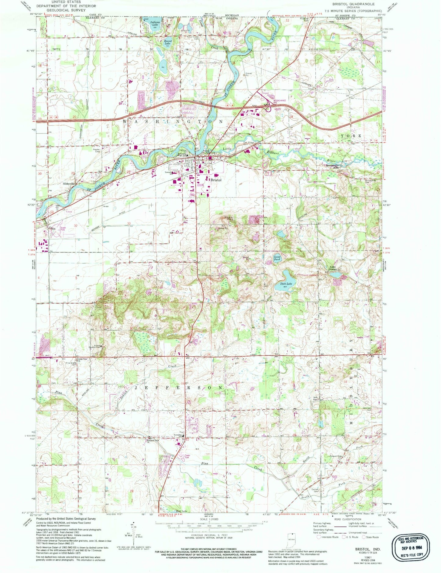
Classic USGS Bristol Indiana 7.5'x7.5' Topo Map
Couldn't load pickup availability
Historical USGS topographic quad map of Bristol in the state of Indiana. Map scale may vary for some years, but is generally around 1:24,000. Print size is approximately 24" x 27"
This quadrangle is in the following counties: Elkhart.
The map contains contour lines, roads, rivers, towns, and lakes. Printed on high-quality waterproof paper with UV fade-resistant inks, and shipped rolled.
Contains the following named places: Bonneyville Cemetery, Bonneyville Mills, Bristol, Bristol Elementary School, Bristol Fire Department, Bristol Police Dept, Bristol Post Office, Cathcart Cemetery, Cornell Cemetery, Dock Lake, Elcona Country Club, Geisinger Cemetery, Goose Pond, Harmony Acre Farm, Hatfield Airport, Hildreth Ditch, Hoobirk Farm, Indian Creek, Jefferson Township Fire Department, Kropf Airport, Lake Grange, Leann Acres, Little Elkhart River, Little Pine Church, Marlee Acres, Menges Ditch, Neff Cemetery, Nibbyville, North Fork Pine Creek, Oak Ridge Cemetery, Old Oak Farm, Pine Creek Cemetery, Pleasant Ridge Church, Pleasant View Church, Proctor Cemetery, Sheep Creek, South Fork Pine Creek, Town of Bristol, Township of Jefferson, Township of Washington, Trout Creek, Washington Township Ditch, Woodsbrook Farm, York Elementary School, York Township Ditch, ZIP Code: 46507