MyTopo
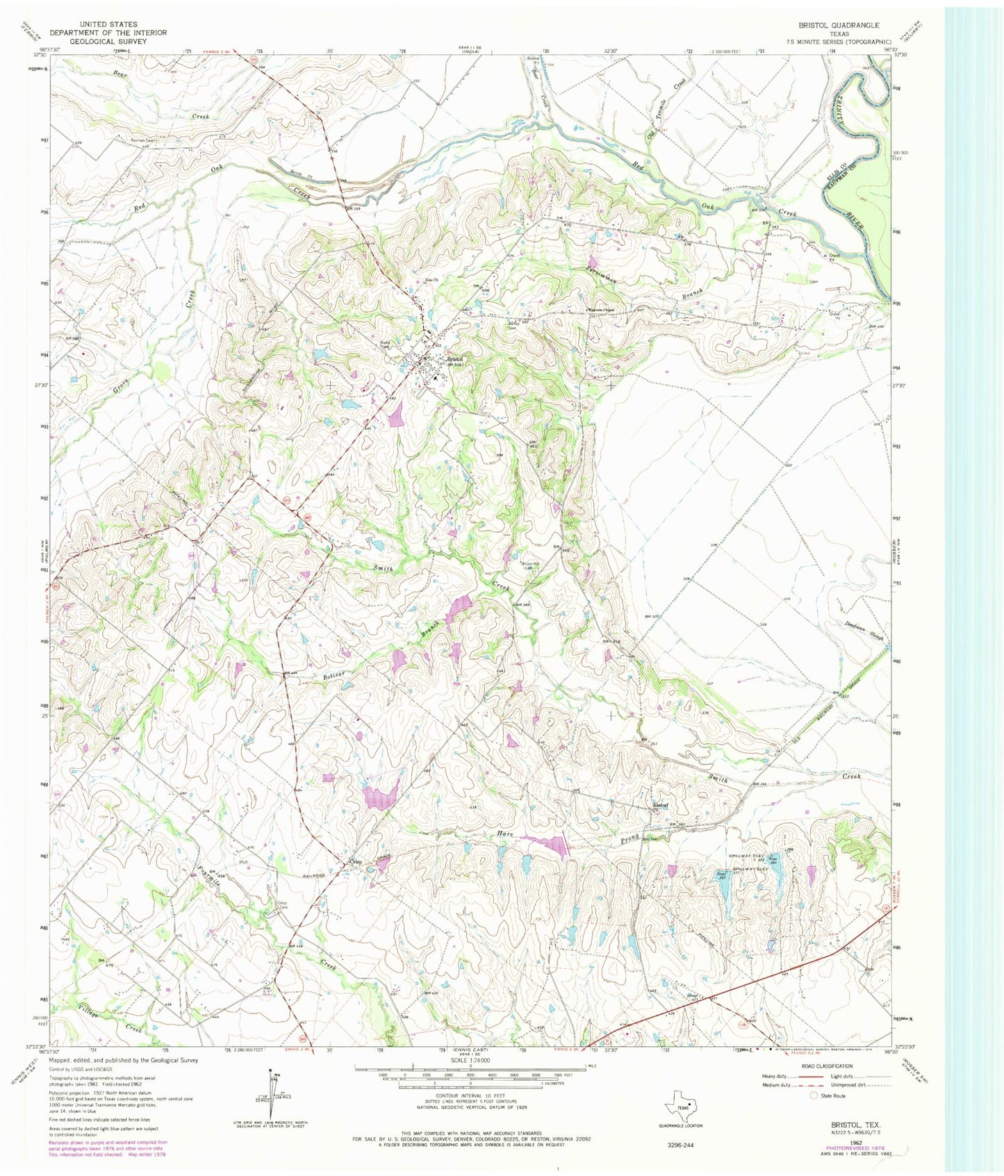
Classic USGS Bristol Texas 7.5'x7.5' Topo Map
Couldn't load pickup availability
Historical USGS topographic quad map of Bristol in the state of Texas. Map scale may vary for some years, but is generally around 1:24,000. Print size is approximately 24" x 27"
This quadrangle is in the following counties: Ellis, Kaufman.
The map contains contour lines, roads, rivers, towns, and lakes. Printed on high-quality waterproof paper with UV fade-resistant inks, and shipped rolled.
Contains the following named places: Alsdorf, Bear Creek, Bolivar Branch, Bristol, Bristol Census Designated Place, Bristol Volunteer Fire Department, Cherry Lake, Cherry Lake Dam, Crisp, Crisp Cemetery, East Fork Trinity River, Eisenbeck Ranch Airport, Grove Creek, Hare Prong, Hefley Cemetery, Hefner Lake Number 1, Hefner Lake Number 1 Dam, Hefner Lake Number 2, Hefner Lake Number 2 Dam, Johnson Lake, Johnson Lake Dam, Norman Cemetery, Old Tenmile Creek, Persimmon Branch, Red Oak Creek, Soil Conservation Service Site 2 Dam, Soil Conservation Service Site 2 Reservoir, Soil Conservation Service Site 3 Dam, Soil Conservation Service Site 3 Reservoir, Soil Conservation Service Site 4 Dam, Soil Conservation Service Site 4 Reservoir, Soil Conservation Service Site 5 Dam, Soil Conservation Service Site 5 Reservoir, Soil Conservation Service Site 6 Dam, Soil Conservation Service Site 6 Reservoir, Soil Conservation Service Site 7 Dam, Soil Conservation Service Site 7 Reservoir, Soil Conservation Service Site 8 Dam, Soil Conservation Service Site 8 Reservoir, Soil Conservation Service Site 8a Dam, Soil Conservation Service Site 8a Reservoir, Union Hill Cemetery, Weavers Chapel, Zion Church