MyTopo
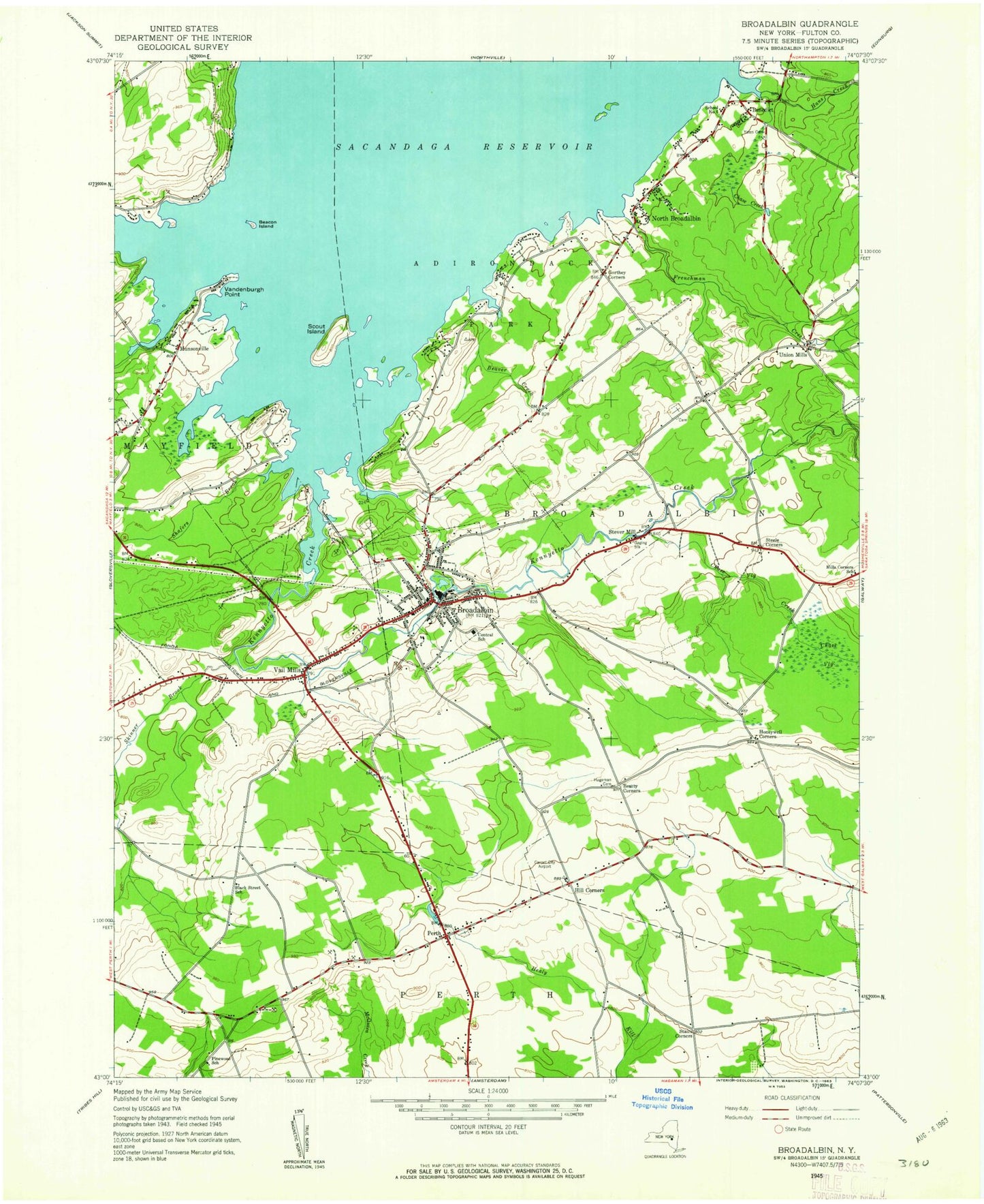
Classic USGS Broadalbin New York 7.5'x7.5' Topo Map
Couldn't load pickup availability
Historical USGS topographic quad map of Broadalbin in the state of New York. Typical map scale is 1:24,000, but may vary for certain years, if available. Print size: 24" x 27"
This quadrangle is in the following counties: Fulton.
The map contains contour lines, roads, rivers, towns, and lakes. Printed on high-quality waterproof paper with UV fade-resistant inks, and shipped rolled.
Contains the following named places: Beacon Island, Beatty Corners, Beaver Creek, Benedict, Broadalbin, Broadalbin - Perth Intermediate School, Broadalbin - Perth Primary School, Chambers Brook, Chase Creek, Chase Vly, Chase Vly Creek, Frenchman Creek, Gorthey Corners, Hageman Cemetery, Hans Creek, Hill Corners, Honeywell Corners, Kennyetto Creek, Kunkel Point, Munsonville, North Broadalbin, Perth, Pittock Brook, Saint Basils Church, Saint Josephs Church, Sand Island, Scout Island, Shafers Brook, Sherman Brook, Skinner Creek, Stairs Corners, Steele Corners, Stever Mill, Union Mills, Union Mills Cemetery, Vail Mills, Vandenburgh Point, Yates Cemetery, WKOL-FM (Amsterdam), The Pines Airport, Murphys Landing Strip, Hines Field, Town of Broadalbin, Town of Perth, School Number 4 (historical), School Number 5 (historical), Mills Corners School (historical), School Number 10 (historical), Black Street School (historical), Pine Wood School (historical), Village of Broadalbin, Longwell Airport (historical), Munsonville Cemetery, Vail Mills Cemetery, Broadalbin Mayfield Rural Cemetery, Perth Cemetery, Springers Farm, El Rancho Drive-In, Vail Mills Drive-In (historical), Holland Meadows Golf Course, Adirondack Baptist Church, Broadalbin Baptist Church, Broadalbin United Methodist Church, First Presbyterian Church, Broadalbin Post Office, Indian Village Mobile Home Park, Sacandaga Meadows Mobile Home Park, Broadalbin - Perth Middle School, Broadalbin - Perth High School, Perth Bible Christian Academy, Patti's Greenhouses, Windy Willow Farm, Broadalbin Kennyetto Fire Department, Perth Volunteer Fire Company, Broadalbin Volunteer Ambulance Corps, Broadalbin Kennyetto Volunteer Fire Company, Beacon Island, Beatty Corners, Beaver Creek, Benedict, Broadalbin, Broadalbin - Perth Intermediate School, Broadalbin - Perth Primary School, Chambers Brook, Chase Creek, Chase Vly, Chase Vly Creek, Frenchman Creek, Gorthey Corners, Hageman Cemetery, Hans Creek, Hill Corners, Honeywell Corners, Kennyetto Creek, Kunkel Point, Munsonville, North Broadalbin, Perth, Pittock Brook, Saint Basils Church, Saint Josephs Church, Sand Island, Scout Island, Shafers Brook, Sherman Brook, Skinner Creek, Stairs Corners, Steele Corners, Stever Mill, Union Mills, Union Mills Cemetery, Vail Mills, Vandenburgh Point, Yates Cemetery, WKOL-FM (Amsterdam), The Pines Airport, Murphys Landing Strip, Hines Field, Town of Broadalbin, Town of Perth, School Number 4 (historical), School Number 5 (historical), Mills Corners School (historical), School Number 10 (historical), Black Street School (historical), Pine Wood School (historical), Village of Broadalbin, Longwell Airport (historical), Munsonville Cemetery, Vail Mills Cemetery, Broadalbin Mayfield Rural Cemetery, Perth Cemetery, Springers Farm, El Rancho Drive-In, Vail Mills Drive-In (historical), Holland Meadows Golf Course, Adirondack Baptist Church, Broadalbin Baptist Church, Broadalbin United Methodist Church, First Presbyterian Church, Broadalbin Post Office, Indian Village Mobile Home Park, Sacandaga Meadows Mobile Home Park, Broadalbin - Perth Middle School, Broadalbin - Perth High School, Perth Bible Christian Academy, Patti's Greenhouses, Windy Willow Farm, Broadalbin Kennyetto Fire Department, Perth Volunteer Fire Company, Broadalbin Volunteer Ambulance Corps, Broadalbin Kennyetto Volunteer Fire Company


