MyTopo
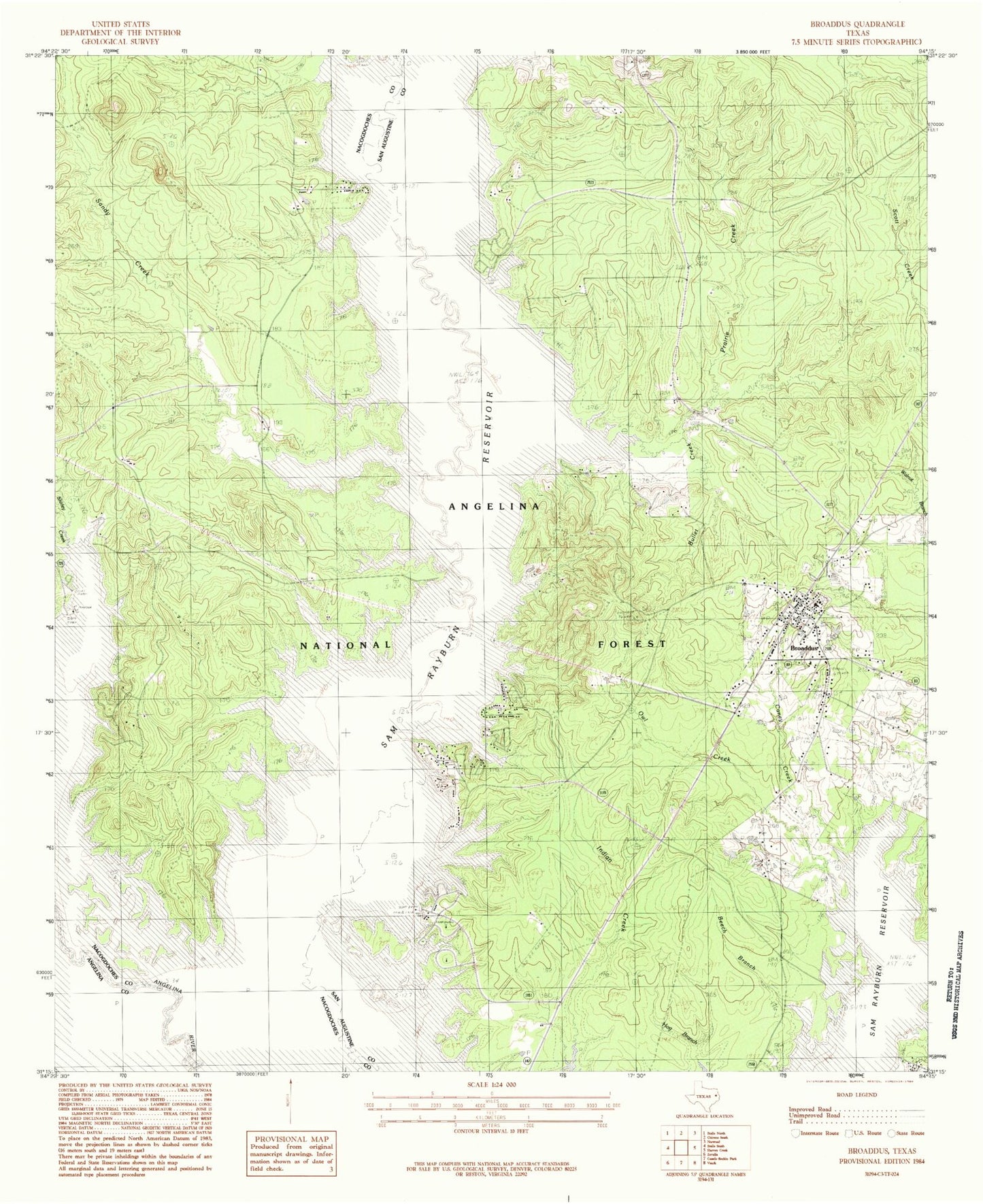
Classic USGS Broaddus Texas 7.5'x7.5' Topo Map
Couldn't load pickup availability
Historical USGS topographic quad map of Broaddus in the state of Texas. Map scale may vary for some years, but is generally around 1:24,000. Print size is approximately 24" x 27"
This quadrangle is in the following counties: Angelina, Nacogdoches, San Augustine.
The map contains contour lines, roads, rivers, towns, and lakes. Printed on high-quality waterproof paper with UV fade-resistant inks, and shipped rolled.
Contains the following named places: Attoyac Property Owners Volunteer Fire Department, Beech Branch, Boggy Creek, Brewers Chapel, Broaddus, Broaddus Cemetery, Broaddus Post Office, Broaddus Volunteer Fire Department, Bullet Creek, Caney Creek, Cedar Creek, Fox Cemetery, Harvey Cemetery, Harvy Cemetery, Horseshoe Lake, Jackson Hill Lookout, Jackson Hill Park, Lee Cemetery, Lowery Cemetery, Owl Creek, Prairie Creek, Priority One Emergency Medical Service, Saint Peter Church, Salt Lake, Sandy Creek, Shirley Creek Campground, Smyrna Cemetery, Sowell Cemetery, Town of Broaddus, Townsend, Townsend Recreation Site, Ware Branch, Williams Cemetery