MyTopo
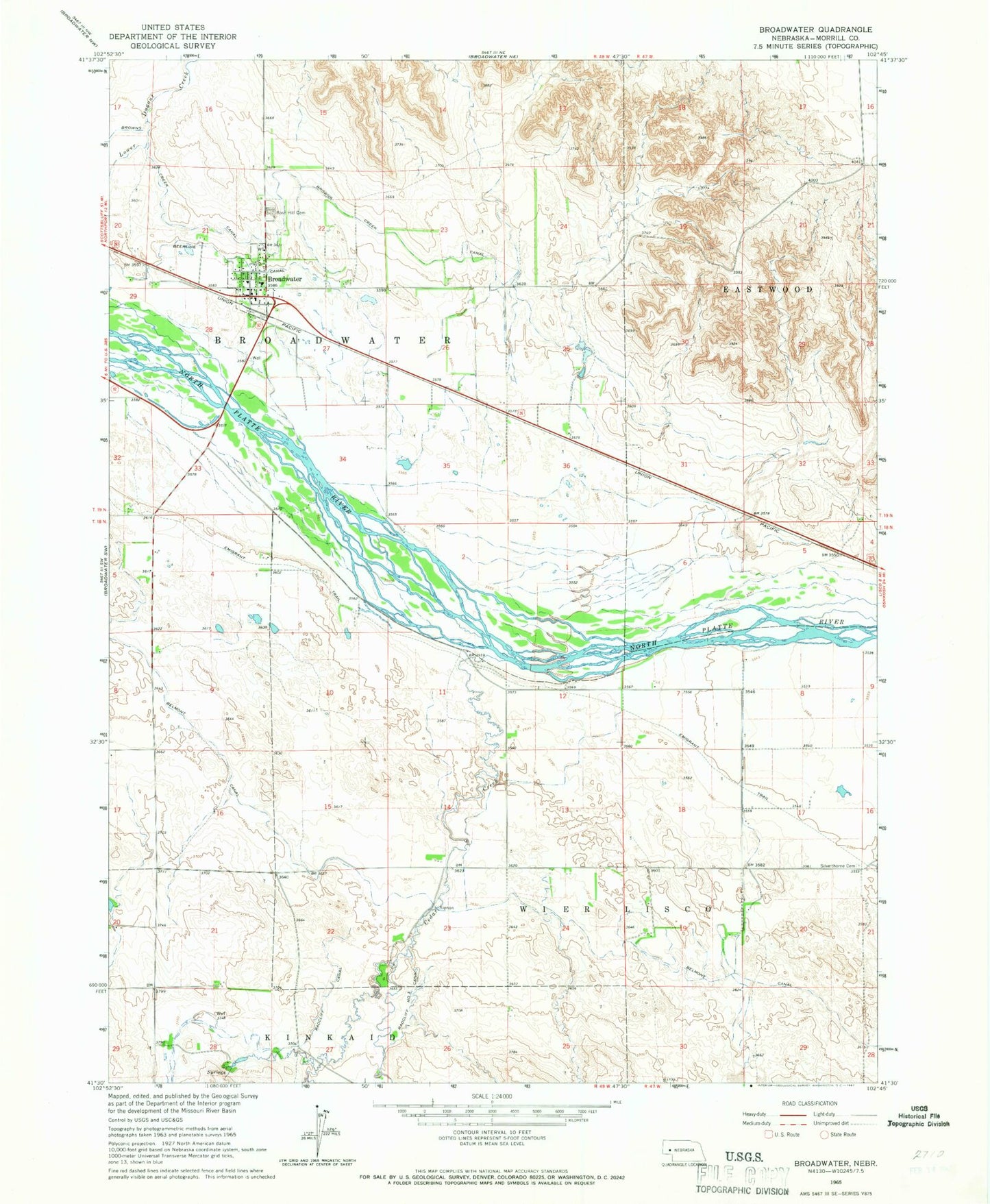
Classic USGS Broadwater Nebraska 7.5'x7.5' Topo Map
Couldn't load pickup availability
Historical USGS topographic quad map of Broadwater in the state of Nebraska. Map scale may vary for some years, but is generally around 1:24,000. Print size is approximately 24" x 27"
This quadrangle is in the following counties: Morrill.
The map contains contour lines, roads, rivers, towns, and lakes. Printed on high-quality waterproof paper with UV fade-resistant inks, and shipped rolled.
Contains the following named places: Ag Air Airport, Ancient Bluff Ruins, Beerline Canal, Broadwater, Broadwater Election Precinct, Broadwater Post Office, Broadwater Public Library, Broadwater Public School, Broadwater Volunteer Fire Department, Cedar Creek, Eastwood, Finley, Messiah Lutheran Church, Narcissa Whitman Historical Marker, Radcliff Number 3 Canal, Radcliffe Canal, Rose Hill Cemetery, Silverthorn Cemetery, Village of Broadwater