MyTopo
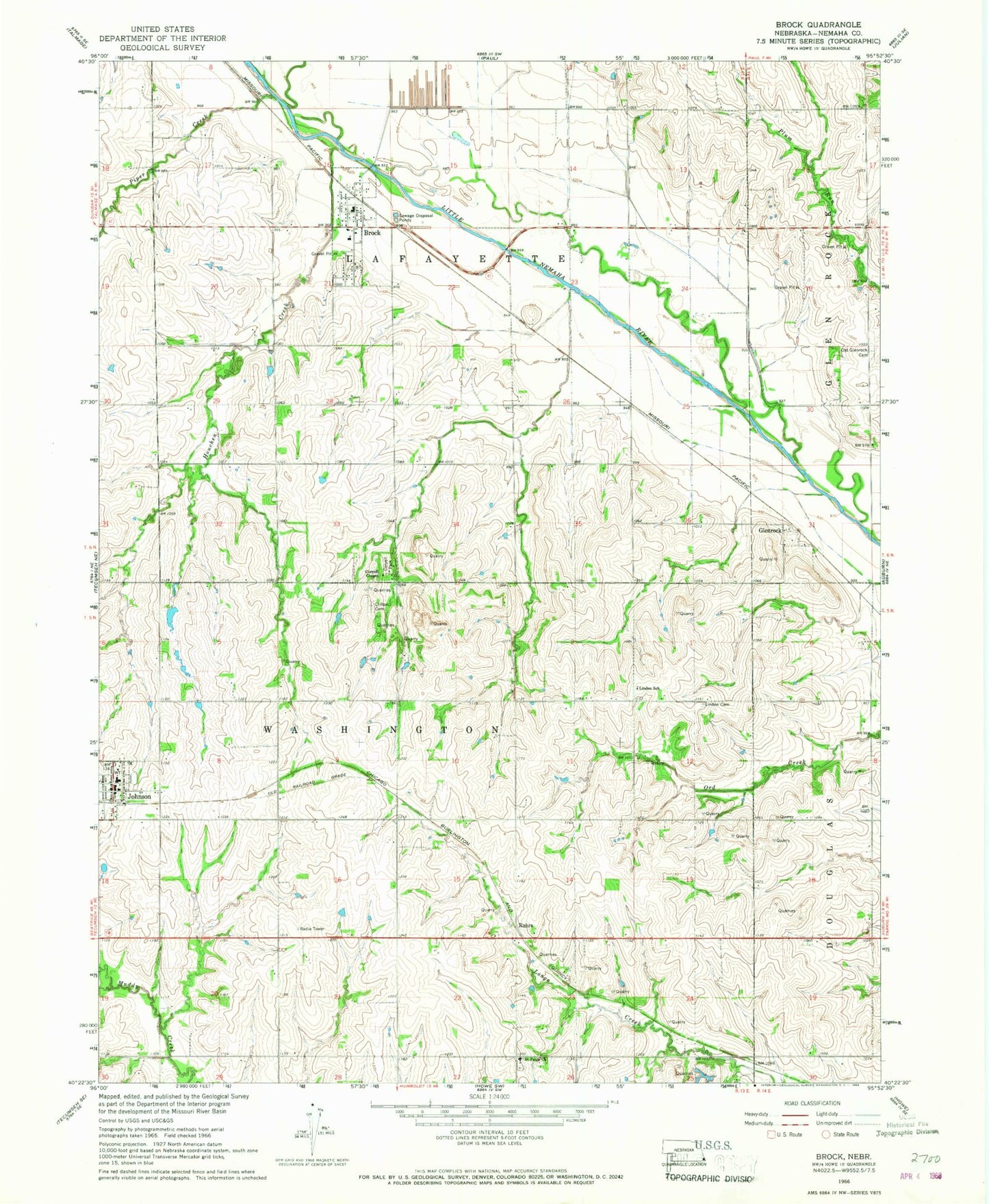
Classic USGS Brock Nebraska 7.5'x7.5' Topo Map
Couldn't load pickup availability
Historical USGS topographic quad map of Brock in the state of Nebraska. Map scale may vary for some years, but is generally around 1:24,000. Print size is approximately 24" x 27"
This quadrangle is in the following counties: Nemaha.
The map contains contour lines, roads, rivers, towns, and lakes. Printed on high-quality waterproof paper with UV fade-resistant inks, and shipped rolled.
Contains the following named places: Brock, Brock Christian Church, Brock Post Office, Brock Rural Fire Department, Brock School, Clark Grain Company Elevator, Clifton Cemetery, Corvell Park, Coryell Chapel, Dayton Post Office, Dominey Reservoir, Dominy Dam, Gauchat Creek, Gauchat Group Dam, Gauchat Group Reservoir, Glenrock, Glenrock Cemetery, Glenrock Post Office, Houchen Creek, Johnson, Johnson Area Quick Response Team, Johnson Post Office, Johnson Volunteer Fire Department, Johnson-Brock Public Schools, Lafayette Election Precinct, Linden Cemetery, Linden School, Piper Creek, Rohrs, Rohrs Post Office, Saint Matthew Lutheran Church, Saint Pauls Church, Township of Lafayette, Township of Washington, United Methodist Church, Village of Brock, Village of Johnson, Washington Election Precinct, ZIP Code: 68320